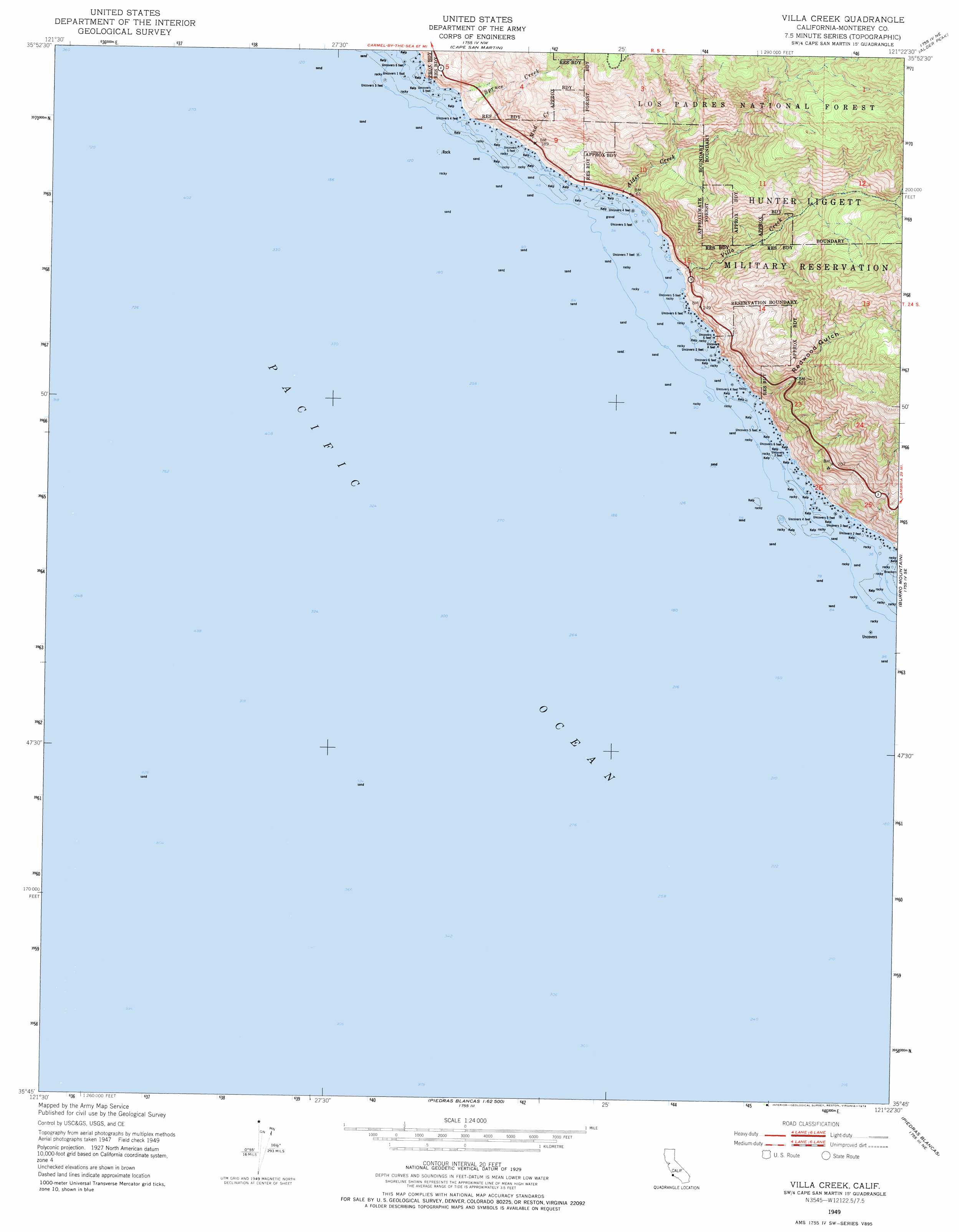
Villa Creek Topo Map California
To zoom in, hover over the map of Villa Creek
USGS Topo Quad 35121g4 - 1:24,000 scale
| Topo Map Name: | Villa Creek |
| USGS Topo Quad ID: | 35121g4 |
| Print Size: | ca. 21 1/4" wide x 27" high |
| Southeast Coordinates: | 35.75° N latitude / 121.375° W longitude |
| Map Center Coordinates: | 35.8125° N latitude / 121.4375° W longitude |
| U.S. State: | CA |
| Filename: | o35121g4.jpg |
| Download Map JPG Image: | Villa Creek topo map 1:24,000 scale |
| Map Type: | Topographic |
| Topo Series: | 7.5´ |
| Map Scale: | 1:24,000 |
| Source of Map Images: | United States Geological Survey (USGS) |
| Alternate Map Versions: |
Villa Creek CA 1949, updated 1953 Download PDF Buy paper map Villa Creek CA 1949, updated 1958 Download PDF Buy paper map Villa Creek CA 1949, updated 1974 Download PDF Buy paper map Villa Creek CA 1949, updated 1974 Download PDF Buy paper map Villa Creek CA 1995, updated 2000 Download PDF Buy paper map Villa Creek CA 2012 Download PDF Buy paper map Villa Creek CA 2015 Download PDF Buy paper map |
| FStopo: | US Forest Service topo Villa Creek is available: Download FStopo PDF Download FStopo TIF |
1:24,000 Topo Quads surrounding Villa Creek
Lopez Point |
Cone Peak |
Bear Canyon |
Cosio Knob |
|
Cape San Martin |
Alder Peak |
Jolon |
||
Villa Creek |
Burro Mountain |
Burnett Peak |
||
Piedras Blancas |
San Simeon |
|||
Pico Creek |
> Back to 35121e1 at 1:100,000 scale
> Back to 35120a1 at 1:250,000 scale
> Back to U.S. Topo Maps home
Villa Creek topo map: Gazetteer
Villa Creek: Bars
White Rock Number Two elevation 0m 0′Villa Creek: Islands
Whaleboat Rock elevation 1m 3′Villa Creek: Mines
Los Burros Mine elevation 694m 2276′Villa Creek: Springs
Buckeye Spring elevation 652m 2139′Villa Creek: Streams
Alder Creek elevation 0m 0′Mud Creek elevation 0m 0′
Soda Spring Creek elevation 2m 6′
Spruce Creek elevation 0m 0′
Villa Creek elevation 0m 0′
Villa Creek: Valleys
Redwood Gulch elevation 16m 52′Villa Creek digital topo map on disk
Buy this Villa Creek topo map showing relief, roads, GPS coordinates and other geographical features, as a high-resolution digital map file on DVD: