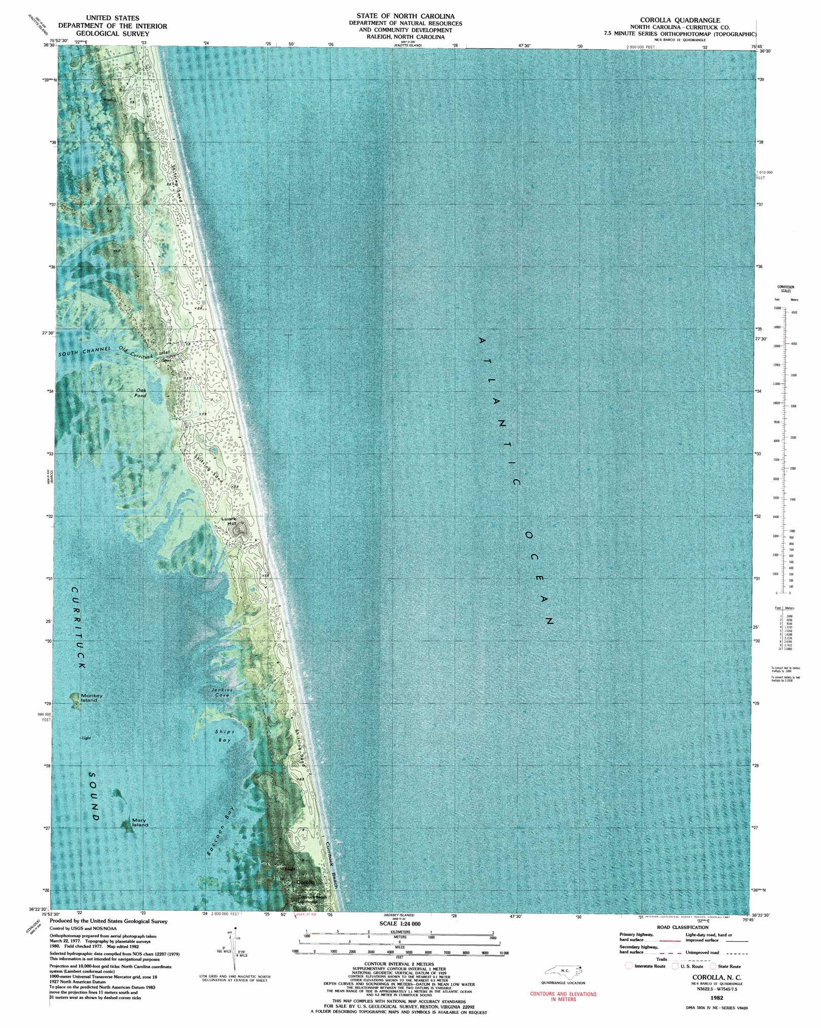
Corolla Topo Map North Carolina
To zoom in, hover over the map of Corolla
USGS Topo Quad 36075d7 - 1:24,000 scale
| Topo Map Name: | Corolla |
| USGS Topo Quad ID: | 36075d7 |
| Print Size: | ca. 21 1/4" wide x 27" high |
| Southeast Coordinates: | 36.375° N latitude / 75.75° W longitude |
| Map Center Coordinates: | 36.4375° N latitude / 75.8125° W longitude |
| U.S. State: | NC |
| Filename: | p36075d7.jpg |
| Download Map JPG Image: | Corolla topo map 1:24,000 scale |
| Map Type: | Orthophoto |
| Topo Series: | 7.5´ |
| Map Scale: | 1:24,000 |
| Source of Map Images: | United States Geological Survey (USGS) |
| Alternate Map Versions: |
Corolla NC 1982, updated 1983 Download PDF Buy paper map Corolla NC 1982, updated 1987 Download PDF Buy paper map Corolla NC 2010 Download PDF Buy paper map Corolla NC 2013 Download PDF Buy paper map Corolla NC 2016 Download PDF Buy paper map |
1:24,000 Topo Quads surrounding Corolla
Pleasant Ridge |
North Bay |
|||
Creeds |
Knotts Island |
|||
Currituck |
Barco |
Corolla |
||
Shiloh |
Coinjock |
Mossey Islands |
||
Wade Point |
Camden Point |
Jarvisburg |
Martin Point |
> Back to 36075a1 at 1:100,000 scale
> Back to 36074a1 at 1:250,000 scale
> Back to U.S. Topo Maps home
Corolla topo map: Gazetteer
Corolla: Bays
Jenkins Cove elevation 0m 0′Raccoon Bay elevation 0m 0′
Ships Bay elevation 0m 0′
Corolla: Beaches
Currituck Beach elevation 1m 3′Corolla: Channels
Musketo Inlet elevation 4m 13′Corolla: Islands
Lucks Island (historical) elevation 1m 3′Mary Island elevation 0m 0′
Monkey Island elevation 1m 3′
Corolla: Lakes
Oak Pond elevation 0m 0′Corolla: Populated Places
Corolla elevation 2m 6′Ocean Hills elevation 3m 9′
Corolla: Post Offices
Corolla Post Office elevation 2m 6′Corolla: Streams
Old Currituck Inlet elevation 0m 0′Corolla: Summits
Luark Hill elevation 4m 13′Corolla digital topo map on disk
Buy this Corolla topo map showing relief, roads, GPS coordinates and other geographical features, as a high-resolution digital map file on DVD:
Atlantic Coast (NY, NJ, PA, DE, MD, VA, NC)
Buy digital topo maps: Atlantic Coast (NY, NJ, PA, DE, MD, VA, NC)
 map DVD")