Yeopim River Topo Map North Carolina
To zoom in, hover over the map of Yeopim River
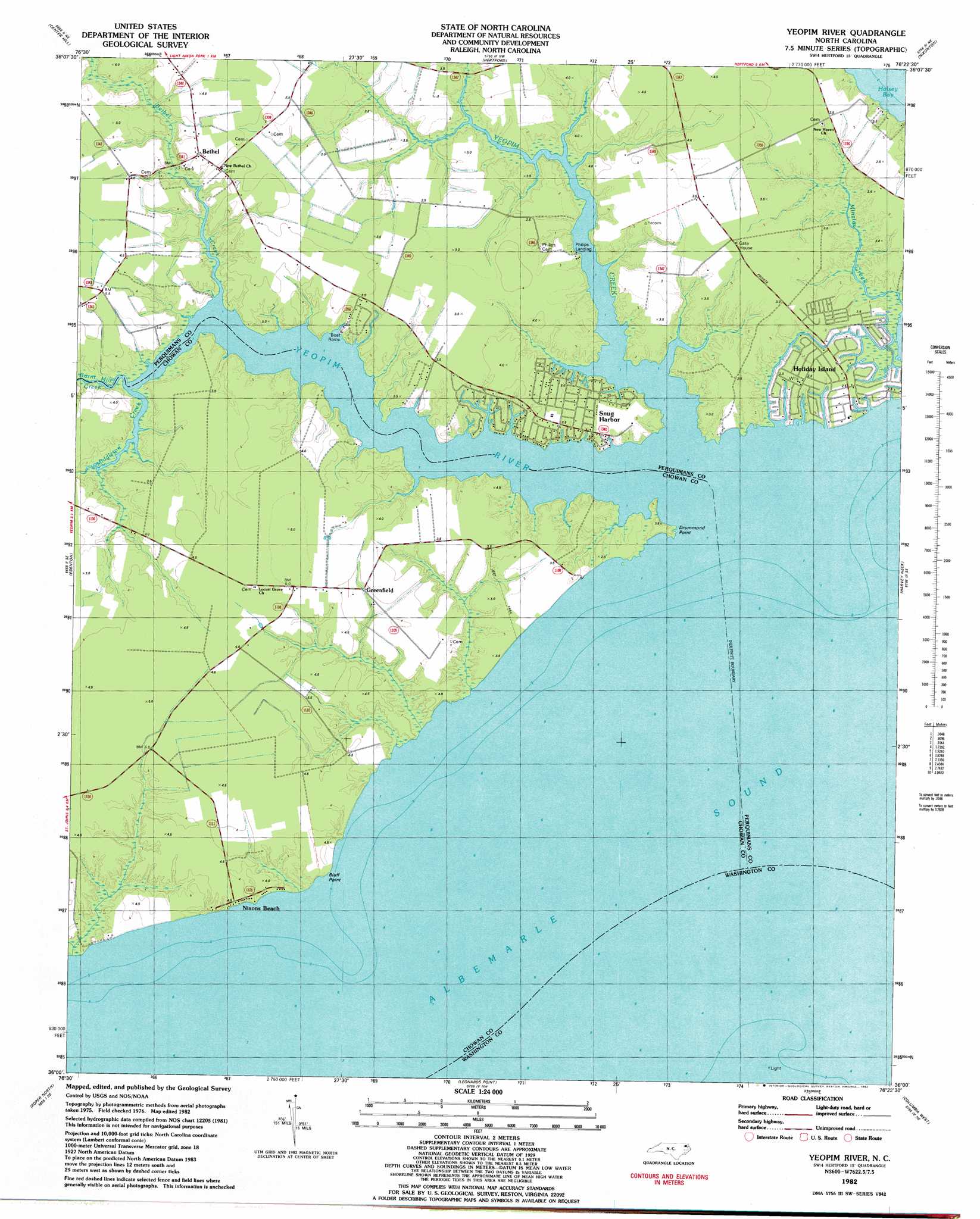
USGS Topo Quad 36076a4 - 1:24,000 scale
| Topo Map Name: | Yeopim River |
| USGS Topo Quad ID: | 36076a4 |
| Print Size: | ca. 21 1/4" wide x 27" high |
| Southeast Coordinates: | 36° N latitude / 76.375° W longitude |
| Map Center Coordinates: | 36.0625° N latitude / 76.4375° W longitude |
| U.S. State: | NC |
| Filename: | o36076a4.jpg |
| Download Map JPG Image: | Yeopim River topo map 1:24,000 scale |
| Map Type: | Topographic |
| Topo Series: | 7.5´ |
| Map Scale: | 1:24,000 |
| Source of Map Images: | United States Geological Survey (USGS) |
| Alternate Map Versions: |
Yeopim River NC 1982, updated 1982 Download PDF Buy paper map Yeopim River NC 2010 Download PDF Buy paper map Yeopim River NC 2013 Download PDF Buy paper map Yeopim River NC 2016 Download PDF Buy paper map |
1:24,000 Topo Quads surrounding Yeopim River
Mintonsville |
Hobbsville |
Chapanoke |
Pasquotank |
Elizabeth City |
Valhalla |
Center Hill |
Hertford |
Nixonton |
Weeksville |
Edenhouse |
Edenton |
Yeopim River |
Harvey Neck |
Stevenson Point |
Westover |
Roper North |
Leonards Point |
Columbia West |
Columbia East |
Plymouth East |
Roper South |
Creswell |
Creswell Se |
Scotia |
> Back to 36076a1 at 1:100,000 scale
> Back to 36076a1 at 1:250,000 scale
> Back to U.S. Topo Maps home
Yeopim River topo map: Gazetteer
Yeopim River: Capes
Bluff Point elevation 0m 0′Drummond Point elevation 0m 0′
Yeopim River: Islands
Batts Island (historical) elevation 0m 0′Yeopim River: Populated Places
Bethel elevation 4m 13′Greenfield elevation 3m 9′
Holiday Island elevation 2m 6′
Nixons Beach elevation 4m 13′
Snug Harbor elevation 3m 9′
Somerset elevation 3m 9′
Yeopim River: Streams
Bethel Creek elevation 0m 0′Burnt Mill Creek elevation 0m 0′
Middleton Creek elevation 0m 0′
Yeopim Creek elevation -1m -4′
Yeopim River elevation -1m -4′
Yeopim River digital topo map on disk
Buy this Yeopim River topo map showing relief, roads, GPS coordinates and other geographical features, as a high-resolution digital map file on DVD:
Atlantic Coast (NY, NJ, PA, DE, MD, VA, NC)
Buy digital topo maps: Atlantic Coast (NY, NJ, PA, DE, MD, VA, NC)
 map DVD")