Draughn Topo Map North Carolina
To zoom in, hover over the map of Draughn
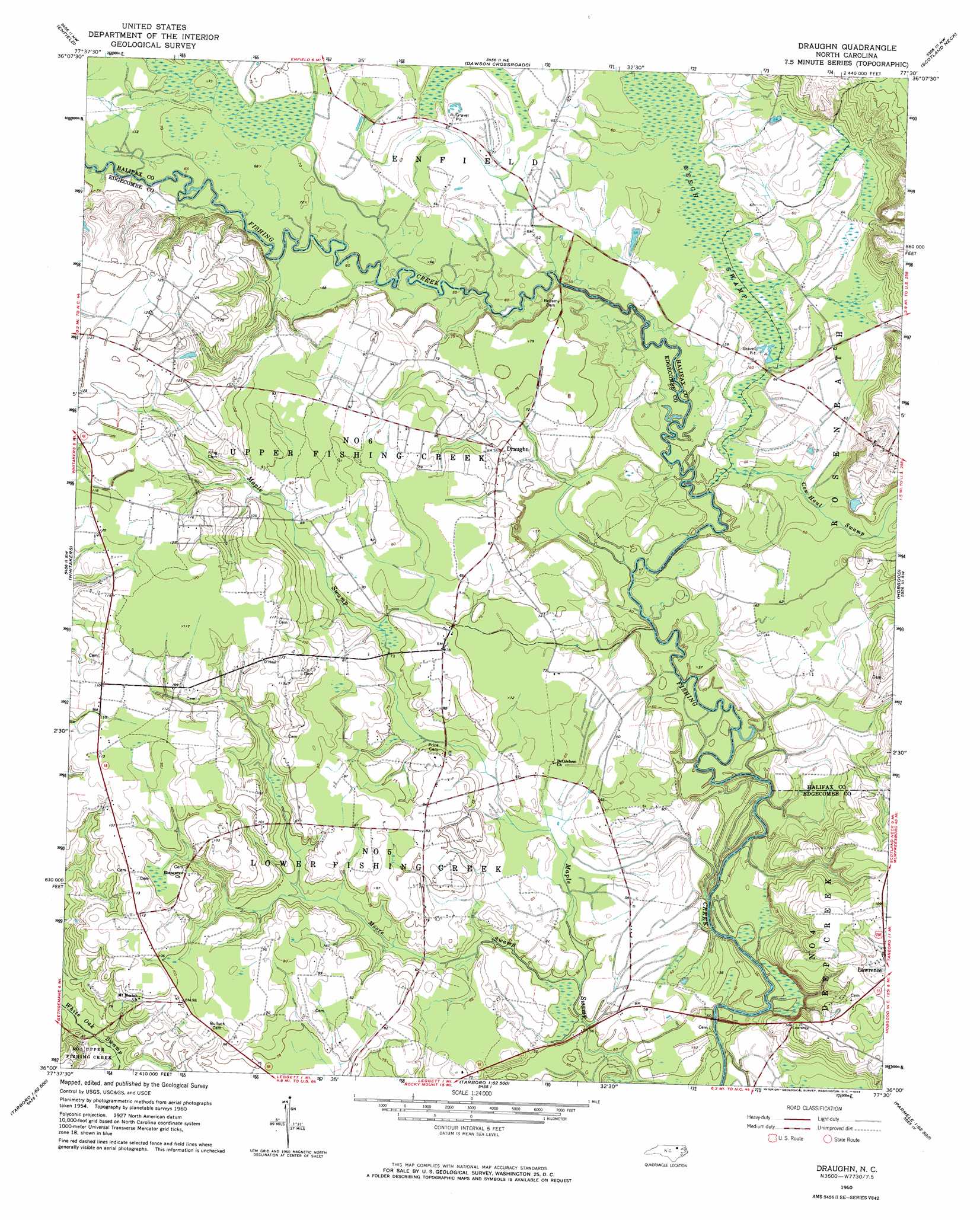
USGS Topo Quad 36077a5 - 1:24,000 scale
| Topo Map Name: | Draughn |
| USGS Topo Quad ID: | 36077a5 |
| Print Size: | ca. 21 1/4" wide x 27" high |
| Southeast Coordinates: | 36° N latitude / 77.5° W longitude |
| Map Center Coordinates: | 36.0625° N latitude / 77.5625° W longitude |
| U.S. State: | NC |
| Filename: | o36077a5.jpg |
| Download Map JPG Image: | Draughn topo map 1:24,000 scale |
| Map Type: | Topographic |
| Topo Series: | 7.5´ |
| Map Scale: | 1:24,000 |
| Source of Map Images: | United States Geological Survey (USGS) |
| Alternate Map Versions: |
Draughn NC 1960, updated 1964 Download PDF Buy paper map Draughn NC 2010 Download PDF Buy paper map Draughn NC 2013 Download PDF Buy paper map Draughn NC 2016 Download PDF Buy paper map |
1:24,000 Topo Quads surrounding Draughn
Aurelian Springs |
Darlington |
Halifax |
Boones Crossroads |
Rich Square |
Ringwood |
Enfield |
Dawson Crossroads |
Scotland Neck |
Norfleet |
Drake |
Whitakers |
Draughn |
Hobgood |
Palmyra |
Rocky Mount |
Hartsease |
Tarboro |
Speed |
Oak City |
Elm City |
Pinetops |
Old Sparta |
Conetoe |
Robersonville West |
> Back to 36077a1 at 1:100,000 scale
> Back to 36076a1 at 1:250,000 scale
> Back to U.S. Topo Maps home
Draughn topo map: Gazetteer
Draughn: Dams
Hoerners Waldorf Pond Dam elevation 17m 55′Draughn: Populated Places
Draughn elevation 23m 75′Draughn: Reservoirs
Hoerner Waldorf Pond elevation 17m 55′Draughn: Streams
Cow Haul Swamp elevation 13m 42′Moore Swamp elevation 16m 52′
Draughn digital topo map on disk
Buy this Draughn topo map showing relief, roads, GPS coordinates and other geographical features, as a high-resolution digital map file on DVD:
Atlantic Coast (NY, NJ, PA, DE, MD, VA, NC)
Buy digital topo maps: Atlantic Coast (NY, NJ, PA, DE, MD, VA, NC)
 map DVD")