Red Oak Topo Map North Carolina
To zoom in, hover over the map of Red Oak
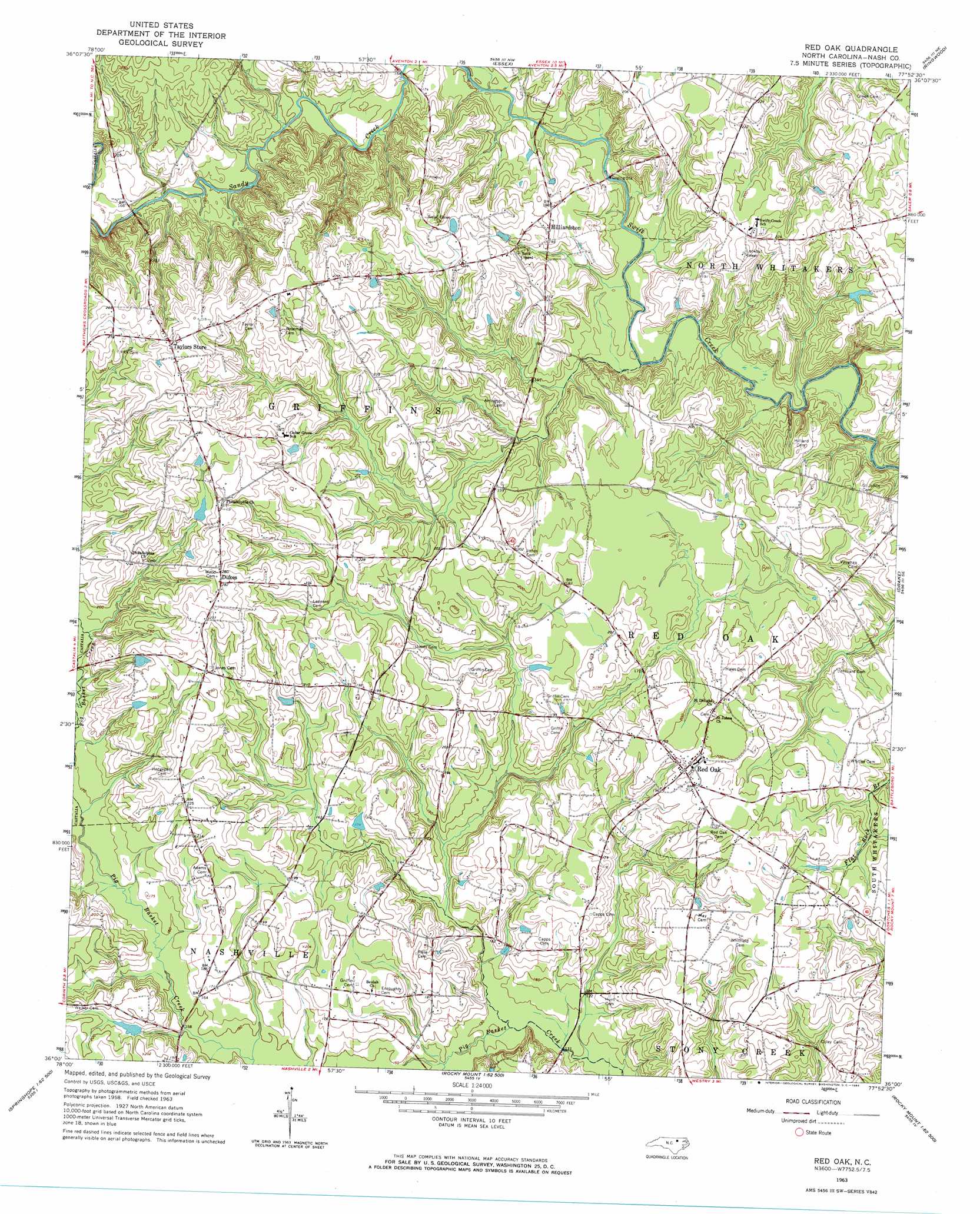
USGS Topo Quad 36077a8 - 1:24,000 scale
| Topo Map Name: | Red Oak |
| USGS Topo Quad ID: | 36077a8 |
| Print Size: | ca. 21 1/4" wide x 27" high |
| Southeast Coordinates: | 36° N latitude / 77.875° W longitude |
| Map Center Coordinates: | 36.0625° N latitude / 77.9375° W longitude |
| U.S. State: | NC |
| Filename: | o36077a8.jpg |
| Download Map JPG Image: | Red Oak topo map 1:24,000 scale |
| Map Type: | Topographic |
| Topo Series: | 7.5´ |
| Map Scale: | 1:24,000 |
| Source of Map Images: | United States Geological Survey (USGS) |
| Alternate Map Versions: |
Red Oak NC 1963, updated 1964 Download PDF Buy paper map Red Oak NC 2010 Download PDF Buy paper map Red Oak NC 2013 Download PDF Buy paper map Red Oak NC 2016 Download PDF Buy paper map |
1:24,000 Topo Quads surrounding Red Oak
Afton |
Inez |
Hollister |
Aurelian Springs |
Darlington |
Gold Sand |
Centerville |
Essex |
Ringwood |
Enfield |
Justice |
Castalia |
Red Oak |
Drake |
Whitakers |
Bunn East |
Spring Hope |
Nashville |
Rocky Mount |
Hartsease |
Middlesex |
Bailey |
Winstead Crossroads |
Elm City |
Pinetops |
> Back to 36077a1 at 1:100,000 scale
> Back to 36076a1 at 1:250,000 scale
> Back to U.S. Topo Maps home
Red Oak topo map: Gazetteer
Red Oak: Bridges
Coopers Bridge elevation 44m 144′Drakes Bridge elevation 47m 154′
Red Oak: Dams
Collins Pond Dam elevation 54m 177′Coopers Pond Dam elevation 70m 229′
Red Oak: Populated Places
Dukes elevation 86m 282′Hilliardston elevation 61m 200′
Red Oak elevation 62m 203′
Taylors Store elevation 88m 288′
Red Oak: Reservoirs
Collins Pond elevation 54m 177′Coopers Pond elevation 70m 229′
Red Oak: Streams
Gideon Swamp elevation 43m 141′Sandy Creek elevation 43m 141′
Red Oak digital topo map on disk
Buy this Red Oak topo map showing relief, roads, GPS coordinates and other geographical features, as a high-resolution digital map file on DVD:
Atlantic Coast (NY, NJ, PA, DE, MD, VA, NC)
Buy digital topo maps: Atlantic Coast (NY, NJ, PA, DE, MD, VA, NC)
 map DVD")