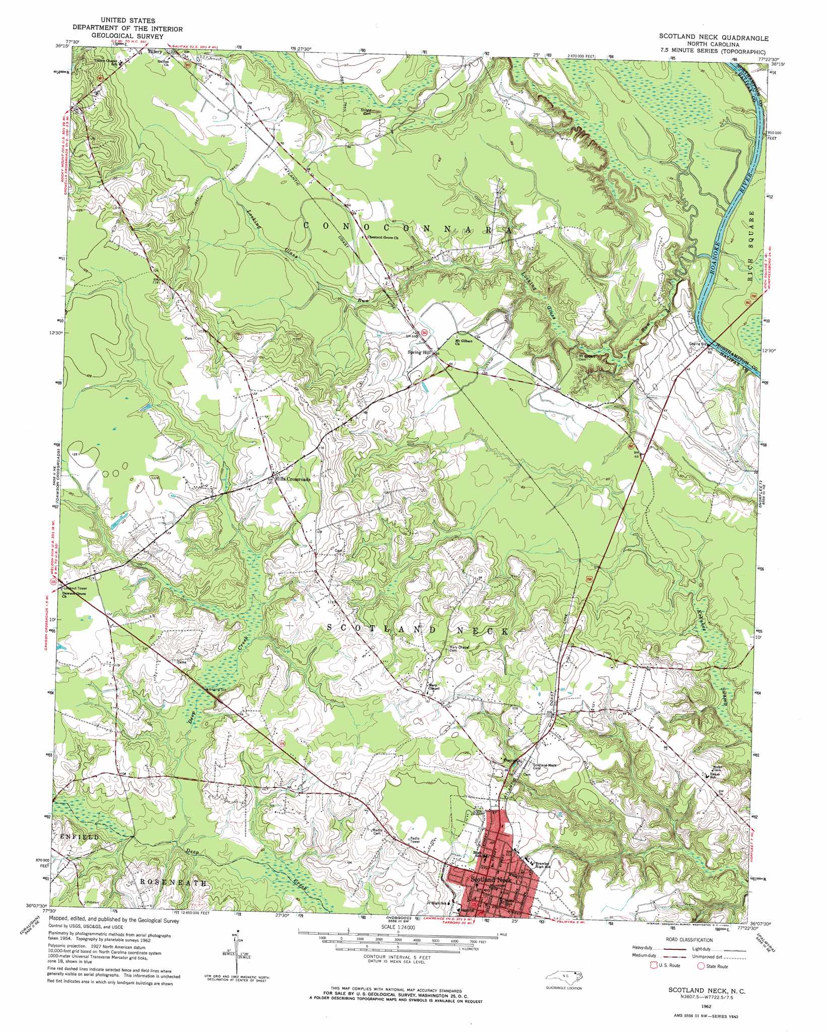
Scotland Neck Topo Map North Carolina
To zoom in, hover over the map of Scotland Neck
USGS Topo Quad 36077b4 - 1:24,000 scale
| Topo Map Name: | Scotland Neck |
| USGS Topo Quad ID: | 36077b4 |
| Print Size: | ca. 21 1/4" wide x 27" high |
| Southeast Coordinates: | 36.125° N latitude / 77.375° W longitude |
| Map Center Coordinates: | 36.1875° N latitude / 77.4375° W longitude |
| U.S. State: | NC |
| Filename: | o36077b4.jpg |
| Download Map JPG Image: | Scotland Neck topo map 1:24,000 scale |
| Map Type: | Topographic |
| Topo Series: | 7.5´ |
| Map Scale: | 1:24,000 |
| Source of Map Images: | United States Geological Survey (USGS) |
| Alternate Map Versions: |
Scotland Neck NC 1962, updated 1964 Download PDF Buy paper map Scotland Neck NC 2010 Download PDF Buy paper map Scotland Neck NC 2013 Download PDF Buy paper map Scotland Neck NC 2016 Download PDF Buy paper map |
1:24,000 Topo Quads surrounding Scotland Neck
Roanoke Rapids |
Weldon |
Jackson |
Galatia |
Conway |
Darlington |
Halifax |
Boones Crossroads |
Rich Square |
Woodland |
Enfield |
Dawson Crossroads |
Scotland Neck |
Norfleet |
Kelford |
Whitakers |
Draughn |
Hobgood |
Palmyra |
Woodville |
Hartsease |
Tarboro |
Speed |
Oak City |
Hamilton |
> Back to 36077a1 at 1:100,000 scale
> Back to 36076a1 at 1:250,000 scale
> Back to U.S. Topo Maps home
Scotland Neck topo map: Gazetteer
Scotland Neck: Airports
Scotland Neck Airport elevation 24m 78′Scotland Neck: Populated Places
Hills Crossroads elevation 36m 118′Scotland Neck elevation 30m 98′
Spring Hill elevation 20m 65′
Scotland Neck: Streams
Looking Glass Run elevation 7m 22′Scotland Neck digital topo map on disk
Buy this Scotland Neck topo map showing relief, roads, GPS coordinates and other geographical features, as a high-resolution digital map file on DVD:
Atlantic Coast (NY, NJ, PA, DE, MD, VA, NC)
Buy digital topo maps: Atlantic Coast (NY, NJ, PA, DE, MD, VA, NC)
 map DVD")