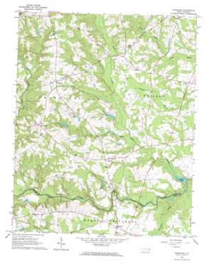
Ringwood Topo Map North Carolina
To zoom in, hover over the map of Ringwood
USGS Topo Quad 36077b7 - 1:24,000 scale
| Topo Map Name: | Ringwood |
| USGS Topo Quad ID: | 36077b7 |
| Print Size: | ca. 21 1/4" wide x 27" high |
| Southeast Coordinates: | 36.125° N latitude / 77.75° W longitude |
| Map Center Coordinates: | 36.1875° N latitude / 77.8125° W longitude |
| U.S. State: | NC |
| Filename: | o36077b7.jpg |
| Download Map JPG Image: | Ringwood topo map 1:24,000 scale |
| Map Type: | Topographic |
| Topo Series: | 7.5´ |
| Map Scale: | 1:24,000 |
| Source of Map Images: | United States Geological Survey (USGS) |
| Alternate Map Versions: |
Ringwood NC 1963, updated 1964 Download PDF Buy paper map Ringwood NC 2010 Download PDF Buy paper map Ringwood NC 2013 Download PDF Buy paper map Ringwood NC 2016 Download PDF Buy paper map |
1:24,000 Topo Quads surrounding Ringwood
> Back to 36077a1 at 1:100,000 scale
> Back to 36076a1 at 1:250,000 scale
> Back to U.S. Topo Maps home
Ringwood topo map: Gazetteer
Ringwood: Bridges
Culpeppers Bridge elevation 29m 95′Meltons Bridge elevation 32m 104′
Ringwood: Dams
Bellamys Lake Dam elevation 34m 111′Moss Lake Dam elevation 38m 124′
Moss Lake Number One Dam elevation 50m 164′
Moss Lake Number Two Dam elevation 57m 187′
Ringwood: Lakes
Gum Lake elevation 28m 91′Ringwood: Populated Places
Glenview elevation 46m 150′Hickory elevation 42m 137′
Ringwood elevation 71m 232′
White Oak elevation 77m 252′
Ringwood: Reservoirs
Bellamy Lake elevation 29m 95′Bellamys Lake elevation 34m 111′
Moss Lake elevation 38m 124′
Moss Lake Number One elevation 50m 164′
Moss Lake Number Two elevation 57m 187′
Ringwood: Streams
Beaverdam Swamp elevation 28m 91′Jack Horse Swamp elevation 32m 104′
Rocky Swamp elevation 28m 91′
Ringwood digital topo map on disk
Buy this Ringwood topo map showing relief, roads, GPS coordinates and other geographical features, as a high-resolution digital map file on DVD:
Atlantic Coast (NY, NJ, PA, DE, MD, VA, NC)
Buy digital topo maps: Atlantic Coast (NY, NJ, PA, DE, MD, VA, NC)


