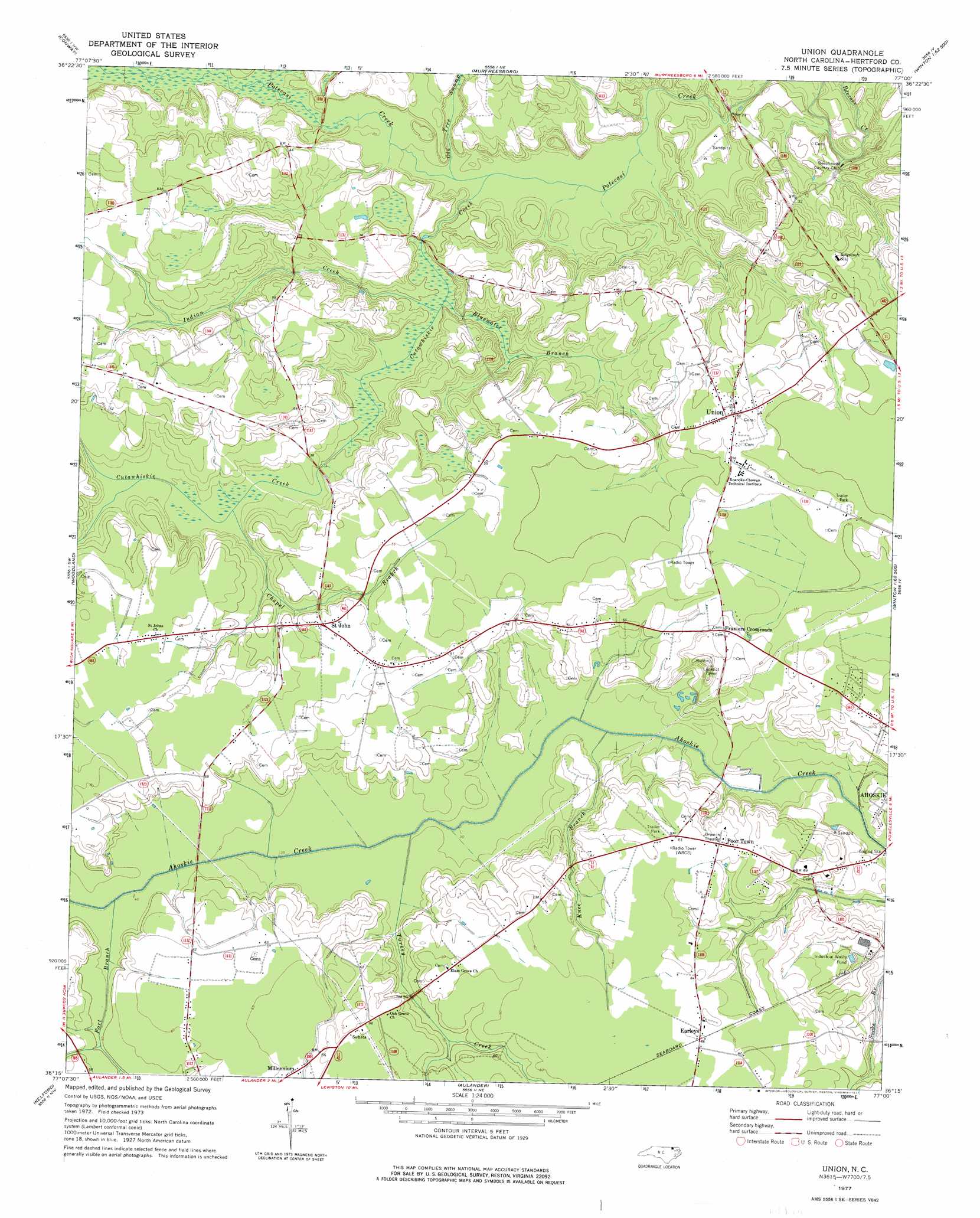
Union Topo Map North Carolina
To zoom in, hover over the map of Union
USGS Topo Quad 36077c1 - 1:24,000 scale
| Topo Map Name: | Union |
| USGS Topo Quad ID: | 36077c1 |
| Print Size: | ca. 21 1/4" wide x 27" high |
| Southeast Coordinates: | 36.25° N latitude / 77° W longitude |
| Map Center Coordinates: | 36.3125° N latitude / 77.0625° W longitude |
| U.S. State: | NC |
| Filename: | o36077c1.jpg |
| Download Map JPG Image: | Union topo map 1:24,000 scale |
| Map Type: | Topographic |
| Topo Series: | 7.5´ |
| Map Scale: | 1:24,000 |
| Source of Map Images: | United States Geological Survey (USGS) |
| Alternate Map Versions: |
Union NC 1977, updated 1977 Download PDF Buy paper map Union NC 2010 Download PDF Buy paper map Union NC 2013 Download PDF Buy paper map Union NC 2016 Download PDF Buy paper map |
1:24,000 Topo Quads surrounding Union
Margarettsville |
Boykins |
Sunbeam |
Riverdale |
Gates |
Galatia |
Conway |
Murfreesboro |
Winton |
Gatesville |
Rich Square |
Woodland |
Union |
Ahoskie |
Harrellsville |
Norfleet |
Kelford |
Aulander |
Powellsville |
Colerain |
Palmyra |
Woodville |
Republican |
Windsor North |
Merry Hill |
> Back to 36077a1 at 1:100,000 scale
> Back to 36076a1 at 1:250,000 scale
> Back to U.S. Topo Maps home
Union topo map: Gazetteer
Union: Bridges
Benthalls Bridge elevation 6m 19′Knights Bridge elevation 6m 19′
Union: Islands
Buffalo Island elevation 8m 26′Union: Populated Places
Earleys elevation 19m 62′Fraziers Crossroads elevation 19m 62′
Poor Town elevation 19m 62′
Saint John elevation 17m 55′
Union elevation 16m 52′
Union: Streams
Bluewater Branch elevation 6m 19′Chapel Branch elevation 9m 29′
Cutawhiskie Creek elevation 4m 13′
Fort Branch elevation 13m 42′
Indian Creek elevation 6m 19′
Knee Branch elevation 8m 26′
Old Tree Swamp elevation 4m 13′
Turkey Creek elevation 11m 36′
Union digital topo map on disk
Buy this Union topo map showing relief, roads, GPS coordinates and other geographical features, as a high-resolution digital map file on DVD:
Atlantic Coast (NY, NJ, PA, DE, MD, VA, NC)
Buy digital topo maps: Atlantic Coast (NY, NJ, PA, DE, MD, VA, NC)
 map DVD")