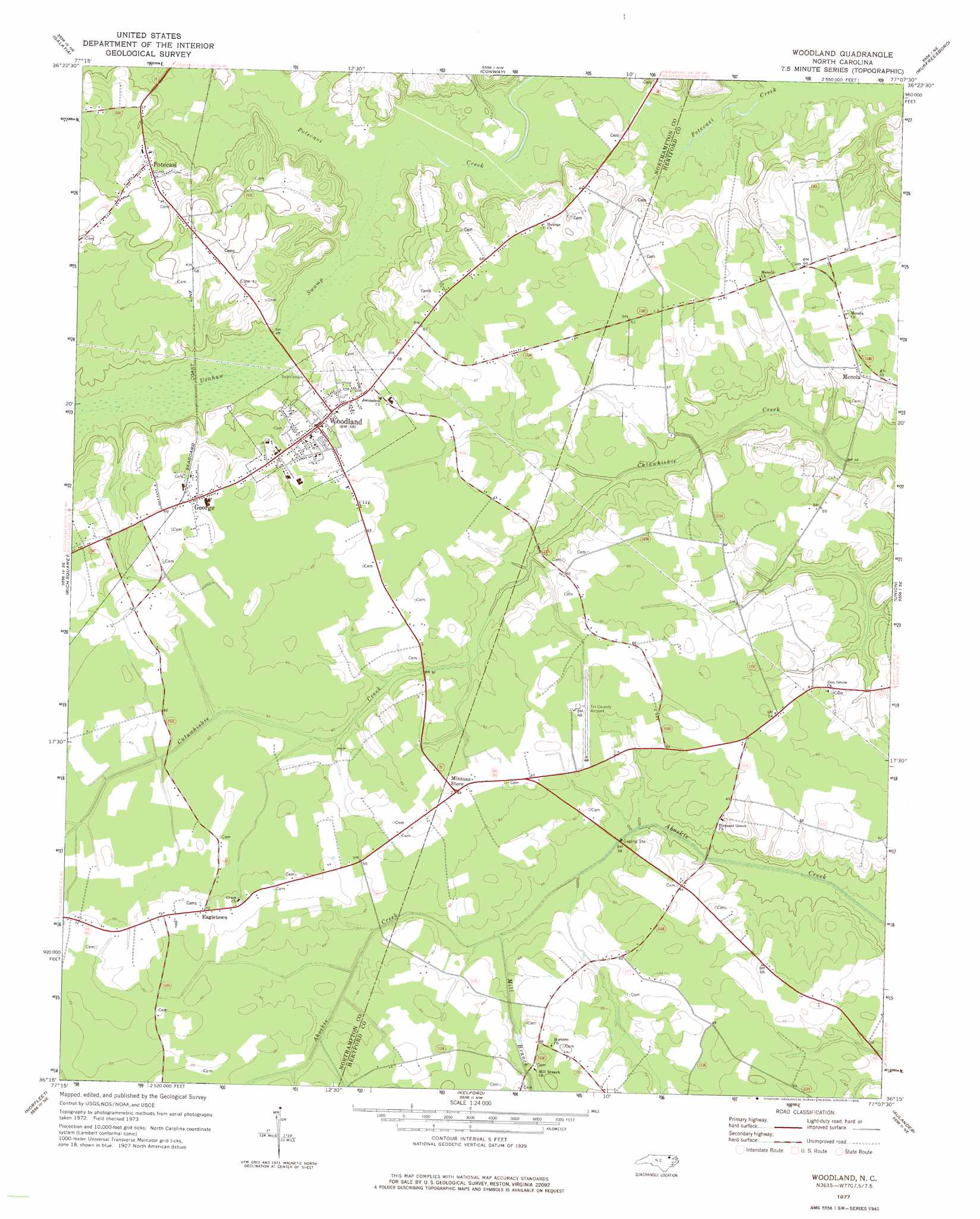
Woodland Topo Map North Carolina
To zoom in, hover over the map of Woodland
USGS Topo Quad 36077c2 - 1:24,000 scale
| Topo Map Name: | Woodland |
| USGS Topo Quad ID: | 36077c2 |
| Print Size: | ca. 21 1/4" wide x 27" high |
| Southeast Coordinates: | 36.25° N latitude / 77.125° W longitude |
| Map Center Coordinates: | 36.3125° N latitude / 77.1875° W longitude |
| U.S. State: | NC |
| Filename: | o36077c2.jpg |
| Download Map JPG Image: | Woodland topo map 1:24,000 scale |
| Map Type: | Topographic |
| Topo Series: | 7.5´ |
| Map Scale: | 1:24,000 |
| Source of Map Images: | United States Geological Survey (USGS) |
| Alternate Map Versions: |
Woodland NC 1977, updated 1978 Download PDF Buy paper map Woodland NC 2010 Download PDF Buy paper map Woodland NC 2013 Download PDF Buy paper map Woodland NC 2016 Download PDF Buy paper map |
1:24,000 Topo Quads surrounding Woodland
Claresville |
Margarettsville |
Boykins |
Sunbeam |
Riverdale |
Jackson |
Galatia |
Conway |
Murfreesboro |
Winton |
Boones Crossroads |
Rich Square |
Woodland |
Union |
Ahoskie |
Scotland Neck |
Norfleet |
Kelford |
Aulander |
Powellsville |
Hobgood |
Palmyra |
Woodville |
Republican |
Windsor North |
> Back to 36077a1 at 1:100,000 scale
> Back to 36076a1 at 1:250,000 scale
> Back to U.S. Topo Maps home
Woodland topo map: Gazetteer
Woodland: Populated Places
Eagletown elevation 22m 72′George elevation 21m 68′
Menola elevation 18m 59′
Potecasi elevation 21m 68′
Woodland elevation 20m 65′
Woodland: Streams
Mill Branch elevation 15m 49′Urahaw Swamp elevation 11m 36′
Woodland digital topo map on disk
Buy this Woodland topo map showing relief, roads, GPS coordinates and other geographical features, as a high-resolution digital map file on DVD:
Atlantic Coast (NY, NJ, PA, DE, MD, VA, NC)
Buy digital topo maps: Atlantic Coast (NY, NJ, PA, DE, MD, VA, NC)
 map DVD")