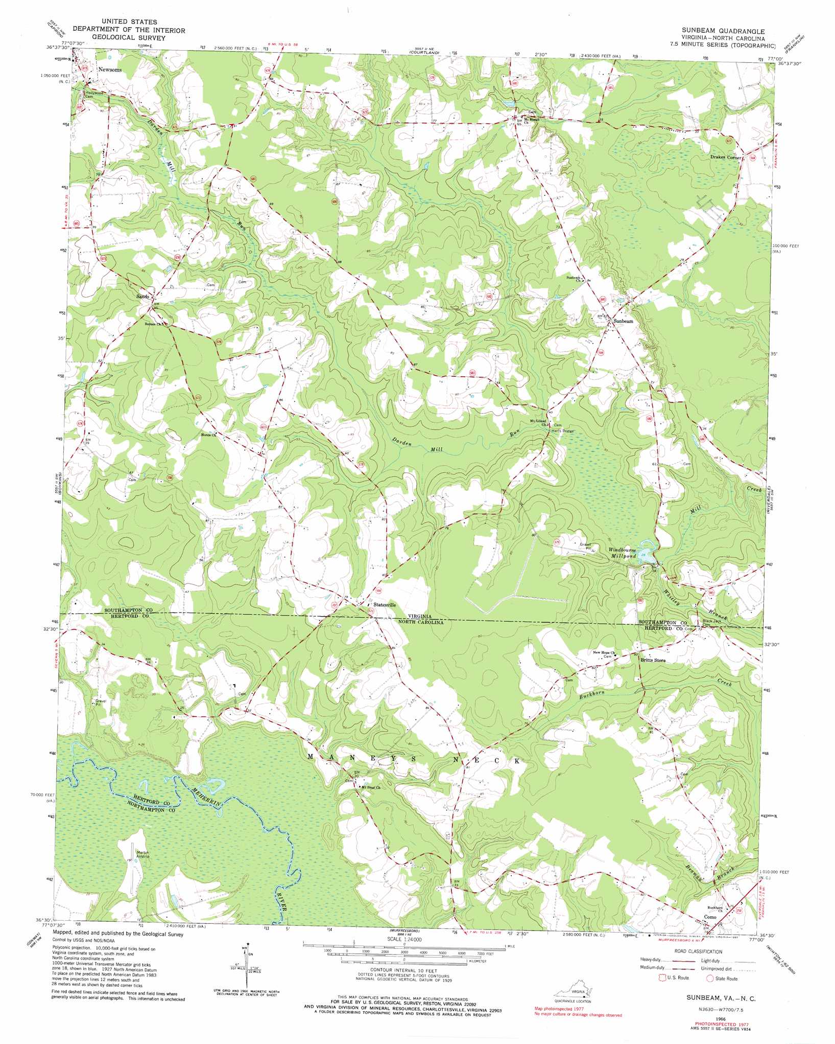
Sunbeam Topo Map Virginia
To zoom in, hover over the map of Sunbeam
USGS Topo Quad 36077e1 - 1:24,000 scale
| Topo Map Name: | Sunbeam |
| USGS Topo Quad ID: | 36077e1 |
| Print Size: | ca. 21 1/4" wide x 27" high |
| Southeast Coordinates: | 36.5° N latitude / 77° W longitude |
| Map Center Coordinates: | 36.5625° N latitude / 77.0625° W longitude |
| U.S. States: | VA, NC |
| Filename: | o36077e1.jpg |
| Download Map JPG Image: | Sunbeam topo map 1:24,000 scale |
| Map Type: | Topographic |
| Topo Series: | 7.5´ |
| Map Scale: | 1:24,000 |
| Source of Map Images: | United States Geological Survey (USGS) |
| Alternate Map Versions: |
Sunbeam VA 1966, updated 1968 Download PDF Buy paper map Sunbeam VA 1966, updated 1980 Download PDF Buy paper map Sunbeam VA 1997, updated 2000 Download PDF Buy paper map Sunbeam VA 2010 Download PDF Buy paper map Sunbeam VA 2013 Download PDF Buy paper map Sunbeam VA 2016 Download PDF Buy paper map |
1:24,000 Topo Quads surrounding Sunbeam
Yale |
Sebrell |
Vicksville |
Sedley |
Zuni |
Drewryville |
Capron |
Courtland |
Franklin |
Holland |
Margarettsville |
Boykins |
Sunbeam |
Riverdale |
Gates |
Galatia |
Conway |
Murfreesboro |
Winton |
Gatesville |
Rich Square |
Woodland |
Union |
Ahoskie |
Harrellsville |
> Back to 36077e1 at 1:100,000 scale
> Back to 36076a1 at 1:250,000 scale
> Back to U.S. Topo Maps home
Sunbeam topo map: Gazetteer
Sunbeam: Airports
Martin Airport elevation 5m 16′Sunbeam: Bridges
Harts Bridge elevation 8m 26′Sunbeam: Dams
Windbourne Dam elevation 9m 29′Sunbeam: Populated Places
Como elevation 23m 75′Drakes Corner elevation 9m 29′
Newsoms elevation 26m 85′
Statesville elevation 23m 75′
Sunbeam elevation 24m 78′
Sunbeam: Post Offices
Como Post Office elevation 21m 68′Newsoms Post Office elevation 26m 85′
Sunbeam: Reservoirs
Windbourne Mill Pond elevation 9m 29′Sunbeam: Streams
Darden Mill Run elevation 7m 22′Whitley Branch elevation 8m 26′
Whitley Branch elevation 8m 26′
Sunbeam digital topo map on disk
Buy this Sunbeam topo map showing relief, roads, GPS coordinates and other geographical features, as a high-resolution digital map file on DVD:
Atlantic Coast (NY, NJ, PA, DE, MD, VA, NC)
Buy digital topo maps: Atlantic Coast (NY, NJ, PA, DE, MD, VA, NC)
 map DVD")