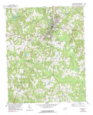
Louisburg Topo Map North Carolina
To zoom in, hover over the map of Louisburg
USGS Topo Quad 36078a3 - 1:24,000 scale
| Topo Map Name: | Louisburg |
| USGS Topo Quad ID: | 36078a3 |
| Print Size: | ca. 21 1/4" wide x 27" high |
| Southeast Coordinates: | 36° N latitude / 78.25° W longitude |
| Map Center Coordinates: | 36.0625° N latitude / 78.3125° W longitude |
| U.S. State: | NC |
| Filename: | o36078a3.jpg |
| Download Map JPG Image: | Louisburg topo map 1:24,000 scale |
| Map Type: | Topographic |
| Topo Series: | 7.5´ |
| Map Scale: | 1:24,000 |
| Source of Map Images: | United States Geological Survey (USGS) |
| Alternate Map Versions: |
Louisburg NC 1978, updated 1979 Download PDF Buy paper map Louisburg NC 1978, updated 1990 Download PDF Buy paper map Louisburg NC 2010 Download PDF Buy paper map Louisburg NC 2013 Download PDF Buy paper map Louisburg NC 2016 Download PDF Buy paper map |
1:24,000 Topo Quads surrounding Louisburg
> Back to 36078a1 at 1:100,000 scale
> Back to 36078a1 at 1:250,000 scale
> Back to U.S. Topo Maps home
Louisburg topo map: Gazetteer
Louisburg: Airports
Franklin County Airport elevation 104m 341′Griffin Airport elevation 82m 269′
Louisburg: Bridges
Perry Mill Bridge elevation 67m 219′Timberlake Bridge elevation 69m 226′
Louisburg: Dams
Cliftons Pond Dam elevation 78m 255′Mitchiners Pond Dam elevation 65m 213′
Timmerman Pond Dam elevation 77m 252′
Louisburg: Parks
Frazier Field elevation 67m 219′River Bend Park elevation 59m 193′
Louisburg: Populated Places
Katesville elevation 107m 351′Louisburg elevation 67m 219′
Raynor elevation 92m 301′
Royal elevation 116m 380′
Louisburg: Reservoirs
Alford Brothers Pond elevation 57m 187′Cliftons Pond elevation 78m 255′
Mitchiners Pond elevation 65m 213′
Timmerman Pond elevation 77m 252′
Louisburg: Streams
Bear Swamp Creek elevation 59m 193′Big Branch Creek elevation 56m 183′
Camping Creek elevation 68m 223′
Cedar Creek elevation 51m 167′
Coole Creek elevation 58m 190′
Fox Creek elevation 55m 180′
Jumping Run elevation 53m 173′
Neal Gut elevation 64m 209′
Sycamore Creek elevation 57m 187′
Wolfpen Branch elevation 54m 177′
Louisburg digital topo map on disk
Buy this Louisburg topo map showing relief, roads, GPS coordinates and other geographical features, as a high-resolution digital map file on DVD:
Western Virginia & Southern West Virginia
Buy digital topo maps: Western Virginia & Southern West Virginia


