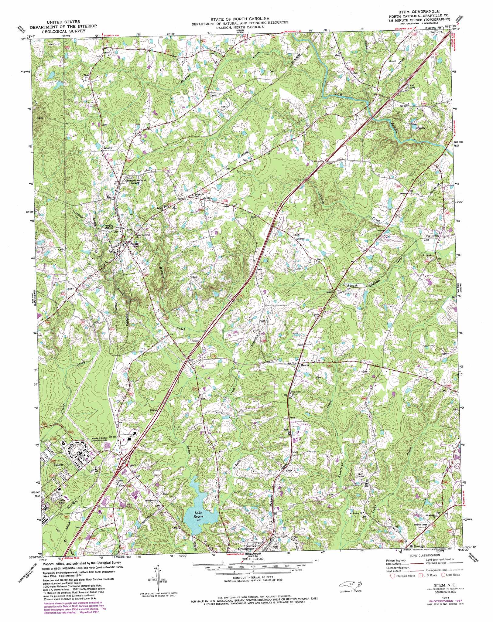
Stem Topo Map North Carolina
To zoom in, hover over the map of Stem
USGS Topo Quad 36078b6 - 1:24,000 scale
| Topo Map Name: | Stem |
| USGS Topo Quad ID: | 36078b6 |
| Print Size: | ca. 21 1/4" wide x 27" high |
| Southeast Coordinates: | 36.125° N latitude / 78.625° W longitude |
| Map Center Coordinates: | 36.1875° N latitude / 78.6875° W longitude |
| U.S. State: | NC |
| Filename: | o36078b6.jpg |
| Download Map JPG Image: | Stem topo map 1:24,000 scale |
| Map Type: | Topographic |
| Topo Series: | 7.5´ |
| Map Scale: | 1:24,000 |
| Source of Map Images: | United States Geological Survey (USGS) |
| Alternate Map Versions: |
Stem NC 1974, updated 1977 Download PDF Buy paper map Stem NC 1974, updated 1987 Download PDF Buy paper map Stem NC 2010 Download PDF Buy paper map Stem NC 2013 Download PDF Buy paper map Stem NC 2016 Download PDF Buy paper map |
1:24,000 Topo Quads surrounding Stem
Roxboro |
Triple Springs |
Satterwhite |
Stovall |
Townsville |
Timberlake |
Moriah |
Berea |
Oxford |
Henderson |
Rougemont |
Lake Michie |
Stem |
Wilton |
Kittrell |
Northwest Durham |
Northeast Durham |
Creedmoor |
Grissom |
Franklinton |
Southwest Durham |
Southeast Durham |
Bayleaf |
Wake Forest |
Rolesville |
> Back to 36078a1 at 1:100,000 scale
> Back to 36078a1 at 1:250,000 scale
> Back to U.S. Topo Maps home
Stem topo map: Gazetteer
Stem: Crossings
Interchange 191 elevation 113m 370′Stem: Dams
Lake Rogers Dam elevation 86m 282′Nye Pond Dam Number One elevation 134m 439′
Veazsys Lake Dam elevation 148m 485′
Stem: Lakes
Lake Rogers elevation 86m 282′Stem: Populated Places
Hester elevation 119m 390′Lyons elevation 114m 374′
Mount Energy elevation 118m 387′
Shoofly elevation 160m 524′
Stem elevation 144m 472′
Tar River elevation 102m 334′
Stem: Reservoirs
Cash Lake elevation 148m 485′Nye Pond Number One elevation 134m 439′
Stem: Streams
Cattail Creek elevation 104m 341′Cedar Creek elevation 83m 272′
Holman Creek elevation 85m 278′
Jackson Creek elevation 108m 354′
Johnson Creek elevation 94m 308′
Stem digital topo map on disk
Buy this Stem topo map showing relief, roads, GPS coordinates and other geographical features, as a high-resolution digital map file on DVD:
Western Virginia & Southern West Virginia
Buy digital topo maps: Western Virginia & Southern West Virginia