Triple Springs Topo Map North Carolina
To zoom in, hover over the map of Triple Springs
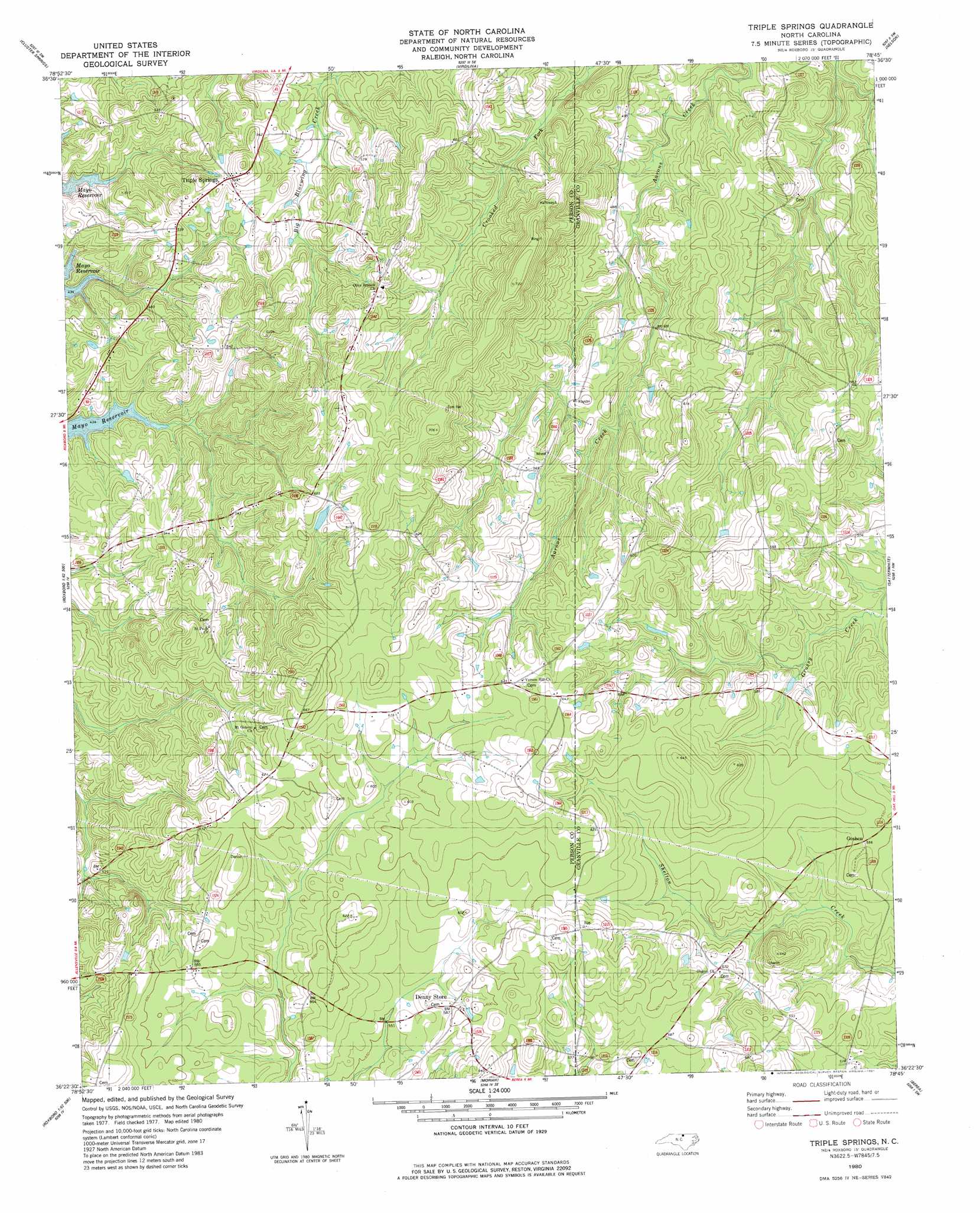
USGS Topo Quad 36078d7 - 1:24,000 scale
| Topo Map Name: | Triple Springs |
| USGS Topo Quad ID: | 36078d7 |
| Print Size: | ca. 21 1/4" wide x 27" high |
| Southeast Coordinates: | 36.375° N latitude / 78.75° W longitude |
| Map Center Coordinates: | 36.4375° N latitude / 78.8125° W longitude |
| U.S. State: | NC |
| Filename: | o36078d7.jpg |
| Download Map JPG Image: | Triple Springs topo map 1:24,000 scale |
| Map Type: | Topographic |
| Topo Series: | 7.5´ |
| Map Scale: | 1:24,000 |
| Source of Map Images: | United States Geological Survey (USGS) |
| Alternate Map Versions: |
Triple Springs NC 1980, updated 1981 Download PDF Buy paper map Triple Springs NC 2010 Download PDF Buy paper map Triple Springs NC 2013 Download PDF Buy paper map Triple Springs NC 2016 Download PDF Buy paper map |
1:24,000 Topo Quads surrounding Triple Springs
Oak Level |
South Boston |
Omega |
Buffalo Springs |
Clarksville North |
Alton |
Cluster Springs |
Virgilina |
Nelson |
Clarksville South |
Olive Hill |
Roxboro |
Triple Springs |
Satterwhite |
Stovall |
Hurdle Mills |
Timberlake |
Moriah |
Berea |
Oxford |
Caldwell |
Rougemont |
Lake Michie |
Stem |
Wilton |
> Back to 36078a1 at 1:100,000 scale
> Back to 36078a1 at 1:250,000 scale
> Back to U.S. Topo Maps home
Triple Springs topo map: Gazetteer
Triple Springs: Mines
Durgy Mine elevation 189m 620′Triple Springs: Populated Places
Catilina elevation 196m 643′Denny Store elevation 175m 574′
Halloway (historical) elevation 177m 580′
Triple Springs elevation 172m 564′
Triple Springs digital topo map on disk
Buy this Triple Springs topo map showing relief, roads, GPS coordinates and other geographical features, as a high-resolution digital map file on DVD:
Western Virginia & Southern West Virginia
Buy digital topo maps: Western Virginia & Southern West Virginia