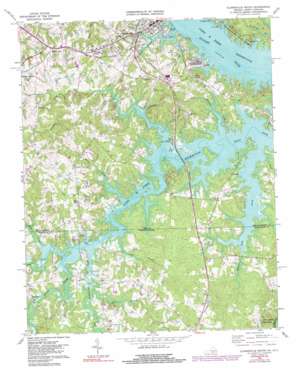
Clarksville South Topo Map Virginia
To zoom in, hover over the map of Clarksville South
USGS Topo Quad 36078e5 - 1:24,000 scale
| Topo Map Name: | Clarksville South |
| USGS Topo Quad ID: | 36078e5 |
| Print Size: | ca. 21 1/4" wide x 27" high |
| Southeast Coordinates: | 36.5° N latitude / 78.5° W longitude |
| Map Center Coordinates: | 36.5625° N latitude / 78.5625° W longitude |
| U.S. States: | VA, NC |
| Filename: | o36078e5.jpg |
| Download Map JPG Image: | Clarksville South topo map 1:24,000 scale |
| Map Type: | Topographic |
| Topo Series: | 7.5´ |
| Map Scale: | 1:24,000 |
| Source of Map Images: | United States Geological Survey (USGS) |
| Alternate Map Versions: |
Clarksville South VA 1968, updated 1972 Download PDF Buy paper map Clarksville South VA 1968, updated 1982 Download PDF Buy paper map Clarksville South VA 1968, updated 1991 Download PDF Buy paper map Clarksville South VA 1977, updated 1979 Download PDF Buy paper map Clarksville South VA 2011 Download PDF Buy paper map Clarksville South VA 2013 Download PDF Buy paper map Clarksville South VA 2016 Download PDF Buy paper map |
1:24,000 Topo Quads surrounding Clarksville South
> Back to 36078e1 at 1:100,000 scale
> Back to 36078a1 at 1:250,000 scale
> Back to U.S. Topo Maps home
Clarksville South topo map: Gazetteer
Clarksville South: Airports
Marks Municipal Airport elevation 119m 390′Merifield Airport elevation 101m 331′
Clarksville South: Cliffs
Rosseechees Bluff elevation 92m 301′Clarksville South: Dams
Lewis Mill Dam (historical) elevation 91m 298′Towns Mill Dam (historical) elevation 91m 298′
Clarksville South: Islands
Lewis Island (historical) elevation 91m 298′Tisdale Island (historical) elevation 91m 298′
Clarksville South: Parks
Beaver Pond Creek Wildlife Management Area elevation 107m 351′Grassy Creek Recreation Area elevation 105m 344′
Longwood Public Use Area elevation 96m 314′
Merifield Wildlife Management Area elevation 104m 341′
Old Soudan Wildlife Management Area elevation 94m 308′
Clarksville South: Populated Places
Blanks elevation 110m 360′Clarksville elevation 108m 354′
Henrico elevation 123m 403′
Merifield Acres elevation 107m 351′
Mill Village elevation 105m 344′
Puryear Corner elevation 129m 423′
Sandy Fork elevation 134m 439′
Shiny Rock elevation 115m 377′
Soudan elevation 101m 331′
Clarksville South: Streams
Beaver Pond Creek elevation 91m 298′Beaver Pond Creek elevation 91m 298′
Beaver Pond Creek elevation 91m 298′
Beech Creek elevation 92m 301′
Beech Creek elevation 92m 301′
Black Creek elevation 91m 298′
Blue Creek elevation 91m 298′
Buckhorn Branch elevation 91m 298′
Cedar Branch elevation 91m 298′
Crowders Branch elevation 92m 301′
Distillery Branch elevation 91m 298′
Essex Branch elevation 91m 298′
Johnson Creek elevation 91m 298′
Lick Branch elevation 106m 347′
Lick Branch elevation 92m 301′
Lick Branch elevation 91m 298′
Little Beaver Pond Creek elevation 102m 334′
Rattlesnake Creek elevation 93m 305′
Spewmarrow Creek elevation 91m 298′
Clarksville South digital topo map on disk
Buy this Clarksville South topo map showing relief, roads, GPS coordinates and other geographical features, as a high-resolution digital map file on DVD:
Western Virginia & Southern West Virginia
Buy digital topo maps: Western Virginia & Southern West Virginia


