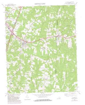
La Crosse Topo Map Virginia
To zoom in, hover over the map of La Crosse
USGS Topo Quad 36078f1 - 1:24,000 scale
| Topo Map Name: | La Crosse |
| USGS Topo Quad ID: | 36078f1 |
| Print Size: | ca. 21 1/4" wide x 27" high |
| Southeast Coordinates: | 36.625° N latitude / 78° W longitude |
| Map Center Coordinates: | 36.6875° N latitude / 78.0625° W longitude |
| U.S. State: | VA |
| Filename: | o36078f1.jpg |
| Download Map JPG Image: | La Crosse topo map 1:24,000 scale |
| Map Type: | Topographic |
| Topo Series: | 7.5´ |
| Map Scale: | 1:24,000 |
| Source of Map Images: | United States Geological Survey (USGS) |
| Alternate Map Versions: |
La Crosse VA 1968, updated 1972 Download PDF Buy paper map La Crosse VA 1968, updated 1977 Download PDF Buy paper map La Crosse VA 1968, updated 1982 Download PDF Buy paper map La Crosse VA 2010 Download PDF Buy paper map La Crosse VA 2013 Download PDF Buy paper map La Crosse VA 2016 Download PDF Buy paper map |
1:24,000 Topo Quads surrounding La Crosse
> Back to 36078e1 at 1:100,000 scale
> Back to 36078a1 at 1:250,000 scale
> Back to U.S. Topo Maps home
La Crosse topo map: Gazetteer
La Crosse: Airports
Mecklenburg-Brunswick Regional Airport elevation 125m 410′La Crosse: Crossings
Interchange 12 elevation 128m 419′La Crosse: Dams
Raineys Dam elevation 119m 390′Winkle Dam elevation 115m 377′
La Crosse: Populated Places
Blackridge elevation 115m 377′Brodnax elevation 118m 387′
Hagood elevation 125m 410′
La Crosse elevation 137m 449′
Marengo elevation 116m 380′
La Crosse: Streams
Long Branch elevation 71m 232′Main Creek elevation 68m 223′
Pole Creek elevation 68m 223′
La Crosse digital topo map on disk
Buy this La Crosse topo map showing relief, roads, GPS coordinates and other geographical features, as a high-resolution digital map file on DVD:
Western Virginia & Southern West Virginia
Buy digital topo maps: Western Virginia & Southern West Virginia


