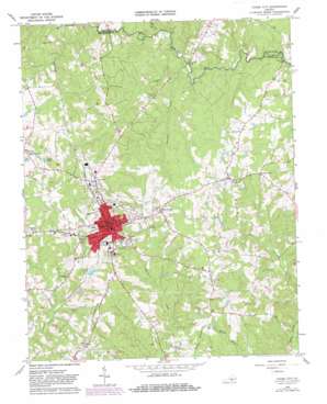
Chase City Topo Map Virginia
To zoom in, hover over the map of Chase City
USGS Topo Quad 36078g4 - 1:24,000 scale
| Topo Map Name: | Chase City |
| USGS Topo Quad ID: | 36078g4 |
| Print Size: | ca. 21 1/4" wide x 27" high |
| Southeast Coordinates: | 36.75° N latitude / 78.375° W longitude |
| Map Center Coordinates: | 36.8125° N latitude / 78.4375° W longitude |
| U.S. State: | VA |
| Filename: | o36078g4.jpg |
| Download Map JPG Image: | Chase City topo map 1:24,000 scale |
| Map Type: | Topographic |
| Topo Series: | 7.5´ |
| Map Scale: | 1:24,000 |
| Source of Map Images: | United States Geological Survey (USGS) |
| Alternate Map Versions: |
Chase City VA 1966, updated 1968 Download PDF Buy paper map Chase City VA 1966, updated 1982 Download PDF Buy paper map Chase City VA 2010 Download PDF Buy paper map Chase City VA 2013 Download PDF Buy paper map Chase City VA 2016 Download PDF Buy paper map |
1:24,000 Topo Quads surrounding Chase City
> Back to 36078e1 at 1:100,000 scale
> Back to 36078a1 at 1:250,000 scale
> Back to U.S. Topo Maps home
Chase City topo map: Gazetteer
Chase City: Bridges
Rocky Mill Bridge elevation 111m 364′Tucker Mill Bridge elevation 115m 377′
Chase City: Dams
Butlers Dam elevation 128m 419′Chase City: Populated Places
Black Branch elevation 162m 531′Chase City elevation 163m 534′
Esnon elevation 155m 508′
Fairview elevation 174m 570′
Scotts Crossroad elevation 150m 492′
Chase City: Post Offices
Chase City Post Office elevation 167m 547′Chase City: Reservoirs
Hughs Lake elevation 164m 538′Chase City: Streams
Finneywood Creek elevation 118m 387′Horsepen Creek elevation 120m 393′
Mitchell Creek elevation 122m 400′
Chase City digital topo map on disk
Buy this Chase City topo map showing relief, roads, GPS coordinates and other geographical features, as a high-resolution digital map file on DVD:
Western Virginia & Southern West Virginia
Buy digital topo maps: Western Virginia & Southern West Virginia


