Kenbridge East Topo Map Virginia
To zoom in, hover over the map of Kenbridge East
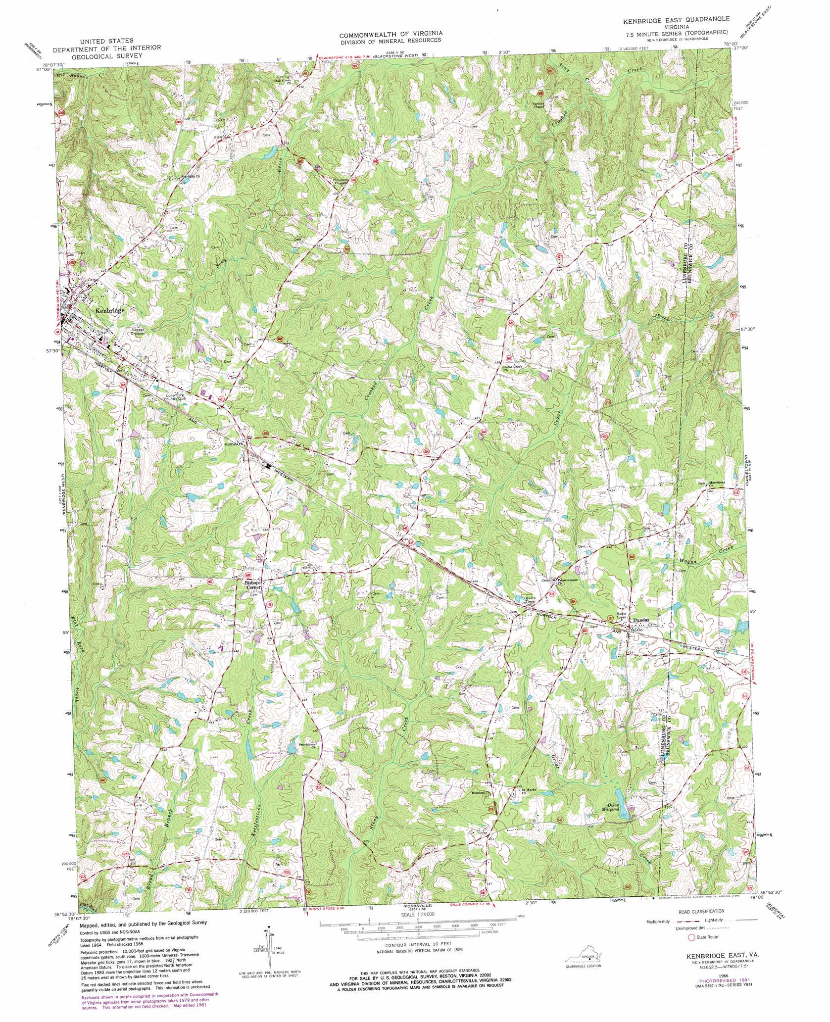
USGS Topo Quad 36078h1 - 1:24,000 scale
| Topo Map Name: | Kenbridge East |
| USGS Topo Quad ID: | 36078h1 |
| Print Size: | ca. 21 1/4" wide x 27" high |
| Southeast Coordinates: | 36.875° N latitude / 78° W longitude |
| Map Center Coordinates: | 36.9375° N latitude / 78.0625° W longitude |
| U.S. State: | VA |
| Filename: | o36078h1.jpg |
| Download Map JPG Image: | Kenbridge East topo map 1:24,000 scale |
| Map Type: | Topographic |
| Topo Series: | 7.5´ |
| Map Scale: | 1:24,000 |
| Source of Map Images: | United States Geological Survey (USGS) |
| Alternate Map Versions: |
Kenbridge East VA 1966, updated 1968 Download PDF Buy paper map Kenbridge East VA 1966, updated 1982 Download PDF Buy paper map Kenbridge East VA 1966, updated 1982 Download PDF Buy paper map Kenbridge East VA 2010 Download PDF Buy paper map Kenbridge East VA 2013 Download PDF Buy paper map Kenbridge East VA 2016 Download PDF Buy paper map |
1:24,000 Topo Quads surrounding Kenbridge East
Green Bay |
Crewe West |
Crewe East |
Wellville |
Hebron |
Meherrin |
Rubermont |
Blackstone West |
Blackstone East |
Darvills |
Lunenburg |
Kenbridge West |
Kenbridge East |
Danieltown |
Warfield |
Wightman |
North View |
Forksville |
Alberta |
Lawrenceville |
Baskerville |
South Hill |
La Crosse |
White Plains |
Powellton |
> Back to 36078e1 at 1:100,000 scale
> Back to 36078a1 at 1:250,000 scale
> Back to U.S. Topo Maps home
Kenbridge East topo map: Gazetteer
Kenbridge East: Dams
Dixons Dam elevation 108m 354′Kenbridge East: Populated Places
Bishops Corner elevation 145m 475′Dundas elevation 139m 456′
Kenbridge East: Reservoirs
Dixon Millpond elevation 106m 347′Dixons Millpond elevation 108m 354′
Kenbridge East: Streams
Seay Creek elevation 79m 259′Kenbridge East digital topo map on disk
Buy this Kenbridge East topo map showing relief, roads, GPS coordinates and other geographical features, as a high-resolution digital map file on DVD:
Western Virginia & Southern West Virginia
Buy digital topo maps: Western Virginia & Southern West Virginia