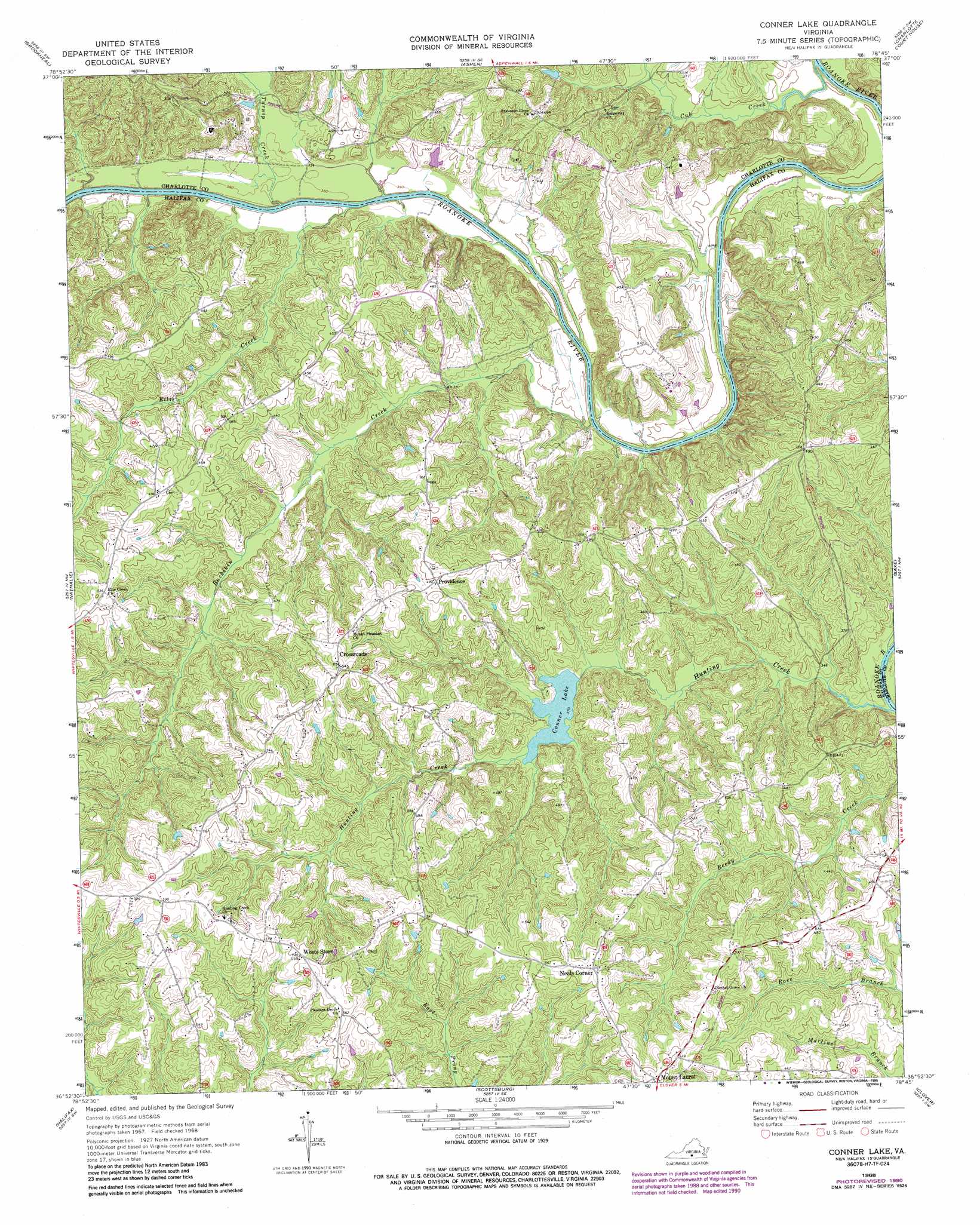
Conner Lake Topo Map Virginia
To zoom in, hover over the map of Conner Lake
USGS Topo Quad 36078h7 - 1:24,000 scale
| Topo Map Name: | Conner Lake |
| USGS Topo Quad ID: | 36078h7 |
| Print Size: | ca. 21 1/4" wide x 27" high |
| Southeast Coordinates: | 36.875° N latitude / 78.75° W longitude |
| Map Center Coordinates: | 36.9375° N latitude / 78.8125° W longitude |
| U.S. State: | VA |
| Filename: | o36078h7.jpg |
| Download Map JPG Image: | Conner Lake topo map 1:24,000 scale |
| Map Type: | Topographic |
| Topo Series: | 7.5´ |
| Map Scale: | 1:24,000 |
| Source of Map Images: | United States Geological Survey (USGS) |
| Alternate Map Versions: |
Conner Lake VA 1968, updated 1972 Download PDF Buy paper map Conner Lake VA 1968, updated 1990 Download PDF Buy paper map Conner Lake VA 2010 Download PDF Buy paper map Conner Lake VA 2013 Download PDF Buy paper map Conner Lake VA 2016 Download PDF Buy paper map |
1:24,000 Topo Quads surrounding Conner Lake
Gladys |
Mike |
Red House |
Madisonville |
Abilene |
Long Island |
Brookneal |
Aspen |
Charlotte Court House |
Eureka |
Republican Grove |
Nathalie |
Conner Lake |
Saxe |
Drakes Branch |
Vernon Hill |
Halifax |
Scottsburg |
Clover |
Wylliesburg |
Oak Level |
South Boston |
Omega |
Buffalo Springs |
Clarksville North |
> Back to 36078e1 at 1:100,000 scale
> Back to 36078a1 at 1:250,000 scale
> Back to U.S. Topo Maps home
Conner Lake topo map: Gazetteer
Conner Lake: Crossings
Coles Ferry (historical) elevation 106m 347′Conner Lake: Dams
Conners Dam elevation 111m 364′Conner Lake: Populated Places
Carrington elevation 168m 551′Crossroads elevation 166m 544′
Mount Laurel elevation 173m 567′
Neals Corner elevation 172m 564′
Providence elevation 151m 495′
Watkins elevation 150m 492′
Conner Lake: Reservoirs
Conner Lake elevation 111m 364′Conners Lake elevation 128m 419′
Conner Lake: Streams
Buckskin Creek elevation 102m 334′Cub Creek elevation 100m 328′
Ellis Creek elevation 105m 344′
Hunting Creek elevation 99m 324′
Turnip Creek elevation 105m 344′
Conner Lake digital topo map on disk
Buy this Conner Lake topo map showing relief, roads, GPS coordinates and other geographical features, as a high-resolution digital map file on DVD:
Western Virginia & Southern West Virginia
Buy digital topo maps: Western Virginia & Southern West Virginia