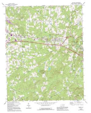
Efland Topo Map North Carolina
To zoom in, hover over the map of Efland
USGS Topo Quad 36079a2 - 1:24,000 scale
| Topo Map Name: | Efland |
| USGS Topo Quad ID: | 36079a2 |
| Print Size: | ca. 21 1/4" wide x 27" high |
| Southeast Coordinates: | 36° N latitude / 79.125° W longitude |
| Map Center Coordinates: | 36.0625° N latitude / 79.1875° W longitude |
| U.S. State: | NC |
| Filename: | o36079a2.jpg |
| Download Map JPG Image: | Efland topo map 1:24,000 scale |
| Map Type: | Topographic |
| Topo Series: | 7.5´ |
| Map Scale: | 1:24,000 |
| Source of Map Images: | United States Geological Survey (USGS) |
| Alternate Map Versions: |
Efland NC 1968, updated 1970 Download PDF Buy paper map Efland NC 1968, updated 1994 Download PDF Buy paper map Efland NC 2002, updated 2002 Download PDF Buy paper map Efland NC 2011 Download PDF Buy paper map Efland NC 2013 Download PDF Buy paper map Efland NC 2016 Download PDF Buy paper map |
1:24,000 Topo Quads surrounding Efland
> Back to 36079a1 at 1:100,000 scale
> Back to 36078a1 at 1:250,000 scale
> Back to U.S. Topo Maps home
Efland topo map: Gazetteer
Efland: Dams
Fellowship Lake Dam elevation 202m 662′Lake Michael Dam elevation 185m 606′
Orange-Alamance Lake Dam elevation 162m 531′
Rivins Lake Dam elevation 208m 682′
Smiths Lake Dam elevation 190m 623′
Efland: Lakes
Efland Millpond elevation 183m 600′Lake Michael elevation 193m 633′
Efland: Populated Places
Cheeks Crossroads elevation 221m 725′Efland elevation 199m 652′
Flying Elephant Ranch elevation 210m 688′
Garland Acres elevation 218m 715′
Holly Meadows elevation 213m 698′
Jordan Oak elevation 192m 629′
Miles elevation 214m 702′
Perry Hills elevation 216m 708′
Seven Mills Farms elevation 210m 688′
Stagecoach Forest elevation 191m 626′
Sugar Ridge elevation 201m 659′
Sunset Ridge elevation 200m 656′
Efland: Reservoirs
Fellowship Lake elevation 202m 662′Lake Michael elevation 185m 606′
Orange-Alamance Lake elevation 162m 531′
Rivins Lake elevation 208m 682′
Smiths Lake elevation 190m 623′
Efland: Streams
Crabtree Creek elevation 162m 531′Dry Run elevation 166m 544′
McGowan Creek elevation 164m 538′
Rocky Run elevation 158m 518′
Sevenmile Creek elevation 157m 515′
Efland digital topo map on disk
Buy this Efland topo map showing relief, roads, GPS coordinates and other geographical features, as a high-resolution digital map file on DVD:
Western Virginia & Southern West Virginia
Buy digital topo maps: Western Virginia & Southern West Virginia


