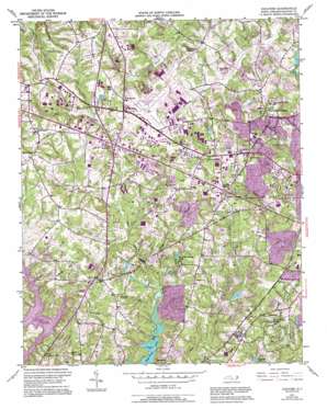
Guilford Topo Map North Carolina
To zoom in, hover over the map of Guilford
USGS Topo Quad 36079a8 - 1:24,000 scale
| Topo Map Name: | Guilford |
| USGS Topo Quad ID: | 36079a8 |
| Print Size: | ca. 21 1/4" wide x 27" high |
| Southeast Coordinates: | 36° N latitude / 79.875° W longitude |
| Map Center Coordinates: | 36.0625° N latitude / 79.9375° W longitude |
| U.S. State: | NC |
| Filename: | o36079a8.jpg |
| Download Map JPG Image: | Guilford topo map 1:24,000 scale |
| Map Type: | Topographic |
| Topo Series: | 7.5´ |
| Map Scale: | 1:24,000 |
| Source of Map Images: | United States Geological Survey (USGS) |
| Alternate Map Versions: |
Guilford NC 1951, updated 1952 Download PDF Buy paper map Guilford NC 1951, updated 1963 Download PDF Buy paper map Guilford NC 1951, updated 1969 Download PDF Buy paper map Guilford NC 1951, updated 1970 Download PDF Buy paper map Guilford NC 1951, updated 1994 Download PDF Buy paper map Guilford NC 1977, updated 1979 Download PDF Buy paper map Guilford NC 1997, updated 2001 Download PDF Buy paper map Guilford NC 2010 Download PDF Buy paper map Guilford NC 2013 Download PDF Buy paper map Guilford NC 2016 Download PDF Buy paper map |
1:24,000 Topo Quads surrounding Guilford
> Back to 36079a1 at 1:100,000 scale
> Back to 36078a1 at 1:250,000 scale
> Back to U.S. Topo Maps home
Guilford topo map: Gazetteer
Guilford: Airports
Piedmont Triad International Airport elevation 272m 892′Guilford: Dams
Adams Lake Dam elevation 243m 797′Daniel Lumber Company Lake Dam elevation 259m 849′
Dogwood Lake Dam elevation 239m 784′
Fairfield Lake Dam elevation 249m 816′
Freemon Lake Dam elevation 244m 800′
Friendly Lake Dam elevation 237m 777′
Hillside Lake Dam elevation 259m 849′
Oak Hollow Dam elevation 244m 800′
Pilot Life Dam elevation 255m 836′
Upper Colonial Dam elevation 273m 895′
Uwharrie Lake Dam elevation 255m 836′
Guilford: Populated Places
Adams Farm elevation 252m 826′Beechcroft elevation 269m 882′
Deep River elevation 271m 889′
Florence elevation 274m 898′
Friendship elevation 272m 892′
Friendswood elevation 275m 902′
Guilford elevation 284m 931′
Guilford College elevation 284m 931′
Hilltop elevation 268m 879′
Jefferson Gardens elevation 275m 902′
Madison Woods elevation 282m 925′
Oaks West elevation 268m 879′
Quaker Acres elevation 246m 807′
Sandy Ridge elevation 292m 958′
Sedgefield elevation 266m 872′
Sedgefield Lakes elevation 256m 839′
Guilford: Reservoirs
Adams Lake elevation 243m 797′Daniel Lumber Company Lake elevation 259m 849′
Dogwood Lake elevation 239m 784′
Fairfield Lake elevation 249m 816′
Freemon Lake elevation 244m 800′
Friendly Lake elevation 237m 777′
Hillside Lake elevation 259m 849′
Oak Hollow Lake elevation 244m 800′
Upper Colonial Lake elevation 273m 895′
Uwharrie Lake elevation 255m 836′
Guilford: Streams
East Fork Deep River elevation 230m 754′Hiatt Branch elevation 245m 803′
Long Branch elevation 232m 761′
Guilford digital topo map on disk
Buy this Guilford topo map showing relief, roads, GPS coordinates and other geographical features, as a high-resolution digital map file on DVD:
Western Virginia & Southern West Virginia
Buy digital topo maps: Western Virginia & Southern West Virginia


