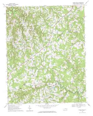
Hurdle Mills Topo Map North Carolina
To zoom in, hover over the map of Hurdle Mills
USGS Topo Quad 36079c1 - 1:24,000 scale
| Topo Map Name: | Hurdle Mills |
| USGS Topo Quad ID: | 36079c1 |
| Print Size: | ca. 21 1/4" wide x 27" high |
| Southeast Coordinates: | 36.25° N latitude / 79° W longitude |
| Map Center Coordinates: | 36.3125° N latitude / 79.0625° W longitude |
| U.S. State: | NC |
| Filename: | o36079c1.jpg |
| Download Map JPG Image: | Hurdle Mills topo map 1:24,000 scale |
| Map Type: | Topographic |
| Topo Series: | 7.5´ |
| Map Scale: | 1:24,000 |
| Source of Map Images: | United States Geological Survey (USGS) |
| Alternate Map Versions: |
Hurdle Mills NC 1968, updated 1971 Download PDF Buy paper map Hurdle Mills NC 1997, updated 2000 Download PDF Buy paper map Hurdle Mills NC 2010 Download PDF Buy paper map Hurdle Mills NC 2013 Download PDF Buy paper map Hurdle Mills NC 2016 Download PDF Buy paper map |
1:24,000 Topo Quads surrounding Hurdle Mills
> Back to 36079a1 at 1:100,000 scale
> Back to 36078a1 at 1:250,000 scale
> Back to U.S. Topo Maps home
Hurdle Mills topo map: Gazetteer
Hurdle Mills: Airports
Perry Field elevation 174m 570′Whitfield Farms Airport elevation 196m 643′
Hurdle Mills: Dams
Thaxton Pond Dam elevation 192m 629′Whitfield Pond Dam elevation 191m 626′
Hurdle Mills: Populated Places
Allens Level elevation 191m 626′Bushy Fork elevation 207m 679′
Hurdle Mills elevation 186m 610′
Paynes Tavern elevation 192m 629′
Roseville elevation 207m 679′
Whitt Town elevation 208m 682′
Hurdle Mills: Reservoirs
Thaxton Pond elevation 192m 629′Whitfield Pond elevation 191m 626′
Hurdle Mills: Streams
Alderidge Creek elevation 157m 515′Broachs Mill Creek elevation 129m 423′
Bushy Fork Creek elevation 172m 564′
Byrds Creek elevation 160m 524′
Double Creek elevation 128m 419′
Lick Creek elevation 158m 518′
Snipe Creek elevation 133m 436′
Hurdle Mills digital topo map on disk
Buy this Hurdle Mills topo map showing relief, roads, GPS coordinates and other geographical features, as a high-resolution digital map file on DVD:
Western Virginia & Southern West Virginia
Buy digital topo maps: Western Virginia & Southern West Virginia


