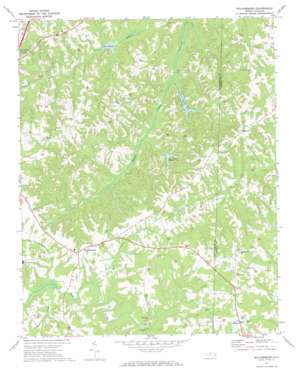
Williamsburg Topo Map North Carolina
To zoom in, hover over the map of Williamsburg
USGS Topo Quad 36079c5 - 1:24,000 scale
| Topo Map Name: | Williamsburg |
| USGS Topo Quad ID: | 36079c5 |
| Print Size: | ca. 21 1/4" wide x 27" high |
| Southeast Coordinates: | 36.25° N latitude / 79.5° W longitude |
| Map Center Coordinates: | 36.3125° N latitude / 79.5625° W longitude |
| U.S. State: | NC |
| Filename: | o36079c5.jpg |
| Download Map JPG Image: | Williamsburg topo map 1:24,000 scale |
| Map Type: | Topographic |
| Topo Series: | 7.5´ |
| Map Scale: | 1:24,000 |
| Source of Map Images: | United States Geological Survey (USGS) |
| Alternate Map Versions: |
Williamsburg NC 1972, updated 1974 Download PDF Buy paper map Williamsburg NC 1997, updated 2000 Download PDF Buy paper map Williamsburg NC 2010 Download PDF Buy paper map Williamsburg NC 2013 Download PDF Buy paper map Williamsburg NC 2016 Download PDF Buy paper map |
1:24,000 Topo Quads surrounding Williamsburg
> Back to 36079a1 at 1:100,000 scale
> Back to 36078a1 at 1:250,000 scale
> Back to U.S. Topo Maps home
Williamsburg topo map: Gazetteer
Williamsburg: Dams
Beaver Lodge Dam Number One elevation 178m 583′Joyce Dam elevation 219m 718′
Lake Wade Dam elevation 163m 534′
Stallings Lake Dam elevation 206m 675′
Williamsburg Wildlife Club Lake Dam elevation 178m 583′
Williamsburg: Lakes
Lake Wade elevation 163m 534′Williamsburg: Populated Places
Ashland elevation 229m 751′Hill View Acres elevation 243m 797′
Lenox Castle elevation 231m 757′
Matkins elevation 240m 787′
Williamsburg elevation 228m 748′
Williamsburg: Reservoirs
Beaver Lodge Lake Number One elevation 178m 583′Joyce Lake elevation 219m 718′
Rockingham Lake elevation 170m 557′
Stallings Lake elevation 206m 675′
Talleys Lake elevation 163m 534′
Williamsburg Wildlife Lake elevation 178m 583′
Williamsburg: Streams
Giles Creek elevation 194m 636′Little Troublesome Creek elevation 196m 643′
Rose Creek elevation 198m 649′
Williamsburg digital topo map on disk
Buy this Williamsburg topo map showing relief, roads, GPS coordinates and other geographical features, as a high-resolution digital map file on DVD:
Western Virginia & Southern West Virginia
Buy digital topo maps: Western Virginia & Southern West Virginia


