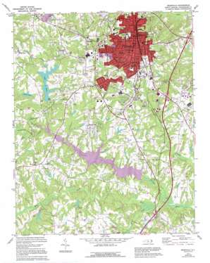
Reidsville Topo Map North Carolina
To zoom in, hover over the map of Reidsville
USGS Topo Quad 36079c6 - 1:24,000 scale
| Topo Map Name: | Reidsville |
| USGS Topo Quad ID: | 36079c6 |
| Print Size: | ca. 21 1/4" wide x 27" high |
| Southeast Coordinates: | 36.25° N latitude / 79.625° W longitude |
| Map Center Coordinates: | 36.3125° N latitude / 79.6875° W longitude |
| U.S. State: | NC |
| Filename: | o36079c6.jpg |
| Download Map JPG Image: | Reidsville topo map 1:24,000 scale |
| Map Type: | Topographic |
| Topo Series: | 7.5´ |
| Map Scale: | 1:24,000 |
| Source of Map Images: | United States Geological Survey (USGS) |
| Alternate Map Versions: |
Reidsville NC 1972, updated 1974 Download PDF Buy paper map Reidsville NC 1972, updated 1994 Download PDF Buy paper map Reidsville NC 2010 Download PDF Buy paper map Reidsville NC 2013 Download PDF Buy paper map Reidsville NC 2016 Download PDF Buy paper map |
1:24,000 Topo Quads surrounding Reidsville
> Back to 36079a1 at 1:100,000 scale
> Back to 36078a1 at 1:250,000 scale
> Back to U.S. Topo Maps home
Reidsville topo map: Gazetteer
Reidsville: Airports
Warf Airport elevation 227m 744′Reidsville: Dams
Clarks Lake Dam elevation 224m 734′Hesters Lake Dam elevation 224m 734′
Lake Hunt Dam elevation 225m 738′
Methodist Camp Lake Dam elevation 214m 702′
Reidsville Water Supply Dam elevation 201m 659′
Washburns Lake Dam elevation 229m 751′
Reidsville: Lakes
Hester Lake elevation 222m 728′Reidsville: Populated Places
Belmont elevation 246m 807′Cambridge elevation 243m 797′
Colonial Estates elevation 217m 711′
Courtland Park elevation 237m 777′
Forest Hills elevation 241m 790′
Foushee elevation 237m 777′
Monroeton elevation 254m 833′
Norwood elevation 248m 813′
Oak Hills elevation 239m 784′
Reidsville elevation 245m 803′
Sandy Cross elevation 261m 856′
Trentwood elevation 247m 810′
Womack Courts elevation 244m 800′
Woodland Park elevation 259m 849′
Reidsville: Reservoirs
Clarks Lake elevation 224m 734′Hesters Lake elevation 224m 734′
Lake Hunt elevation 225m 738′
Lake Reidsville elevation 201m 659′
Methodist Camp Lake elevation 214m 702′
Washburns Lake elevation 229m 751′
Reidsville: Streams
Benaja Creek elevation 200m 656′Candy Creek elevation 200m 656′
Troublesome Creek elevation 199m 652′
Reidsville digital topo map on disk
Buy this Reidsville topo map showing relief, roads, GPS coordinates and other geographical features, as a high-resolution digital map file on DVD:
Western Virginia & Southern West Virginia
Buy digital topo maps: Western Virginia & Southern West Virginia


