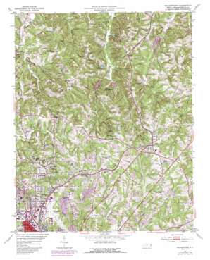
Walkertown Topo Map North Carolina
To zoom in, hover over the map of Walkertown
USGS Topo Quad 36080b2 - 1:24,000 scale
| Topo Map Name: | Walkertown |
| USGS Topo Quad ID: | 36080b2 |
| Print Size: | ca. 21 1/4" wide x 27" high |
| Southeast Coordinates: | 36.125° N latitude / 80.125° W longitude |
| Map Center Coordinates: | 36.1875° N latitude / 80.1875° W longitude |
| U.S. State: | NC |
| Filename: | o36080b2.jpg |
| Download Map JPG Image: | Walkertown topo map 1:24,000 scale |
| Map Type: | Topographic |
| Topo Series: | 7.5´ |
| Map Scale: | 1:24,000 |
| Source of Map Images: | United States Geological Survey (USGS) |
| Alternate Map Versions: |
Walkertown NC 1951, updated 1953 Download PDF Buy paper map Walkertown NC 1951, updated 1973 Download PDF Buy paper map Walkertown NC 1951, updated 1984 Download PDF Buy paper map Walkertown NC 1951, updated 1987 Download PDF Buy paper map Walkertown NC 1951, updated 1987 Download PDF Buy paper map Walkertown NC 1977, updated 1979 Download PDF Buy paper map Walkertown NC 1997, updated 2000 Download PDF Buy paper map Walkertown NC 2010 Download PDF Buy paper map Walkertown NC 2013 Download PDF Buy paper map Walkertown NC 2016 Download PDF Buy paper map |
1:24,000 Topo Quads surrounding Walkertown
> Back to 36080a1 at 1:100,000 scale
> Back to 36080a1 at 1:250,000 scale
> Back to U.S. Topo Maps home
Walkertown topo map: Gazetteer
Walkertown: Airports
Robertson Field elevation 261m 856′Smith Reynolds Airport elevation 290m 951′
Walkertown: Dams
Beason Stoltz Dam elevation 271m 889′Blaylock Lake Dam elevation 293m 961′
Grubbs Lake Dam elevation 271m 889′
Inman Brothers Dam elevation 260m 853′
Lovell Lake Dam elevation 268m 879′
Town Creek Watershed Dam Number Thirteen elevation 206m 675′
Town Fork Creek Watershed Dam Number Five elevation 226m 741′
Town Fork Creek Watershed Dam Number Six elevation 249m 816′
Town Fork Creek Watershed Dam Number Two elevation 205m 672′
Walkertown: Lakes
Morgan Pond elevation 239m 784′Waggoner Lake elevation 227m 744′
Walkertown: Parks
Mineral Springs Park elevation 297m 974′Piedmont Park elevation 284m 931′
Walkertown: Populated Places
Bon Air elevation 303m 994′Brookwood elevation 276m 905′
Chalk Level (historical) elevation 313m 1026′
Chestnut Trails elevation 232m 761′
Creekwood Acres elevation 290m 951′
Day Acres elevation 273m 895′
Dennis elevation 258m 846′
Dilhast elevation 293m 961′
Forest Hills elevation 296m 971′
Montview elevation 299m 980′
Ogburn Station elevation 306m 1003′
Old Hollow Estates elevation 290m 951′
Sedges Garden (historical) elevation 295m 967′
Walkertown elevation 302m 990′
Walkertown: Reservoirs
Beason Stoltz Lake elevation 271m 889′Blaylock Lake elevation 293m 961′
Dalton Pond elevation 284m 931′
Grubbs Lake elevation 271m 889′
Inman Brothers Lake elevation 260m 853′
Jones Pond elevation 294m 964′
Lake Woussicket elevation 220m 721′
Lovell Lake elevation 268m 879′
Pineview Lake elevation 277m 908′
Town Fork Creek Watershed Lake Five elevation 226m 741′
Town Fork Creek Watershed Lake Six elevation 249m 816′
Town Fork Creek Watershed Lake Thirteen elevation 206m 675′
Town Fork Creek Watershed Lake Two elevation 205m 672′
Walls Lakes elevation 217m 711′
Walkertown: Streams
Ader Creek elevation 219m 718′Coffer Creek elevation 213m 698′
Fivemile Branch elevation 255m 836′
Kansas Branch elevation 215m 705′
Mill Creek elevation 218m 715′
Old Mill Branch elevation 217m 711′
Rough Fork elevation 211m 692′
Trick-Um Creek elevation 215m 705′
Walkertown: Summits
Baux Mountain elevation 296m 971′Walkertown digital topo map on disk
Buy this Walkertown topo map showing relief, roads, GPS coordinates and other geographical features, as a high-resolution digital map file on DVD:
Western Virginia & Southern West Virginia
Buy digital topo maps: Western Virginia & Southern West Virginia


