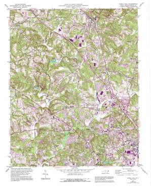
Rural Hall Topo Map North Carolina
To zoom in, hover over the map of Rural Hall
USGS Topo Quad 36080b3 - 1:24,000 scale
| Topo Map Name: | Rural Hall |
| USGS Topo Quad ID: | 36080b3 |
| Print Size: | ca. 21 1/4" wide x 27" high |
| Southeast Coordinates: | 36.125° N latitude / 80.25° W longitude |
| Map Center Coordinates: | 36.1875° N latitude / 80.3125° W longitude |
| U.S. State: | NC |
| Filename: | o36080b3.jpg |
| Download Map JPG Image: | Rural Hall topo map 1:24,000 scale |
| Map Type: | Topographic |
| Topo Series: | 7.5´ |
| Map Scale: | 1:24,000 |
| Source of Map Images: | United States Geological Survey (USGS) |
| Alternate Map Versions: |
Rural Hall NC 1951, updated 1952 Download PDF Buy paper map Rural Hall NC 1951, updated 1973 Download PDF Buy paper map Rural Hall NC 1951, updated 1987 Download PDF Buy paper map Rural Hall NC 1951, updated 1994 Download PDF Buy paper map Rural Hall NC 1977, updated 1979 Download PDF Buy paper map Rural Hall NC 2010 Download PDF Buy paper map Rural Hall NC 2013 Download PDF Buy paper map Rural Hall NC 2016 Download PDF Buy paper map |
1:24,000 Topo Quads surrounding Rural Hall
> Back to 36080a1 at 1:100,000 scale
> Back to 36080a1 at 1:250,000 scale
> Back to U.S. Topo Maps home
Rural Hall topo map: Gazetteer
Rural Hall: Airports
Northwest Airstrip elevation 253m 830′Summit School Airport elevation 274m 898′
Wedgewood Airport elevation 274m 898′
Rural Hall: Dams
Babcock Lake Dam elevation 251m 823′Creeson Lake Dam elevation 263m 862′
Doug Young Dam Number Two elevation 243m 797′
Fowler Lake Number One Dam elevation 245m 803′
Fowler Lake Number Two Dam elevation 250m 820′
Grandview Golf Lake Dam elevation 241m 790′
Hanes Lake Dam elevation 238m 780′
Hill Top Lake Dam elevation 253m 830′
K and W Lake Dam elevation 264m 866′
Lake Hills Club Dam elevation 244m 800′
Linville Lake Dam elevation 255m 836′
Lower Temora Lake Dam elevation 271m 889′
Mallard Lake Lower Dam elevation 254m 833′
Mallard Lake Upper Dam elevation 260m 853′
Middle Gambill Dam elevation 261m 856′
Petree Lake Dam elevation 305m 1000′
Piatts Lake Dam elevation 247m 810′
Shattalon Lake Dam elevation 244m 800′
Tommys Fishing Lake Dam elevation 248m 813′
Rural Hall: Lakes
Crystal Lake elevation 269m 882′Rural Hall: Parks
BB&T Field elevation 283m 928′Historic Bethabara Park elevation 249m 816′
Memorial Coliseum elevation 292m 958′
Pine Brook Golf and Country Club elevation 255m 836′
Polo Park and Recreation Center elevation 278m 912′
Rural Hall: Populated Places
Alspaugh elevation 302m 990′Bethania elevation 249m 816′
Bethania Station elevation 241m 790′
Creek View elevation 256m 839′
Hunter Meadows elevation 276m 905′
Mallard Lakes elevation 251m 823′
Oak Crest elevation 295m 967′
Old Town elevation 265m 869′
Oldtown elevation 243m 797′
Pfafftown elevation 249m 816′
Reynolda elevation 271m 889′
Rural Hall elevation 308m 1010′
Seward elevation 290m 951′
Stanleyville elevation 287m 941′
Temora Lake Estates elevation 251m 823′
Tobaccoville elevation 310m 1017′
Tower Gate elevation 261m 856′
Valley View elevation 238m 780′
Rural Hall: Reservoirs
Babcock Lake elevation 251m 823′Clinard Lake elevation 232m 761′
Creeson Lake elevation 263m 862′
Doug Young Lake Number Two elevation 243m 797′
Fowler Lake Number One elevation 245m 803′
Fowler Lake Number Two elevation 250m 820′
Grandview Golf Lake elevation 241m 790′
Hanes Lake elevation 238m 780′
Hill Top Lake elevation 253m 830′
K and W Lake elevation 264m 866′
Lake Hills elevation 244m 800′
Linville Lake elevation 255m 836′
Lower Temora Lake elevation 271m 889′
Mallard Lake Lower elevation 254m 833′
Mallard Lake Upper elevation 260m 853′
Middle Gambill Lake elevation 261m 856′
Paitts Lake elevation 247m 810′
Petree Lake elevation 305m 1000′
Shattalon Lake elevation 244m 800′
Speas Lakes elevation 251m 823′
Rural Hall: Streams
Barkers Creek elevation 258m 846′Beaver Dam Creek elevation 248m 813′
Bill Branch elevation 228m 748′
Grassy Creek elevation 237m 777′
Leak Fork elevation 237m 777′
Lucy Branch elevation 226m 741′
Mill Creek Number 3 elevation 240m 787′
Monarcas Creek elevation 235m 770′
Ogburn Branch elevation 246m 807′
Oil Mill Branch elevation 225m 738′
Parkers Creek elevation 256m 839′
Rural Hall digital topo map on disk
Buy this Rural Hall topo map showing relief, roads, GPS coordinates and other geographical features, as a high-resolution digital map file on DVD:
Western Virginia & Southern West Virginia
Buy digital topo maps: Western Virginia & Southern West Virginia


