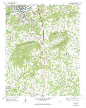
Elkin South Topo Map North Carolina
To zoom in, hover over the map of Elkin South
USGS Topo Quad 36080b7 - 1:24,000 scale
| Topo Map Name: | Elkin South |
| USGS Topo Quad ID: | 36080b7 |
| Print Size: | ca. 21 1/4" wide x 27" high |
| Southeast Coordinates: | 36.125° N latitude / 80.75° W longitude |
| Map Center Coordinates: | 36.1875° N latitude / 80.8125° W longitude |
| U.S. State: | NC |
| Filename: | o36080b7.jpg |
| Download Map JPG Image: | Elkin South topo map 1:24,000 scale |
| Map Type: | Topographic |
| Topo Series: | 7.5´ |
| Map Scale: | 1:24,000 |
| Source of Map Images: | United States Geological Survey (USGS) |
| Alternate Map Versions: |
Elkin South NC 1971, updated 1973 Download PDF Buy paper map Elkin South NC 1976, updated 1979 Download PDF Buy paper map Elkin South NC 1996, updated 2000 Download PDF Buy paper map Elkin South NC 2010 Download PDF Buy paper map Elkin South NC 2013 Download PDF Buy paper map Elkin South NC 2016 Download PDF Buy paper map |
1:24,000 Topo Quads surrounding Elkin South
> Back to 36080a1 at 1:100,000 scale
> Back to 36080a1 at 1:250,000 scale
> Back to U.S. Topo Maps home
Elkin South topo map: Gazetteer
Elkin South: Airports
Elkin Airport elevation 343m 1125′Elkin South: Dams
Deep Creek W/S Structure Number Six B Dam elevation 295m 967′Jonesville Golf Course Lake Dam elevation 302m 990′
Elkin South: Parks
Elkin City Park elevation 298m 977′Elkin South: Populated Places
Arlington elevation 294m 964′Cycle elevation 328m 1076′
Elkin elevation 273m 895′
Jonesville elevation 283m 928′
Longtown elevation 318m 1043′
Marler elevation 334m 1095′
Pea Ridge elevation 317m 1040′
Rena elevation 346m 1135′
Swan Creek elevation 361m 1184′
Wagoner elevation 330m 1082′
Elkin South: Reservoirs
Deep Creek W/S Structure Number Six B elevation 295m 967′Jonesville Golf Course Lake elevation 302m 990′
Elkin South: Streams
Arnold Branch elevation 312m 1023′Beaverdam Creek elevation 276m 905′
Cobb Creek elevation 276m 905′
Dutchman Creek elevation 264m 866′
Elkin Creek elevation 265m 869′
Fall Creek elevation 277m 908′
Jonesville Creek elevation 269m 882′
Sandyberry Creek elevation 266m 872′
Elkin South: Summits
Arnold Mountain elevation 348m 1141′Bald Knob elevation 443m 1453′
Hemric Mountain elevation 431m 1414′
Rock House Mountain elevation 500m 1640′
Star Peak elevation 473m 1551′
Elkin South digital topo map on disk
Buy this Elkin South topo map showing relief, roads, GPS coordinates and other geographical features, as a high-resolution digital map file on DVD:
Western Virginia & Southern West Virginia
Buy digital topo maps: Western Virginia & Southern West Virginia


