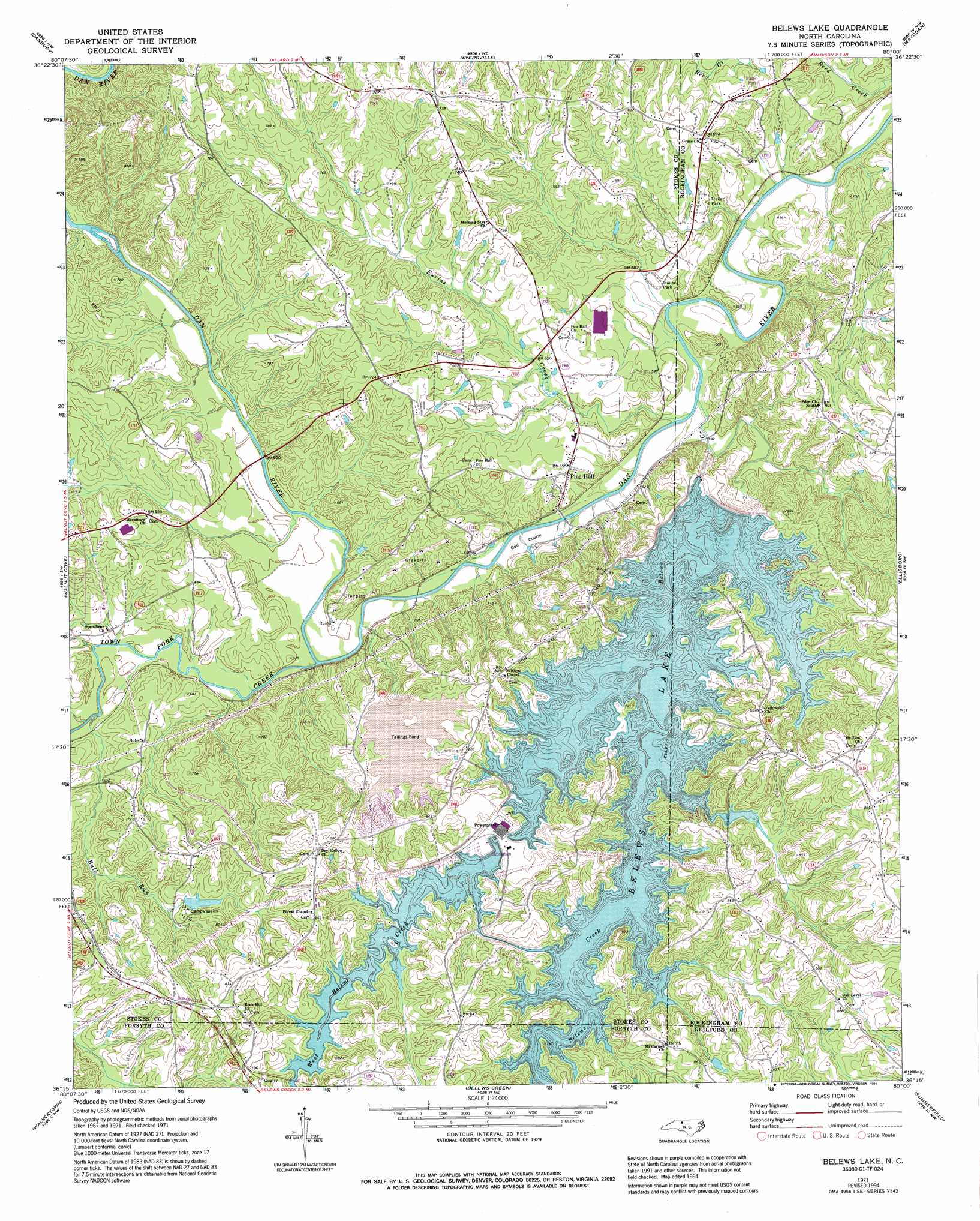
Belews Lake Topo Map North Carolina
To zoom in, hover over the map of Belews Lake
USGS Topo Quad 36080c1 - 1:24,000 scale
| Topo Map Name: | Belews Lake |
| USGS Topo Quad ID: | 36080c1 |
| Print Size: | ca. 21 1/4" wide x 27" high |
| Southeast Coordinates: | 36.25° N latitude / 80° W longitude |
| Map Center Coordinates: | 36.3125° N latitude / 80.0625° W longitude |
| U.S. State: | NC |
| Filename: | o36080c1.jpg |
| Download Map JPG Image: | Belews Lake topo map 1:24,000 scale |
| Map Type: | Topographic |
| Topo Series: | 7.5´ |
| Map Scale: | 1:24,000 |
| Source of Map Images: | United States Geological Survey (USGS) |
| Alternate Map Versions: |
Belews Lake NC 1971, updated 1973 Download PDF Buy paper map Belews Lake NC 1971, updated 1988 Download PDF Buy paper map Belews Lake NC 1971, updated 1994 Download PDF Buy paper map Belews Lake NC 2000, updated 2003 Download PDF Buy paper map Belews Lake NC 2010 Download PDF Buy paper map Belews Lake NC 2013 Download PDF Buy paper map Belews Lake NC 2016 Download PDF Buy paper map |
1:24,000 Topo Quads surrounding Belews Lake
Stuart Se |
Nettleridge |
Spencer |
Price |
Northwest Eden |
Hanging Rock |
Danbury |
Ayersville |
Mayodan |
Southwest Eden |
King |
Walnut Cove |
Belews Lake |
Ellisboro |
Bethany |
Rural Hall |
Walkertown |
Belews Creek |
Summerfield |
Lake Brandt |
Winston-Salem West |
Winston-Salem East |
Kernersville |
Guilford |
Greensboro |
> Back to 36080a1 at 1:100,000 scale
> Back to 36080a1 at 1:250,000 scale
> Back to U.S. Topo Maps home
Belews Lake topo map: Gazetteer
Belews Lake: Dams
Belews Creek Dam elevation 205m 672′Boy Scout Pond Dam elevation 221m 725′
Belews Lake: Parks
East Walnut Cove Community Park elevation 212m 695′Belews Lake: Populated Places
Ceramic elevation 186m 610′Chisman (historical) elevation 181m 593′
Hariston elevation 247m 810′
Pine Hall elevation 196m 643′
Sharps elevation 210m 688′
Stonewood Acres elevation 263m 862′
Belews Lake: Reservoirs
Belews Lake elevation 205m 672′Boy Scout Pond elevation 221m 725′
Belews Lake: Streams
Belews Creek elevation 174m 570′Bull Run elevation 181m 593′
Eurins Creek elevation 171m 561′
Town Fork Creek elevation 181m 593′
West Belews Creek elevation 220m 721′
Belews Lake digital topo map on disk
Buy this Belews Lake topo map showing relief, roads, GPS coordinates and other geographical features, as a high-resolution digital map file on DVD:
Western Virginia & Southern West Virginia
Buy digital topo maps: Western Virginia & Southern West Virginia