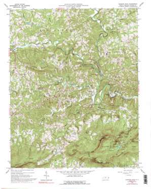
Hanging Rock Topo Map North Carolina
To zoom in, hover over the map of Hanging Rock
USGS Topo Quad 36080d3 - 1:24,000 scale
| Topo Map Name: | Hanging Rock |
| USGS Topo Quad ID: | 36080d3 |
| Print Size: | ca. 21 1/4" wide x 27" high |
| Southeast Coordinates: | 36.375° N latitude / 80.25° W longitude |
| Map Center Coordinates: | 36.4375° N latitude / 80.3125° W longitude |
| U.S. State: | NC |
| Filename: | o36080d3.jpg |
| Download Map JPG Image: | Hanging Rock topo map 1:24,000 scale |
| Map Type: | Topographic |
| Topo Series: | 7.5´ |
| Map Scale: | 1:24,000 |
| Source of Map Images: | United States Geological Survey (USGS) |
| Alternate Map Versions: |
Hanging Rock NC 1964, updated 1965 Download PDF Buy paper map Hanging Rock NC 1964, updated 1973 Download PDF Buy paper map Hanging Rock NC 1964, updated 1992 Download PDF Buy paper map Hanging Rock NC 1964, updated 1992 Download PDF Buy paper map Hanging Rock NC 1997, updated 1999 Download PDF Buy paper map Hanging Rock NC 2010 Download PDF Buy paper map Hanging Rock NC 2013 Download PDF Buy paper map Hanging Rock NC 2016 Download PDF Buy paper map |
1:24,000 Topo Quads surrounding Hanging Rock
> Back to 36080a1 at 1:100,000 scale
> Back to 36080a1 at 1:250,000 scale
> Back to U.S. Topo Maps home
Hanging Rock topo map: Gazetteer
Hanging Rock: Cliffs
Cooks Wall elevation 658m 2158′Indian Face elevation 689m 2260′
Moores Wall elevation 714m 2342′
Hanging Rock: Dams
Hanging Rock Park Lake Dam elevation 519m 1702′Kiser Dam elevation 345m 1131′
Witherow Dam elevation 398m 1305′
Hanging Rock: Falls
Hidden Falls elevation 465m 1525′Lower Cascade Falls elevation 298m 977′
Tory Falls elevation 437m 1433′
Upper Cascade Falls elevation 484m 1587′
Window Falls elevation 421m 1381′
Hanging Rock: Gaps
Cool Gap elevation 708m 2322′Wolf Gap elevation 595m 1952′
Hanging Rock: Parks
Hanging Rock State Park elevation 525m 1722′Hanging Rock: Pillars
Hanging Rock elevation 641m 2103′Hanging Rock: Populated Places
Dan River Shores elevation 225m 738′Moores Springs elevation 234m 767′
Vade Mecum elevation 263m 862′
Hanging Rock: Reservoirs
Hanging Rock Park Lake elevation 519m 1702′Kiser Lake elevation 345m 1131′
Witherow Lake elevation 398m 1305′
Hanging Rock: Ridges
Huckleberry Ridge elevation 638m 2093′Hanging Rock: Streams
Beaverdam Creek elevation 273m 895′Big Creek elevation 229m 751′
Bonds Branch elevation 240m 787′
Camp Creek elevation 450m 1476′
Cascade Creek elevation 226m 741′
Little Creek elevation 252m 826′
Long Branch elevation 263m 862′
Marshall Creek elevation 268m 879′
North Double Creek elevation 230m 754′
Peters Creek elevation 243m 797′
Peters Creek elevation 243m 797′
Pinch Gut Creek elevation 276m 905′
Rocky Branch elevation 274m 898′
South Double Creek elevation 229m 751′
Vade Mecum Creek elevation 232m 761′
Hanging Rock: Summits
Balanced Rock elevation 764m 2506′Brown Mountain elevation 472m 1548′
Cole Gap Mountain elevation 617m 2024′
Cooks Wall Mountain elevation 715m 2345′
Devils Chimney elevation 730m 2395′
House Rock elevation 625m 2050′
Moores Knob elevation 782m 2565′
Ruben Mountain elevation 552m 1811′
Wolf Rock elevation 617m 2024′
Hanging Rock: Trails
Cascade Trail elevation 513m 1683′Cooks Wall Trail elevation 609m 1998′
Hanging Rock Trail elevation 563m 1847′
Moores Knob Trail elevation 626m 2053′
Hanging Rock digital topo map on disk
Buy this Hanging Rock topo map showing relief, roads, GPS coordinates and other geographical features, as a high-resolution digital map file on DVD:
Western Virginia & Southern West Virginia
Buy digital topo maps: Western Virginia & Southern West Virginia


