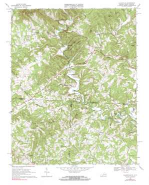
Claudville Topo Map Virginia
To zoom in, hover over the map of Claudville
USGS Topo Quad 36080e4 - 1:24,000 scale
| Topo Map Name: | Claudville |
| USGS Topo Quad ID: | 36080e4 |
| Print Size: | ca. 21 1/4" wide x 27" high |
| Southeast Coordinates: | 36.5° N latitude / 80.375° W longitude |
| Map Center Coordinates: | 36.5625° N latitude / 80.4375° W longitude |
| U.S. States: | VA, NC |
| Filename: | o36080e4.jpg |
| Download Map JPG Image: | Claudville topo map 1:24,000 scale |
| Map Type: | Topographic |
| Topo Series: | 7.5´ |
| Map Scale: | 1:24,000 |
| Source of Map Images: | United States Geological Survey (USGS) |
| Alternate Map Versions: |
Claudville VA 1968, updated 1971 Download PDF Buy paper map Claudville VA 1968, updated 1971 Download PDF Buy paper map Claudville VA 1968, updated 1991 Download PDF Buy paper map Claudville VA 2010 Download PDF Buy paper map Claudville VA 2013 Download PDF Buy paper map Claudville VA 2016 Download PDF Buy paper map |
1:24,000 Topo Quads surrounding Claudville
> Back to 36080e1 at 1:100,000 scale
> Back to 36080a1 at 1:250,000 scale
> Back to U.S. Topo Maps home
Claudville topo map: Gazetteer
Claudville: Populated Places
Albion elevation 359m 1177′Asbury elevation 389m 1276′
Brim (historical) elevation 417m 1368′
Carters Mill elevation 443m 1453′
Claudville elevation 444m 1456′
Joyce Mill elevation 327m 1072′
Meadowfield elevation 380m 1246′
Mount Herman elevation 486m 1594′
Woodville elevation 432m 1417′
Claudville: Reservoirs
Big Dan Lake elevation 331m 1085′Claudville: Ridges
Blue Ridge elevation 432m 1417′Claudville: Streams
Archies Creek elevation 347m 1138′Big Branch elevation 349m 1145′
Browns Dan River elevation 342m 1122′
Burges Branch elevation 406m 1332′
Fall Creek elevation 373m 1223′
Harris Creek elevation 387m 1269′
Hookers Creek elevation 341m 1118′
Lickskillet Branch elevation 408m 1338′
Little Dan River elevation 307m 1007′
Little Dan River elevation 307m 1007′
Pig Creek elevation 393m 1289′
Silverleaf Creek elevation 400m 1312′
Silverleaf Creek elevation 400m 1312′
Squirrel Creek elevation 393m 1289′
Claudville: Summits
Archies Knob elevation 519m 1702′Bowens Knob elevation 511m 1676′
Little Mountain elevation 563m 1847′
Mill Mountain elevation 527m 1729′
Nunns Mountain elevation 556m 1824′
Rich Hill elevation 526m 1725′
Simmons Mountain elevation 551m 1807′
Tar Kiln Mountain elevation 538m 1765′
Claudville digital topo map on disk
Buy this Claudville topo map showing relief, roads, GPS coordinates and other geographical features, as a high-resolution digital map file on DVD:
Western Virginia & Southern West Virginia
Buy digital topo maps: Western Virginia & Southern West Virginia


