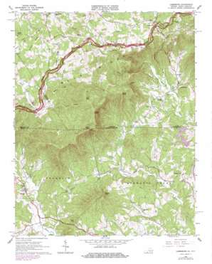
Lambsburg Topo Map Virginia
To zoom in, hover over the map of Lambsburg
USGS Topo Quad 36080e7 - 1:24,000 scale
| Topo Map Name: | Lambsburg |
| USGS Topo Quad ID: | 36080e7 |
| Print Size: | ca. 21 1/4" wide x 27" high |
| Southeast Coordinates: | 36.5° N latitude / 80.75° W longitude |
| Map Center Coordinates: | 36.5625° N latitude / 80.8125° W longitude |
| U.S. States: | VA, NC |
| Filename: | o36080e7.jpg |
| Download Map JPG Image: | Lambsburg topo map 1:24,000 scale |
| Map Type: | Topographic |
| Topo Series: | 7.5´ |
| Map Scale: | 1:24,000 |
| Source of Map Images: | United States Geological Survey (USGS) |
| Alternate Map Versions: |
Lambsburg VA 1965, updated 1968 Download PDF Buy paper map Lambsburg VA 1965, updated 1978 Download PDF Buy paper map Lambsburg VA 1965, updated 1978 Download PDF Buy paper map Lambsburg VA 2010 Download PDF Buy paper map Lambsburg VA 2013 Download PDF Buy paper map Lambsburg VA 2016 Download PDF Buy paper map |
1:24,000 Topo Quads surrounding Lambsburg
> Back to 36080e1 at 1:100,000 scale
> Back to 36080a1 at 1:250,000 scale
> Back to U.S. Topo Maps home
Lambsburg topo map: Gazetteer
Lambsburg: Areas
Wards Garden elevation 807m 2647′Lambsburg: Parks
Fishers Peak Historical Site elevation 1046m 3431′Lambsburg: Populated Places
Crooked Oak elevation 432m 1417′Drenn elevation 821m 2693′
Lambsburg elevation 451m 1479′
Lowgap elevation 444m 1456′
Round Peak elevation 392m 1286′
Lambsburg: Ridges
Coleman Ridge elevation 843m 2765′Flint Ridge elevation 976m 3202′
Lashley Ridge elevation 884m 2900′
Wolfpen Ridge elevation 877m 2877′
Lambsburg: Streams
Auberry Creek elevation 399m 1309′Auberry Creek elevation 399m 1309′
Camp Branch elevation 380m 1246′
Flat Creek elevation 434m 1423′
Gully Creek elevation 415m 1361′
Hanks Branch elevation 760m 2493′
Linard Creek elevation 780m 2559′
North Fork Stewarts Creek elevation 513m 1683′
Ramey Creek elevation 388m 1272′
Roaring Fork elevation 384m 1259′
South Fork Stewarts Creek elevation 522m 1712′
Turkey Creek elevation 439m 1440′
Lambsburg: Summits
Buck Mountain elevation 540m 1771′Dicks Knob elevation 921m 3021′
Felt Knob elevation 944m 3097′
Fisher Peak elevation 1077m 3533′
Fisher Peak elevation 1077m 3533′
Fulcher Mountain elevation 558m 1830′
Horse Knob elevation 1047m 3435′
Rich Mountain elevation 1075m 3526′
Round Peak elevation 631m 2070′
Sams Knob elevation 911m 2988′
Wilson Knob elevation 855m 2805′
Lambsburg digital topo map on disk
Buy this Lambsburg topo map showing relief, roads, GPS coordinates and other geographical features, as a high-resolution digital map file on DVD:
Western Virginia & Southern West Virginia
Buy digital topo maps: Western Virginia & Southern West Virginia


