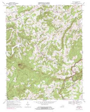
Willis Topo Map Virginia
To zoom in, hover over the map of Willis
USGS Topo Quad 36080g4 - 1:24,000 scale
| Topo Map Name: | Willis |
| USGS Topo Quad ID: | 36080g4 |
| Print Size: | ca. 21 1/4" wide x 27" high |
| Southeast Coordinates: | 36.75° N latitude / 80.375° W longitude |
| Map Center Coordinates: | 36.8125° N latitude / 80.4375° W longitude |
| U.S. State: | VA |
| Filename: | o36080g4.jpg |
| Download Map JPG Image: | Willis topo map 1:24,000 scale |
| Map Type: | Topographic |
| Topo Series: | 7.5´ |
| Map Scale: | 1:24,000 |
| Source of Map Images: | United States Geological Survey (USGS) |
| Alternate Map Versions: |
Willis VA 1968, updated 1971 Download PDF Buy paper map Willis VA 1968, updated 1985 Download PDF Buy paper map Willis VA 2010 Download PDF Buy paper map Willis VA 2013 Download PDF Buy paper map Willis VA 2016 Download PDF Buy paper map |
1:24,000 Topo Quads surrounding Willis
> Back to 36080e1 at 1:100,000 scale
> Back to 36080a1 at 1:250,000 scale
> Back to U.S. Topo Maps home
Willis topo map: Gazetteer
Willis: Dams
Mabry Mill Pond Dam elevation 883m 2896′Willis: Gaps
Rock Castle Gap elevation 938m 3077′Willis: Populated Places
Conners Grove elevation 884m 2900′Mabry Mill elevation 871m 2857′
Union elevation 833m 2732′
Willis elevation 830m 2723′
Willis: Reservoirs
Mabry Mill Pond elevation 883m 2896′Willis: Ridges
Black Ridge elevation 983m 3225′Buffalo Ridge elevation 924m 3031′
Willis: Streams
Buffalo Branch elevation 792m 2598′East Prong Furnace Creek elevation 778m 2552′
Furnace Creek elevation 754m 2473′
Long Mountain Creek elevation 751m 2463′
Oldfield Creek elevation 798m 2618′
Reeds Creek elevation 744m 2440′
Rush Fork elevation 756m 2480′
West Prong Furnace Creek elevation 778m 2552′
Willis: Summits
Buffalo Mountain elevation 1207m 3959′Hog Mountain elevation 1087m 3566′
Jones Mountain elevation 1081m 3546′
Long Mountain elevation 1027m 3369′
Slate Mountain elevation 1059m 3474′
Willis digital topo map on disk
Buy this Willis topo map showing relief, roads, GPS coordinates and other geographical features, as a high-resolution digital map file on DVD:
Western Virginia & Southern West Virginia
Buy digital topo maps: Western Virginia & Southern West Virginia


