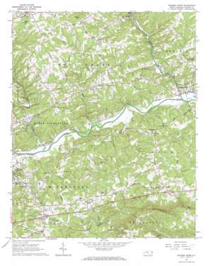
Roaring River Topo Map North Carolina
To zoom in, hover over the map of Roaring River
USGS Topo Quad 36081b1 - 1:24,000 scale
| Topo Map Name: | Roaring River |
| USGS Topo Quad ID: | 36081b1 |
| Print Size: | ca. 21 1/4" wide x 27" high |
| Southeast Coordinates: | 36.125° N latitude / 81° W longitude |
| Map Center Coordinates: | 36.1875° N latitude / 81.0625° W longitude |
| U.S. State: | NC |
| Filename: | o36081b1.jpg |
| Download Map JPG Image: | Roaring River topo map 1:24,000 scale |
| Map Type: | Topographic |
| Topo Series: | 7.5´ |
| Map Scale: | 1:24,000 |
| Source of Map Images: | United States Geological Survey (USGS) |
| Alternate Map Versions: |
Roaring River NC 1966, updated 1968 Download PDF Buy paper map Roaring River NC 2010 Download PDF Buy paper map Roaring River NC 2013 Download PDF Buy paper map Roaring River NC 2016 Download PDF Buy paper map |
1:24,000 Topo Quads surrounding Roaring River
> Back to 36081a1 at 1:100,000 scale
> Back to 36080a1 at 1:250,000 scale
> Back to U.S. Topo Maps home
Roaring River topo map: Gazetteer
Roaring River: Gaps
Windy Gap elevation 484m 1587′Roaring River: Populated Places
Antioch elevation 369m 1210′Bryan (historical) elevation 307m 1007′
Call elevation 351m 1151′
Dellaplane elevation 334m 1095′
Edgewood elevation 374m 1227′
Fishing Creek elevation 396m 1299′
Hays elevation 414m 1358′
Knottville elevation 342m 1122′
Roaring River elevation 297m 974′
Russaw (historical) elevation 293m 961′
Roaring River: Reservoirs
Wilkes Lake elevation 386m 1266′Roaring River: Streams
Fishing Creek elevation 282m 925′Mulberry Creek elevation 287m 941′
Roaring River elevation 278m 912′
Rock Creek elevation 282m 925′
Roaring River: Summits
Round Mountain elevation 445m 1459′Roaring River digital topo map on disk
Buy this Roaring River topo map showing relief, roads, GPS coordinates and other geographical features, as a high-resolution digital map file on DVD:
Western Virginia & Southern West Virginia
Buy digital topo maps: Western Virginia & Southern West Virginia


