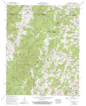
Grayson Topo Map Tennessee
To zoom in, hover over the map of Grayson
USGS Topo Quad 36081e6 - 1:24,000 scale
| Topo Map Name: | Grayson |
| USGS Topo Quad ID: | 36081e6 |
| Print Size: | ca. 21 1/4" wide x 27" high |
| Southeast Coordinates: | 36.5° N latitude / 81.625° W longitude |
| Map Center Coordinates: | 36.5625° N latitude / 81.6875° W longitude |
| U.S. States: | TN, NC, VA |
| Filename: | o36081e6.jpg |
| Download Map JPG Image: | Grayson topo map 1:24,000 scale |
| Map Type: | Topographic |
| Topo Series: | 7.5´ |
| Map Scale: | 1:24,000 |
| Source of Map Images: | United States Geological Survey (USGS) |
| Alternate Map Versions: |
Grayson NC 1935 Download PDF Buy paper map Grayson NC 1938, updated 1957 Download PDF Buy paper map Grayson NC 1959, updated 1969 Download PDF Buy paper map Grayson NC 1959, updated 1990 Download PDF Buy paper map Grayson NC 1959, updated 1990 Download PDF Buy paper map Grayson NC 2003, updated 2004 Download PDF Buy paper map Grayson NC 2011 Download PDF Buy paper map Grayson NC 2013 Download PDF Buy paper map Grayson NC 2016 Download PDF Buy paper map |
| FStopo: | US Forest Service topo Grayson is available: Download FStopo PDF Download FStopo TIF |
1:24,000 Topo Quads surrounding Grayson
> Back to 36081e1 at 1:100,000 scale
> Back to 36080a1 at 1:250,000 scale
> Back to U.S. Topo Maps home
Grayson topo map: Gazetteer
Grayson: Falls
Gentry Creek Falls elevation 1053m 3454′Grayson: Gaps
Cherry Tree Gap elevation 826m 2709′Cut Laurel Gap elevation 1143m 3750′
Cut Laurel Gap elevation 1144m 3753′
Deep Gap elevation 910m 2985′
Haw Gap elevation 1258m 4127′
Haw Gap elevation 1273m 4176′
McQueen Gap elevation 1012m 3320′
Grayson: Mines
Belle Hawkins Mine elevation 940m 3083′Big Rock Prospect elevation 962m 3156′
Boiling Spring Prospect elevation 921m 3021′
Huckleberry Ridge Mine elevation 905m 2969′
Taylor Valley Mine elevation 864m 2834′
Wright Prospect elevation 967m 3172′
Grayson: Populated Places
Flatwood elevation 1074m 3523′Grayson elevation 1017m 3336′
Green Cove elevation 975m 3198′
Listening Rock elevation 1402m 4599′
Sugar Creek elevation 807m 2647′
Taylors Valley elevation 722m 2368′
Whitetop elevation 1109m 3638′
Grayson: Ranges
Stone Mountain elevation 1518m 4980′Stone Mountains elevation 1505m 4937′
Grayson: Ridges
Bearpen Ridge elevation 1062m 3484′Bearpen Ridge elevation 1040m 3412′
Brier Ridge elevation 1324m 4343′
Burnt Hill elevation 1051m 3448′
Catface Ridge elevation 1356m 4448′
Flat Spring Ridge elevation 1141m 3743′
Flat Spring Ridge elevation 1140m 3740′
Grindstone Ridge elevation 1280m 4199′
Huckleberry Ridge elevation 879m 2883′
Piney Knob Ridge elevation 1104m 3622′
Rogers Ridge elevation 1212m 3976′
Tennessee Valley Divide elevation 1039m 3408′
Wolfpen Ridge elevation 932m 3057′
Grayson: Springs
Big Spring elevation 772m 2532′Boiling Spring elevation 911m 2988′
Cave Spring elevation 870m 2854′
Grayson: Streams
Buckeye Branch elevation 945m 3100′Buckeye Branch elevation 939m 3080′
Cave Spring Branch elevation 861m 2824′
Cut Laurel Branch elevation 857m 2811′
Dixon Creek elevation 962m 3156′
Dry Branch elevation 794m 2604′
Elliot Branch elevation 696m 2283′
Gilbert Branch elevation 1084m 3556′
Grindstone Branch elevation 848m 2782′
Hawkins Branch elevation 1009m 3310′
High Trestle Branch elevation 963m 3159′
High Trestle Branch elevation 966m 3169′
Kate Branch elevation 899m 2949′
Kilby Creek elevation 950m 3116′
Laurel Branch elevation 867m 2844′
McQueen Branch elevation 914m 2998′
Owens Branch elevation 699m 2293′
Richardson Branch elevation 986m 3234′
Seng Cove Branch elevation 821m 2693′
South Fork Atchison Branch elevation 887m 2910′
Valley Creek elevation 727m 2385′
Valley Creek elevation 727m 2385′
Whetstone Branch elevation 1019m 3343′
Woodard Branch elevation 946m 3103′
Grayson: Summits
Bald Knob elevation 1318m 4324′Big Spring Mountain elevation 1250m 4101′
Cabin Hill elevation 952m 3123′
Cut Laurel Knob elevation 1270m 4166′
Cut Laurel Knob elevation 1266m 4153′
Fodderstack Mountain elevation 1132m 3713′
Fork Mountain elevation 1074m 3523′
Green Cove Mountain elevation 1162m 3812′
Locust Knob elevation 968m 3175′
McQueen Knob elevation 1176m 3858′
Pond Mountain elevation 1500m 4921′
Pond Mountain elevation 1354m 4442′
Snaggy Mountain elevation 1020m 3346′
Winnie Knob elevation 1311m 4301′
Grayson: Valleys
Bill Gentry Hollow elevation 785m 2575′Denny Hollow elevation 1001m 3284′
Fall Hollow elevation 736m 2414′
Joe Hollow elevation 846m 2775′
Negro Shanty Hollow elevation 841m 2759′
Seng Cove elevation 830m 2723′
Tramroad Hollow elevation 819m 2687′
Grayson digital topo map on disk
Buy this Grayson topo map showing relief, roads, GPS coordinates and other geographical features, as a high-resolution digital map file on DVD:
Western Virginia & Southern West Virginia
Buy digital topo maps: Western Virginia & Southern West Virginia


