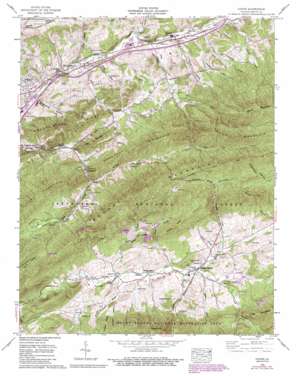
Atkins Topo Map Virginia
To zoom in, hover over the map of Atkins
USGS Topo Quad 36081g4 - 1:24,000 scale
| Topo Map Name: | Atkins |
| USGS Topo Quad ID: | 36081g4 |
| Print Size: | ca. 21 1/4" wide x 27" high |
| Southeast Coordinates: | 36.75° N latitude / 81.375° W longitude |
| Map Center Coordinates: | 36.8125° N latitude / 81.4375° W longitude |
| U.S. State: | VA |
| Filename: | o36081g4.jpg |
| Download Map JPG Image: | Atkins topo map 1:24,000 scale |
| Map Type: | Topographic |
| Topo Series: | 7.5´ |
| Map Scale: | 1:24,000 |
| Source of Map Images: | United States Geological Survey (USGS) |
| Alternate Map Versions: |
Atkins VA 1935 Download PDF Buy paper map Atkins VA 1958, updated 1960 Download PDF Buy paper map Atkins VA 1958, updated 1960 Download PDF Buy paper map Atkins VA 1958, updated 1967 Download PDF Buy paper map Atkins VA 1958, updated 1971 Download PDF Buy paper map Atkins VA 1958, updated 1971 Download PDF Buy paper map Atkins VA 1958, updated 1993 Download PDF Buy paper map Atkins VA 2011 Download PDF Buy paper map Atkins VA 2013 Download PDF Buy paper map Atkins VA 2016 Download PDF Buy paper map |
| FStopo: | US Forest Service topo Atkins is available: Download FStopo PDF Download FStopo TIF |
1:24,000 Topo Quads surrounding Atkins
> Back to 36081e1 at 1:100,000 scale
> Back to 36080a1 at 1:250,000 scale
> Back to U.S. Topo Maps home
Atkins topo map: Gazetteer
Atkins: Bridges
William Andrew Scott Memorial Bridge elevation 668m 2191′Atkins: Crossings
Interchange 47 elevation 685m 2247′Interchange 50 elevation 699m 2293′
Atkins: Populated Places
Atkins elevation 700m 2296′Attoway elevation 738m 2421′
Furnace Hill elevation 685m 2247′
Mount Carmel elevation 671m 2201′
Roberts Mill elevation 770m 2526′
Shady Grove elevation 810m 2657′
Slabtown elevation 800m 2624′
Sugar Grove elevation 788m 2585′
Atkins: Ridges
Goodpasture Ridge elevation 853m 2798′Hickory Ridge elevation 971m 3185′
Russell Ridge elevation 891m 2923′
Sheep Ridge elevation 875m 2870′
Atkins: Streams
Bear Creek elevation 689m 2260′Bishop Branch elevation 780m 2559′
Comers Creek elevation 738m 2421′
Cressy Creek elevation 790m 2591′
Dickey Creek elevation 781m 2562′
Dry Run elevation 722m 2368′
East Fork Nicks Creek elevation 763m 2503′
Georges Branch elevation 763m 2503′
Houndshell Branch elevation 868m 2847′
Hutton Branch elevation 672m 2204′
Marchant Creek elevation 747m 2450′
Mullins Branch elevation 762m 2500′
Nicks Creek elevation 696m 2283′
Pierce Branch elevation 808m 2650′
Quarter Branch elevation 785m 2575′
Slabtown Branch elevation 752m 2467′
Slemp Creek elevation 807m 2647′
Snider Branch elevation 670m 2198′
Wildcat Branch elevation 771m 2529′
Atkins: Summits
Chestnut Mountain elevation 1070m 3510′Dickey Knob elevation 1099m 3605′
Mill Mountain elevation 814m 2670′
Atkins: Valleys
Arney Hollow elevation 683m 2240′Currin Valley elevation 750m 2460′
Goodpasture Hollow elevation 664m 2178′
Hazelnut Hollow elevation 761m 2496′
Long Hollow elevation 869m 2851′
Overbay Hollow elevation 731m 2398′
Russell Hollow elevation 767m 2516′
Rye Valley elevation 760m 2493′
Shupe Hollow elevation 736m 2414′
Slabtown Hollow elevation 754m 2473′
Waddle Hollow elevation 729m 2391′
Atkins digital topo map on disk
Buy this Atkins topo map showing relief, roads, GPS coordinates and other geographical features, as a high-resolution digital map file on DVD:
Western Virginia & Southern West Virginia
Buy digital topo maps: Western Virginia & Southern West Virginia


