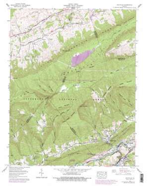
Saltville Topo Map Virginia
To zoom in, hover over the map of Saltville
USGS Topo Quad 36081h7 - 1:24,000 scale
| Topo Map Name: | Saltville |
| USGS Topo Quad ID: | 36081h7 |
| Print Size: | ca. 21 1/4" wide x 27" high |
| Southeast Coordinates: | 36.875° N latitude / 81.75° W longitude |
| Map Center Coordinates: | 36.9375° N latitude / 81.8125° W longitude |
| U.S. State: | VA |
| Filename: | o36081h7.jpg |
| Download Map JPG Image: | Saltville topo map 1:24,000 scale |
| Map Type: | Topographic |
| Topo Series: | 7.5´ |
| Map Scale: | 1:24,000 |
| Source of Map Images: | United States Geological Survey (USGS) |
| Alternate Map Versions: |
Saltville VA 1935 Download PDF Buy paper map Saltville VA 1958, updated 1960 Download PDF Buy paper map Saltville VA 1958, updated 1970 Download PDF Buy paper map Saltville VA 1958, updated 1978 Download PDF Buy paper map Saltville VA 1958, updated 1978 Download PDF Buy paper map Saltville VA 2011 Download PDF Buy paper map Saltville VA 2013 Download PDF Buy paper map Saltville VA 2016 Download PDF Buy paper map |
| FStopo: | US Forest Service topo Saltville is available: Download FStopo PDF Download FStopo TIF |
1:24,000 Topo Quads surrounding Saltville
> Back to 36081e1 at 1:100,000 scale
> Back to 36080a1 at 1:250,000 scale
> Back to U.S. Topo Maps home
Saltville topo map: Gazetteer
Saltville: Basins
Laurel Bed elevation 1152m 3779′Saltville: Dams
Laurel Bed Dam elevation 1079m 3540′Saltville: Flats
Ray Bottoms elevation 952m 3123′Saltville: Gaps
Brown Gap elevation 1166m 3825′Mutters Gap elevation 1178m 3864′
Saltville: Parks
Clinch Mountain State Wildlife Management Area elevation 1094m 3589′Saltville: Populated Places
Allison Gap elevation 562m 1843′Belfast elevation 677m 2221′
Belfast Mills elevation 708m 2322′
Cardwell Town elevation 610m 2001′
Henrytown elevation 548m 1797′
Lick Skillet elevation 588m 1929′
Repass elevation 740m 2427′
Saltville elevation 526m 1725′
Saltville: Post Offices
Saltville Post Office elevation 522m 1712′Saltville: Ranges
Clinch Mountain Spur elevation 1132m 3713′Saltville: Reservoirs
Laurel Bed Lake elevation 1079m 3540′Saltville: Ridges
Piney Ridge elevation 649m 2129′Saltville: Streams
Dry Branch elevation 642m 2106′Hogwallow Branch elevation 659m 2162′
Laurel Bed Creek elevation 935m 3067′
Little Tumbling Creek elevation 587m 1925′
Red Creek elevation 754m 2473′
Robertson Branch elevation 513m 1683′
Saltville: Summits
Arkansas Hill elevation 808m 2650′Bald Rock elevation 1178m 3864′
Flattop Mountain elevation 1379m 4524′
Redrock Mountain elevation 1345m 4412′
Rock House Mountain elevation 1208m 3963′
Short Mountain elevation 1245m 4084′
Whiterock Mountain elevation 1218m 3996′
Saltville: Valleys
Brier Cove elevation 950m 3116′Counts Cove elevation 778m 2552′
Halls Cove elevation 872m 2860′
Horton Valley elevation 728m 2388′
Kyers Cove elevation 796m 2611′
Little Dry Cove elevation 633m 2076′
Little Tumbling Cove elevation 895m 2936′
Locust Cove elevation 890m 2919′
Panther Lick Cove elevation 995m 3264′
Tumbling Cove elevation 656m 2152′
Twin Hollow elevation 906m 2972′
Whiterock Cove elevation 779m 2555′
Saltville digital topo map on disk
Buy this Saltville topo map showing relief, roads, GPS coordinates and other geographical features, as a high-resolution digital map file on DVD:
Western Virginia & Southern West Virginia
Buy digital topo maps: Western Virginia & Southern West Virginia


