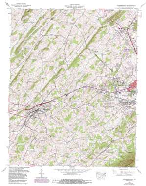
Jonesboro Topo Map Tennessee
To zoom in, hover over the map of Jonesboro
USGS Topo Quad 36082c4 - 1:24,000 scale
| Topo Map Name: | Jonesboro |
| USGS Topo Quad ID: | 36082c4 |
| Print Size: | ca. 21 1/4" wide x 27" high |
| Southeast Coordinates: | 36.25° N latitude / 82.375° W longitude |
| Map Center Coordinates: | 36.3125° N latitude / 82.4375° W longitude |
| U.S. State: | TN |
| Filename: | o36082c4.jpg |
| Download Map JPG Image: | Jonesboro topo map 1:24,000 scale |
| Map Type: | Topographic |
| Topo Series: | 7.5´ |
| Map Scale: | 1:24,000 |
| Source of Map Images: | United States Geological Survey (USGS) |
| Alternate Map Versions: |
Jonesboro TN 1935 Download PDF Buy paper map Jonesboro TN 1939 Download PDF Buy paper map Jonesboro TN 1939, updated 1952 Download PDF Buy paper map Jonesboro TN 1959, updated 1960 Download PDF Buy paper map Jonesboro TN 1959, updated 1971 Download PDF Buy paper map Jonesboro TN 1959, updated 1981 Download PDF Buy paper map Jonesborough TN 1959, updated 1988 Download PDF Buy paper map Jonesborough TN 1959, updated 1988 Download PDF Buy paper map Jonesborough TN 2011 Download PDF Buy paper map Jonesborough TN 2013 Download PDF Buy paper map Jonesborough TN 2016 Download PDF Buy paper map |
| FStopo: | US Forest Service topo Jonesborough is available: Download FStopo PDF Download FStopo TIF |
1:24,000 Topo Quads surrounding Jonesboro
> Back to 36082a1 at 1:100,000 scale
> Back to 36082a1 at 1:250,000 scale
> Back to U.S. Topo Maps home
Jonesboro topo map: Gazetteer
Jonesboro: Airports
McAfee Stol Patch Airport elevation 571m 1873′Jonesboro: Crossings
Interchange 35 elevation 501m 1643′Interchange 36 elevation 461m 1512′
Jonesboro: Parks
Massengill Memorial elevation 475m 1558′New Kiwanis Park elevation 549m 1801′
Jonesboro: Populated Places
Arbor Heights elevation 536m 1758′Asbury elevation 534m 1751′
Avondale Forest elevation 518m 1699′
Beechwood Court elevation 531m 1742′
Belmont Acres elevation 519m 1702′
Boone Trail elevation 476m 1561′
Brentwood elevation 489m 1604′
Camelot elevation 508m 1666′
Camelot Two elevation 506m 1660′
Carmel Village elevation 525m 1722′
Carmol elevation 467m 1532′
Carter Crossing elevation 556m 1824′
Carter Sell elevation 563m 1847′
Charbray elevation 498m 1633′
Cherokee elevation 577m 1893′
Cherokee Grdens elevation 578m 1896′
Clark Manor elevation 516m 1692′
Colony Park elevation 525m 1722′
Dove (historical) elevation 503m 1650′
February elevation 557m 1827′
Forest Hills elevation 554m 1817′
Forest View elevation 541m 1774′
Foxxborough elevation 560m 1837′
Green Hill elevation 547m 1794′
Greenacres elevation 502m 1646′
Greenfield Heights elevation 503m 1650′
Greenfields elevation 494m 1620′
Greenwood elevation 538m 1765′
Hale elevation 533m 1748′
Hill-N-Dale elevation 492m 1614′
Holmes elevation 562m 1843′
Jonesborough elevation 516m 1692′
Keebler Crossroads elevation 541m 1774′
Knob Creek Mill elevation 468m 1535′
Maison elevation 571m 1873′
McKinley elevation 537m 1761′
McKinley Mobile Home Park elevation 519m 1702′
Midway elevation 572m 1876′
Miller elevation 544m 1784′
Millercrest elevation 543m 1781′
Montclair elevation 477m 1564′
Nanatlugunyi (historical) elevation 519m 1702′
North Acres elevation 461m 1512′
North Hills elevation 505m 1656′
North Johnson City elevation 499m 1637′
Onks elevation 565m 1853′
Pine Timbers elevation 497m 1630′
Ramblewood elevation 525m 1722′
Reeves elevation 544m 1784′
Roundtree elevation 569m 1866′
Sandy Ridge Mobile Home Park elevation 565m 1853′
Seaton Subdivision elevation 534m 1751′
Seminole Woods elevation 522m 1712′
Sequoyah Heights elevation 530m 1738′
Sherwood Forest elevation 538m 1765′
Skyline Heights elevation 516m 1692′
South Gate elevation 563m 1847′
South Ridge Estates elevation 556m 1824′
Spring City Mobile Home Park elevation 465m 1525′
Summit elevation 525m 1722′
Tamarack elevation 566m 1856′
Tamassee elevation 507m 1663′
The Y elevation 523m 1715′
Timber Ridge elevation 561m 1840′
Timberlake elevation 498m 1633′
Towne Acres elevation 494m 1620′
Washington Heights elevation 569m 1866′
Wellington Park elevation 552m 1811′
West Hills elevation 508m 1666′
West Oakland Park elevation 489m 1604′
Westover elevation 523m 1715′
Westover Hills elevation 528m 1732′
Westwood-Gray Subdivision elevation 553m 1814′
Woodhill Addition elevation 529m 1735′
Woodlawn elevation 561m 1840′
Y Section elevation 518m 1699′
Jonesboro: Post Offices
Jonesborough Post Office elevation 513m 1683′Jonesboro: Ridges
Archer Ridge elevation 606m 1988′Bowman Ridge elevation 545m 1788′
Chestnut Ridge elevation 554m 1817′
Indian Ridge elevation 574m 1883′
Miller Ridge elevation 540m 1771′
Persimmon Ridge elevation 521m 1709′
Jonesboro: Springs
Beech Spring elevation 503m 1650′Bugaboo Spring elevation 530m 1738′
Susong Spring elevation 497m 1630′
Jonesboro: Streams
Barkley Branch elevation 511m 1676′North Knob Creek elevation 498m 1633′
Paine Branch elevation 496m 1627′
Scott Branch elevation 536m 1758′
Jonesboro: Summits
Bald Knob elevation 617m 2024′Buncombe Hill elevation 603m 1978′
Cherokee Mountain elevation 931m 3054′
Greene Hill elevation 560m 1837′
Jonesboro: Tunnels
Indian Ridge Tunnel elevation 569m 1866′Jonesboro: Valleys
Creassy Hollow elevation 592m 1942′Mahoney Hollow elevation 568m 1863′
Jonesboro digital topo map on disk
Buy this Jonesboro topo map showing relief, roads, GPS coordinates and other geographical features, as a high-resolution digital map file on DVD:
Western Virginia & Southern West Virginia
Buy digital topo maps: Western Virginia & Southern West Virginia


