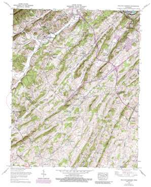
Sullivan Gardens Topo Map Tennessee
To zoom in, hover over the map of Sullivan Gardens
USGS Topo Quad 36082d5 - 1:24,000 scale
| Topo Map Name: | Sullivan Gardens |
| USGS Topo Quad ID: | 36082d5 |
| Print Size: | ca. 21 1/4" wide x 27" high |
| Southeast Coordinates: | 36.375° N latitude / 82.5° W longitude |
| Map Center Coordinates: | 36.4375° N latitude / 82.5625° W longitude |
| U.S. State: | TN |
| Filename: | o36082d5.jpg |
| Download Map JPG Image: | Sullivan Gardens topo map 1:24,000 scale |
| Map Type: | Topographic |
| Topo Series: | 7.5´ |
| Map Scale: | 1:24,000 |
| Source of Map Images: | United States Geological Survey (USGS) |
| Alternate Map Versions: |
Sullivan Gardens TN 1935 Download PDF Buy paper map Sullivan Gardens TN 1939 Download PDF Buy paper map Sullivan Gardens TN 1959, updated 1962 Download PDF Buy paper map Sullivan Gardens TN 1959, updated 1972 Download PDF Buy paper map Sullivan Gardens TN 1959, updated 1990 Download PDF Buy paper map Sullivan Gardens TN 2010 Download PDF Buy paper map Sullivan Gardens TN 2013 Download PDF Buy paper map Sullivan Gardens TN 2016 Download PDF Buy paper map |
1:24,000 Topo Quads surrounding Sullivan Gardens
> Back to 36082a1 at 1:100,000 scale
> Back to 36082a1 at 1:250,000 scale
> Back to U.S. Topo Maps home
Sullivan Gardens topo map: Gazetteer
Sullivan Gardens: Bends
Wexler Bend elevation 374m 1227′Sullivan Gardens: Bridges
Hammond Memorial Bridge elevation 366m 1200′Sullivan Gardens: Crossings
Interchange 45 elevation 500m 1640′Interchange 46 elevation 449m 1473′
Interchange 49 elevation 432m 1417′
Interchange 50 elevation 553m 1814′
Interchange 57 elevation 449m 1473′
Sullivan Gardens: Dams
Fort Patrick Henry Dam elevation 379m 1243′Sullivan Gardens: Populated Places
Applewalk Park elevation 471m 1545′Blue Ridge Estates elevation 430m 1410′
Butterfly (historical) elevation 391m 1282′
Cloverbottom (historical) elevation 372m 1220′
Colonial Acres elevation 439m 1440′
Colonial Heights elevation 438m 1437′
Deerfield elevation 456m 1496′
Double Springs elevation 500m 1640′
Easley Estates elevation 443m 1453′
Fall Branch elevation 454m 1489′
Fordtown elevation 447m 1466′
Gabtown elevation 573m 1879′
Glen Alpine elevation 385m 1263′
Harmony elevation 525m 1722′
Haws Crossroads elevation 542m 1778′
Historic Hills elevation 406m 1332′
Kendrick Creek (historical) elevation 431m 1414′
Kincheloe Mill elevation 494m 1620′
Lone Star elevation 402m 1318′
Meadowbrook elevation 493m 1617′
Mitchell Springs elevation 536m 1758′
Pactolus elevation 406m 1332′
Poplar Grove elevation 425m 1394′
Quail Creek elevation 457m 1499′
Rock Springs elevation 458m 1502′
Slaughter (historical) elevation 470m 1541′
Sullivan Gardens elevation 384m 1259′
Summer Hills elevation 445m 1459′
Summersville elevation 441m 1446′
Vernon Heights elevation 376m 1233′
Wheelocktown (historical) elevation 538m 1765′
Woodstone Estates elevation 428m 1404′
Sullivan Gardens: Post Offices
Colonial Heights Post Office elevation 437m 1433′Sullivan Gardens: Reservoirs
Fort Patrick Henry Lake elevation 379m 1243′Sullivan Gardens: Ridges
Baines Ridge elevation 573m 1879′Birdwell Ridge elevation 541m 1774′
Bowser Ridge elevation 565m 1853′
Buckaloo Ridge elevation 492m 1614′
Cox Ridge elevation 573m 1879′
Deacon Ridge elevation 583m 1912′
Double Springs Ridge elevation 524m 1719′
Douglas Shed Ridge elevation 533m 1748′
Dunham Ridge elevation 605m 1984′
Easley Ridge elevation 524m 1719′
Horse Ridge elevation 390m 1279′
Howard Ridge elevation 617m 2024′
Jackson Ridge elevation 617m 2024′
Kendrick Ridge elevation 453m 1486′
Miller Ridge elevation 496m 1627′
Pine Ridge elevation 482m 1581′
Roseberry Ridge elevation 455m 1492′
Taylor Ridge elevation 539m 1768′
Sullivan Gardens: Springs
Double Springs elevation 493m 1617′Kincheloe Spring elevation 496m 1627′
Mitchell Spring elevation 526m 1725′
Oak Springs elevation 511m 1676′
Sulphur Spring elevation 457m 1499′
Wheelock Spring elevation 534m 1751′
Sullivan Gardens: Streams
Bear Creek elevation 371m 1217′Dolan Branch elevation 383m 1256′
Kendrick Creek elevation 365m 1197′
Mill Creek elevation 372m 1220′
Red River elevation 452m 1482′
Straight Branch elevation 405m 1328′
Walker Fork elevation 378m 1240′
Sullivan Gardens: Summits
Bald Hill elevation 563m 1847′Bald Hill elevation 555m 1820′
Fulwiler Hill elevation 598m 1961′
Old Mountain elevation 557m 1827′
Pine Hill elevation 488m 1601′
Sullivan Gardens: Tunnels
Kendrick Tunnel elevation 438m 1437′Sullivan Gardens: Valleys
Bell Hollow elevation 409m 1341′Cox Hollow elevation 448m 1469′
Dark Hollow elevation 485m 1591′
Gragg Hollow elevation 524m 1719′
Irvin Hollow elevation 531m 1742′
Jackson Valley elevation 511m 1676′
Long Hollow elevation 382m 1253′
Mill Valley elevation 408m 1338′
Rock Springs Valley elevation 367m 1204′
Wheelock Hollow elevation 469m 1538′
Sullivan Gardens digital topo map on disk
Buy this Sullivan Gardens topo map showing relief, roads, GPS coordinates and other geographical features, as a high-resolution digital map file on DVD:
Western Virginia & Southern West Virginia
Buy digital topo maps: Western Virginia & Southern West Virginia


