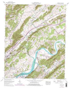
Burem Topo Map Tennessee
To zoom in, hover over the map of Burem
USGS Topo Quad 36082d8 - 1:24,000 scale
| Topo Map Name: | Burem |
| USGS Topo Quad ID: | 36082d8 |
| Print Size: | ca. 21 1/4" wide x 27" high |
| Southeast Coordinates: | 36.375° N latitude / 82.875° W longitude |
| Map Center Coordinates: | 36.4375° N latitude / 82.9375° W longitude |
| U.S. State: | TN |
| Filename: | o36082d8.jpg |
| Download Map JPG Image: | Burem topo map 1:24,000 scale |
| Map Type: | Topographic |
| Topo Series: | 7.5´ |
| Map Scale: | 1:24,000 |
| Source of Map Images: | United States Geological Survey (USGS) |
| Alternate Map Versions: |
Burem TN 1935 Download PDF Buy paper map Burem TN 1939, updated 1954 Download PDF Buy paper map Burem TN 1940 Download PDF Buy paper map Burem TN 1940 Download PDF Buy paper map Burem TN 1961, updated 1964 Download PDF Buy paper map Burem TN 1961, updated 1977 Download PDF Buy paper map Burem TN 1961, updated 1977 Download PDF Buy paper map Burem TN 2010 Download PDF Buy paper map Burem TN 2013 Download PDF Buy paper map Burem TN 2016 Download PDF Buy paper map |
1:24,000 Topo Quads surrounding Burem
> Back to 36082a1 at 1:100,000 scale
> Back to 36082a1 at 1:250,000 scale
> Back to U.S. Topo Maps home
Burem topo map: Gazetteer
Burem: Airports
Hawkins County Airport elevation 378m 1240′Burem: Bars
Big Creek Shoals elevation 329m 1079′Burhams Shoals elevation 329m 1079′
Charles Shoals elevation 331m 1085′
Jacksons Shoals elevation 329m 1079′
Miller Shoals elevation 333m 1092′
Spears Shoals elevation 360m 1181′
Burem: Bends
Bussels Bend elevation 330m 1082′Burem: Bridges
Burem Bridge elevation 329m 1079′Burem: Crossings
Chissolms Ford elevation 329m 1079′Burem: Dams
Burem Lake Dam elevation 345m 1131′Burem: Flats
Miller Flats elevation 334m 1095′Burem: Gaps
Knox Gap elevation 445m 1459′Burem: Islands
Burem Island elevation 330m 1082′Charles Island (historical) elevation 333m 1092′
Jacksons Islands (historical) elevation 329m 1079′
Miller Island elevation 333m 1092′
Burem: Lakes
Clearwater Pond elevation 357m 1171′Burem: Parks
John Sevier State Waterfowl Refuge elevation 329m 1079′Burem: Populated Places
Amis elevation 335m 1099′Belvins elevation 372m 1220′
Big Creek elevation 378m 1240′
Burem elevation 344m 1128′
Gillenwater (historical) elevation 405m 1328′
Guntown elevation 387m 1269′
Henard Mill elevation 387m 1269′
Hickory Cove (historical) elevation 394m 1292′
Honeycutt elevation 349m 1145′
Kepler elevation 344m 1128′
McDonald Hill elevation 386m 1266′
Petersburg elevation 404m 1325′
Striggersville elevation 365m 1197′
Vogel (historical) elevation 391m 1282′
Zion Hill elevation 390m 1279′
Burem: Post Offices
Burem Post Office (historical) elevation 344m 1128′Honeycutt Post Office (historical) elevation 351m 1151′
Slide Post Office (historical) elevation 337m 1105′
Yellow Store Post Office (historical) elevation 362m 1187′
Burem: Reservoirs
Burem Lake elevation 345m 1131′John Sevier Detention Reservoir elevation 329m 1079′
Burem: Ridges
Brushy Mountain elevation 531m 1742′Campbell Knobs elevation 461m 1512′
Cave Ridge elevation 484m 1587′
Grassy Mountain elevation 498m 1633′
Harlan Knobs elevation 518m 1699′
Miller Ridge elevation 445m 1459′
Burem: Springs
Caney Creek Spring elevation 376m 1233′Cold Spring elevation 383m 1256′
Ebbing and Flowing Spring elevation 346m 1135′
Epson Spring elevation 411m 1348′
Miller Spring elevation 379m 1243′
Shanks Spring elevation 438m 1437′
Burem: Streams
Beech Creek elevation 330m 1082′Big Creek elevation 329m 1079′
Devils Nose Branch elevation 368m 1207′
Fisher Creek elevation 388m 1272′
Honeycutt Creek elevation 334m 1095′
Sensabaugh Branch elevation 329m 1079′
Stinking Creek elevation 332m 1089′
Sweetwater Branch elevation 394m 1292′
Tarpine Valley Branch elevation 342m 1122′
West Fork Caney Creek elevation 363m 1190′
Burem: Summits
Bunker Hill elevation 540m 1771′Zion Hill elevation 503m 1650′
Burem: Valleys
Bear Hollow elevation 354m 1161′Carter Valley elevation 410m 1345′
Devils Nose Valley elevation 362m 1187′
Gravelly Valley elevation 440m 1443′
Hickory Cove elevation 393m 1289′
Hipshire Hollow elevation 334m 1095′
Knox Valley elevation 408m 1338′
Owl Hollow elevation 402m 1318′
Pinhook Hollow elevation 388m 1272′
Polecat Hollow elevation 407m 1335′
Possum Hollow elevation 349m 1145′
Stanley Valley elevation 372m 1220′
Webster Valley elevation 344m 1128′
Wickham Hollow elevation 405m 1328′
Winegar Hollow elevation 402m 1318′
Burem digital topo map on disk
Buy this Burem topo map showing relief, roads, GPS coordinates and other geographical features, as a high-resolution digital map file on DVD:
Western Virginia & Southern West Virginia
Buy digital topo maps: Western Virginia & Southern West Virginia


