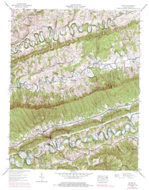
Hilton Topo Map Virginia
To zoom in, hover over the map of Hilton
USGS Topo Quad 36082f4 - 1:24,000 scale
| Topo Map Name: | Hilton |
| USGS Topo Quad ID: | 36082f4 |
| Print Size: | ca. 21 1/4" wide x 27" high |
| Southeast Coordinates: | 36.625° N latitude / 82.375° W longitude |
| Map Center Coordinates: | 36.6875° N latitude / 82.4375° W longitude |
| U.S. State: | VA |
| Filename: | o36082f4.jpg |
| Download Map JPG Image: | Hilton topo map 1:24,000 scale |
| Map Type: | Topographic |
| Topo Series: | 7.5´ |
| Map Scale: | 1:24,000 |
| Source of Map Images: | United States Geological Survey (USGS) |
| Alternate Map Versions: |
Hilton VA 1935 Download PDF Buy paper map Hilton VA 1938, updated 1954 Download PDF Buy paper map Hilton VA 1938, updated 1970 Download PDF Buy paper map Hilton VA 1938, updated 1978 Download PDF Buy paper map Hilton VA 1938, updated 1978 Download PDF Buy paper map Hilton VA 1939 Download PDF Buy paper map Hilton VA 1939 Download PDF Buy paper map Hiltons VA 2010 Download PDF Buy paper map Hiltons VA 2013 Download PDF Buy paper map Hiltons VA 2016 Download PDF Buy paper map |
1:24,000 Topo Quads surrounding Hilton
> Back to 36082e1 at 1:100,000 scale
> Back to 36082a1 at 1:250,000 scale
> Back to U.S. Topo Maps home
Hilton topo map: Gazetteer
Hilton: Cliffs
Bald Alley Bluff elevation 406m 1332′Otter House Bluff elevation 402m 1318′
Hilton: Crossings
Foust Ford elevation 380m 1246′Hart Ford elevation 383m 1256′
Hilton: Gaps
Brickyard Gap elevation 415m 1361′Dowell Gap elevation 425m 1394′
Eddington Gap elevation 422m 1384′
Hamilton Gap elevation 737m 2417′
Hiltons Gap elevation 418m 1371′
Jett Gap elevation 418m 1371′
Hilton: Populated Places
Bruno elevation 408m 1338′Dorton Fort elevation 495m 1624′
Fulkerson elevation 403m 1322′
Hiltons elevation 388m 1272′
Maces Spring elevation 410m 1345′
McConnell elevation 509m 1669′
McConnell Mill elevation 499m 1637′
McCorkle elevation 406m 1332′
Owen Corner elevation 383m 1256′
Snowflake elevation 474m 1555′
Hilton: Ridges
Callahan Spur elevation 552m 1811′Moccasin Ridge elevation 598m 1961′
Pine Ridge elevation 509m 1669′
Hilton: Streams
Amos Branch elevation 491m 1610′Big Branch elevation 481m 1578′
Blue Springs Branch elevation 402m 1318′
Champ Branch elevation 514m 1686′
Cove Creek elevation 398m 1305′
Culbertson Creek elevation 512m 1679′
Dean Branch elevation 530m 1738′
Dowell Branch elevation 387m 1269′
Dry Branch elevation 395m 1295′
East Fork Roberts Creek elevation 444m 1456′
Fowlers Branch elevation 374m 1227′
Gouldman Branch elevation 406m 1332′
Hiltons Creek elevation 381m 1250′
Lark Branch elevation 520m 1706′
Roberts Creek elevation 383m 1256′
Sled Creek elevation 406m 1332′
Hilton: Summits
Miller Knob elevation 678m 2224′Hilton: Valleys
Bright Hollow elevation 437m 1433′Cave Spring Hollow elevation 543m 1781′
Little Valley elevation 409m 1341′
Hilton digital topo map on disk
Buy this Hilton topo map showing relief, roads, GPS coordinates and other geographical features, as a high-resolution digital map file on DVD:
Western Virginia & Southern West Virginia
Buy digital topo maps: Western Virginia & Southern West Virginia


