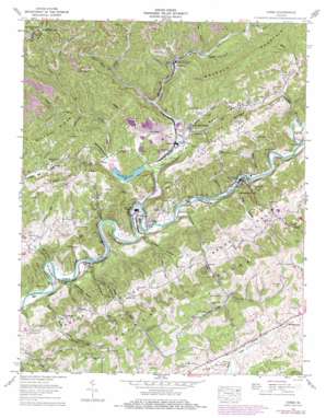
Carbo Topo Map Virginia
To zoom in, hover over the map of Carbo
USGS Topo Quad 36082h2 - 1:24,000 scale
| Topo Map Name: | Carbo |
| USGS Topo Quad ID: | 36082h2 |
| Print Size: | ca. 21 1/4" wide x 27" high |
| Southeast Coordinates: | 36.875° N latitude / 82.125° W longitude |
| Map Center Coordinates: | 36.9375° N latitude / 82.1875° W longitude |
| U.S. State: | VA |
| Filename: | o36082h2.jpg |
| Download Map JPG Image: | Carbo topo map 1:24,000 scale |
| Map Type: | Topographic |
| Topo Series: | 7.5´ |
| Map Scale: | 1:24,000 |
| Source of Map Images: | United States Geological Survey (USGS) |
| Alternate Map Versions: |
Carbo VA 1934 Download PDF Buy paper map Carbo VA 1958, updated 1960 Download PDF Buy paper map Carbo VA 1958, updated 1971 Download PDF Buy paper map Carbo VA 1958, updated 1974 Download PDF Buy paper map Carbo VA 1958, updated 1978 Download PDF Buy paper map Carbo VA 2011 Download PDF Buy paper map Carbo VA 2013 Download PDF Buy paper map Carbo VA 2016 Download PDF Buy paper map |
1:24,000 Topo Quads surrounding Carbo
> Back to 36082e1 at 1:100,000 scale
> Back to 36082a1 at 1:250,000 scale
> Back to U.S. Topo Maps home
Carbo topo map: Gazetteer
Carbo: Bends
Dry Run Bend elevation 471m 1545′Kiser Bend elevation 459m 1505′
Carbo: Bridges
John Counts Memorial Bridge elevation 456m 1496′Carbo: Dams
Clinch River Flyash Dike Number One Dam elevation 472m 1548′Clinch River Flyash Dike Number Two Dam elevation 472m 1548′
Lake Bonaventure Dam elevation 470m 1541′
Middle Fork Slurry Impoundment Dam elevation 512m 1679′
Moss Number Two Mine Pond Dam elevation 558m 1830′
Carbo: Falls
Tank Hollow Falls elevation 485m 1591′Carbo: Islands
Abby Counts Island elevation 460m 1509′Carbo: Mines
Moss Number 2 Mine and Preparation Plant elevation 530m 1738′Moss Number 3 Preparation Plant elevation 474m 1555′
Carbo: Populated Places
Candler elevation 543m 1781′Carbo elevation 466m 1528′
Carterton elevation 456m 1496′
Cleveland elevation 465m 1525′
Clinchfield elevation 472m 1548′
Counts elevation 534m 1751′
Dickenson Corner elevation 536m 1758′
Gravel Lick elevation 591m 1938′
Grizzle (historical) elevation 575m 1886′
Jessees Mill elevation 544m 1784′
Kiser (historical) elevation 601m 1971′
Purcell elevation 583m 1912′
South Clinchfield elevation 477m 1564′
Carbo: Reservoirs
Ash Pond Area Number One elevation 472m 1548′Ash Pond Number Two elevation 472m 1548′
Lake Bonaventure elevation 470m 1541′
Moss Number Three Preparation Plant Upper Slurry elevation 512m 1679′
Carbo: Ridges
Brushy Ridge elevation 693m 2273′Ivy Ridge elevation 626m 2053′
Red Oak Ridge elevation 703m 2306′
Carbo: Streams
Anderson Creek elevation 573m 1879′Bee Branch elevation 470m 1541′
Chaney Creek elevation 469m 1538′
Dry Run elevation 461m 1512′
Dumps Creek elevation 459m 1505′
Eagle Nest Branch elevation 459m 1505′
Grassy Branch elevation 581m 1906′
Honey Branch elevation 586m 1922′
Hurricane Fork elevation 487m 1597′
Laurel Branch elevation 546m 1791′
Meade Branch elevation 451m 1479′
Middle Fork Clinch River elevation 454m 1489′
Mill Creek elevation 453m 1486′
Millstone Branch elevation 460m 1509′
Monk Branch elevation 476m 1561′
Muddy Branch elevation 585m 1919′
Muddy Branch elevation 464m 1522′
Rocky Fork elevation 468m 1535′
Sexton Branch elevation 452m 1482′
Sinking Creek elevation 621m 2037′
Stonecoal Creek elevation 522m 1712′
Wolfpen Branch elevation 546m 1791′
Carbo: Summits
Tunnel Hill elevation 527m 1729′Carbo: Valleys
Back Valley elevation 476m 1561′Chaney Hollow elevation 524m 1719′
Dark Hollow elevation 461m 1512′
Dorton Hollow elevation 543m 1781′
Hop Hollow elevation 498m 1633′
Jessee Hollow elevation 574m 1883′
Muddy Hollow elevation 462m 1515′
Pennus Hollow elevation 579m 1899′
Possum Hollow elevation 454m 1489′
Sexton Hollow elevation 557m 1827′
Sinkhole Valley elevation 546m 1791′
Spruce Pine Hollow elevation 479m 1571′
Stillhouse Hollow elevation 459m 1505′
Tank Hollow elevation 491m 1610′
Winney Hollow elevation 513m 1683′
Carbo digital topo map on disk
Buy this Carbo topo map showing relief, roads, GPS coordinates and other geographical features, as a high-resolution digital map file on DVD:
Western Virginia & Southern West Virginia
Buy digital topo maps: Western Virginia & Southern West Virginia


