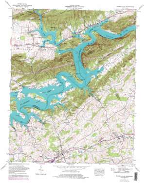
Russellville Topo Map Tennessee
To zoom in, hover over the map of Russellville
USGS Topo Quad 36083c2 - 1:24,000 scale
| Topo Map Name: | Russellville |
| USGS Topo Quad ID: | 36083c2 |
| Print Size: | ca. 21 1/4" wide x 27" high |
| Southeast Coordinates: | 36.25° N latitude / 83.125° W longitude |
| Map Center Coordinates: | 36.3125° N latitude / 83.1875° W longitude |
| U.S. State: | TN |
| Filename: | o36083c2.jpg |
| Download Map JPG Image: | Russellville topo map 1:24,000 scale |
| Map Type: | Topographic |
| Topo Series: | 7.5´ |
| Map Scale: | 1:24,000 |
| Source of Map Images: | United States Geological Survey (USGS) |
| Alternate Map Versions: |
Russellville TN 1935 Download PDF Buy paper map Russellville TN 1939, updated 1958 Download PDF Buy paper map Russellville TN 1940 Download PDF Buy paper map Russellville TN 1961, updated 1962 Download PDF Buy paper map Russellville TN 1961, updated 1977 Download PDF Buy paper map Russellville TN 1961, updated 1977 Download PDF Buy paper map Russellville TN 2010 Download PDF Buy paper map Russellville TN 2013 Download PDF Buy paper map Russellville TN 2016 Download PDF Buy paper map |
1:24,000 Topo Quads surrounding Russellville
> Back to 36083a1 at 1:100,000 scale
> Back to 36082a1 at 1:250,000 scale
> Back to U.S. Topo Maps home
Russellville topo map: Gazetteer
Russellville: Bars
Anderson Shoals elevation 327m 1072′Half Moon Shoals elevation 327m 1072′
Hilts Shoals elevation 327m 1072′
Mooneys Shoals elevation 327m 1072′
Mulberry Grove Shoals elevation 327m 1072′
Poor Valley Shoals elevation 327m 1072′
Russellville: Bends
Anderson Bend elevation 345m 1131′Russellville: Cliffs
White Cliff elevation 358m 1174′Russellville: Crossings
Bright Ferry (historical) elevation 327m 1072′Cobb Ford (historical) elevation 327m 1072′
Nalls Ford (historical) elevation 327m 1072′
Red Bridge Ferry (historical) elevation 327m 1072′
Russellville: Islands
Amy Island (historical) elevation 327m 1072′Berry Island elevation 334m 1095′
Berrys Island elevation 339m 1112′
Bingham Island (historical) elevation 327m 1072′
Cobb Island (historical) elevation 327m 1072′
Kenners Island (historical) elevation 327m 1072′
Prices Island (historical) elevation 327m 1072′
Towhead Island (historical) elevation 327m 1072′
Watermelon Island (historical) elevation 327m 1072′
Russellville: Lakes
Dickenson Pond elevation 393m 1289′Stanifer Pond elevation 390m 1279′
Russellville: Mines
Dougherty Quarry elevation 346m 1135′Evans Quarry elevation 405m 1328′
Fudge Quarry elevation 332m 1089′
McClure Quarry elevation 329m 1079′
Stamps Quarry elevation 356m 1167′
Stamps Star Quarry elevation 400m 1312′
Russellville: Parks
Berrys Island Ecological Study Area elevation 336m 1102′Russellville: Populated Places
Bright (historical) elevation 327m 1072′Cain Mill elevation 364m 1194′
Cardinal Hills elevation 397m 1302′
Cheeks Crossroads elevation 398m 1305′
Clinchview Heights elevation 401m 1315′
East Manor elevation 377m 1236′
Fairfield Acres elevation 392m 1286′
Galbraith elevation 339m 1112′
Galbraith Springs elevation 401m 1315′
Glendale Acres elevation 407m 1335′
Holston Hills elevation 378m 1240′
Hyatt Acres elevation 373m 1223′
Jaybird elevation 391m 1282′
Kentucky Heights elevation 372m 1220′
Lakemont Cabin Area elevation 328m 1076′
Lakeshore Estates elevation 343m 1125′
Mooresburg elevation 332m 1089′
Mooresburg Springs elevation 376m 1233′
Music Acres elevation 399m 1309′
Needmore elevation 346m 1135′
Quarryville (historical) elevation 331m 1085′
Russellville elevation 372m 1220′
Whitesburg elevation 366m 1200′
Russellville: Post Offices
Mooresburg Post Office elevation 340m 1115′Russellville: Ridges
Ironworks Ridge elevation 395m 1295′Nenny Ridge elevation 517m 1696′
Prophet Ridge elevation 533m 1748′
River Knobs elevation 505m 1656′
Sassafras Ridge elevation 462m 1515′
Spring Ridge elevation 487m 1597′
Russellville: Springs
Cave Spring elevation 365m 1197′Dodson Spring elevation 351m 1151′
Hyatt Spring elevation 364m 1194′
Russellville: Streams
Bingham Branch elevation 329m 1079′Cedar Creek elevation 327m 1072′
Dry Branch elevation 327m 1072′
Fall Creek elevation 327m 1072′
Galbraith Branch elevation 327m 1072′
Kellar Branch elevation 327m 1072′
Moore Branch elevation 327m 1072′
Mooresburg Branch elevation 327m 1072′
Needmore Creek elevation 327m 1072′
Poor Valley Creek elevation 327m 1072′
Quarry Branch elevation 327m 1072′
Red House Branch elevation 327m 1072′
Robinson Branch elevation 327m 1072′
Russellville: Summits
Indian Grave Hill elevation 407m 1335′Potato Hill elevation 487m 1597′
Quarry Hill elevation 483m 1584′
Rogers High Point elevation 567m 1860′
Stony Mountain elevation 526m 1725′
Russellville: Valleys
Gander Hollow elevation 360m 1181′Grassy Valley elevation 331m 1085′
Jimtown Hollow elevation 327m 1072′
Lee Valley elevation 327m 1072′
McGhee Hollow elevation 349m 1145′
Reed Hollow elevation 327m 1072′
Stubblefield Hollow elevation 327m 1072′
Russellville digital topo map on disk
Buy this Russellville topo map showing relief, roads, GPS coordinates and other geographical features, as a high-resolution digital map file on DVD:
Western Virginia & Southern West Virginia
Buy digital topo maps: Western Virginia & Southern West Virginia


