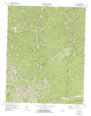
Helton Topo Map Kentucky
To zoom in, hover over the map of Helton
USGS Topo Quad 36083h4 - 1:24,000 scale
| Topo Map Name: | Helton |
| USGS Topo Quad ID: | 36083h4 |
| Print Size: | ca. 21 1/4" wide x 27" high |
| Southeast Coordinates: | 36.875° N latitude / 83.375° W longitude |
| Map Center Coordinates: | 36.9375° N latitude / 83.4375° W longitude |
| U.S. State: | KY |
| Filename: | o36083h4.jpg |
| Download Map JPG Image: | Helton topo map 1:24,000 scale |
| Map Type: | Topographic |
| Topo Series: | 7.5´ |
| Map Scale: | 1:24,000 |
| Source of Map Images: | United States Geological Survey (USGS) |
| Alternate Map Versions: |
Helton KY 1954, updated 1955 Download PDF Buy paper map Helton KY 1954, updated 1967 Download PDF Buy paper map Helton KY 1974, updated 1977 Download PDF Buy paper map Helton KY 1974, updated 1991 Download PDF Buy paper map Helton KY 2011 Download PDF Buy paper map Helton KY 2013 Download PDF Buy paper map Helton KY 2016 Download PDF Buy paper map |
| FStopo: | US Forest Service topo Helton is available: Download FStopo PDF Download FStopo TIF |
1:24,000 Topo Quads surrounding Helton
> Back to 36083e1 at 1:100,000 scale
> Back to 36082a1 at 1:250,000 scale
> Back to U.S. Topo Maps home
Helton topo map: Gazetteer
Helton: Gaps
Buck Gap elevation 527m 1729′Chestnut Gap elevation 777m 2549′
Chestnut Gap elevation 790m 2591′
Deep Gap elevation 676m 2217′
Foundation Gap elevation 610m 2001′
Phillips Gap elevation 605m 1984′
Rainbow Gap elevation 628m 2060′
Helton: Lakes
Spruce Pine Lake elevation 642m 2106′Helton: Populated Places
Helton elevation 378m 1240′Saylor elevation 494m 1620′
Spruce Pine elevation 410m 1345′
Warbranch elevation 385m 1263′
Helton: Post Offices
Helton Post Office (historical) elevation 369m 1210′Imlay Post Office (historical) elevation 377m 1236′
Mozelle Post Office (historical) elevation 326m 1069′
Nantz Post Office (historical) elevation 344m 1128′
Saylor Post Office (historical) elevation 491m 1610′
War Branch Post Office elevation 334m 1095′
Helton: Ridges
Kentucky Ridge elevation 746m 2447′Helton: Streams
Adams Branch elevation 390m 1279′Apple Orchard Branch elevation 369m 1210′
Bear Branch elevation 336m 1102′
Bear Branch elevation 431m 1414′
Big Branch elevation 365m 1197′
Big Branch elevation 413m 1354′
Cawood Branch elevation 403m 1322′
Deep Gap Branch elevation 550m 1804′
Does Fork elevation 457m 1499′
Dry Fork elevation 409m 1341′
Dry Fork elevation 372m 1220′
Dug Fork elevation 349m 1145′
Edd Fork elevation 469m 1538′
Elk Branch elevation 339m 1112′
Fern Branch elevation 400m 1312′
Franks Branch elevation 438m 1437′
Ginseng Branch elevation 337m 1105′
Harvey Branch elevation 401m 1315′
Helton Branch elevation 398m 1305′
Honey Branch elevation 504m 1653′
Hoskin Branch elevation 383m 1256′
Hurricane Branch elevation 388m 1272′
Isaacs Fork elevation 420m 1377′
Johnson Fork elevation 470m 1541′
Kentucky Branch elevation 491m 1610′
Laurel Branch elevation 455m 1492′
Laurel Branch elevation 358m 1174′
Left Fork Marrowbone Creek elevation 394m 1292′
Left Fork Reuben Branch elevation 498m 1633′
Lick Fork elevation 371m 1217′
Long Branch elevation 458m 1502′
Long Fork elevation 507m 1663′
Long Fork elevation 417m 1368′
Long Fork elevation 458m 1502′
Mare Branch elevation 378m 1240′
Marion Branch elevation 329m 1079′
Marrowbone Creek elevation 383m 1256′
Mazie Branch elevation 448m 1469′
Mudlick Branch elevation 350m 1148′
Oldhouse Branch elevation 344m 1128′
Onemile Branch elevation 384m 1259′
Pace Branch elevation 450m 1476′
Peters Branch elevation 336m 1102′
Rainbow Branch elevation 548m 1797′
Right Fork Oldhouse Branch elevation 343m 1125′
Right Fork Onemile Branch elevation 416m 1364′
Right Fork Peters Branch elevation 361m 1184′
Right Fork Stone Coal Branch elevation 336m 1102′
Road Fork elevation 367m 1204′
Road Fork elevation 391m 1282′
Roark Branch elevation 383m 1256′
Rye Cove Branch elevation 367m 1204′
Sandy Fork elevation 507m 1663′
Shade Branch elevation 437m 1433′
Simms Branch elevation 370m 1213′
Spruce Pine Creek elevation 410m 1345′
Trace Branch elevation 347m 1138′
Turkey Branch elevation 397m 1302′
War Branch elevation 365m 1197′
White Oak Creek elevation 332m 1089′
Whitehead Branch elevation 375m 1230′
Wolfpen Branch elevation 341m 1118′
Helton: Summits
Chestnut Knob elevation 777m 2549′Peters Knob elevation 795m 2608′
Potato Knob elevation 671m 2201′
Helton: Valleys
Arrow Hollow elevation 571m 1873′Buck Hollow elevation 377m 1236′
Buckeye Hollow elevation 527m 1729′
Buzzard Hollow elevation 440m 1443′
Coalfield Hollow elevation 497m 1630′
Collins Hollow elevation 436m 1430′
Hobbs Hollow elevation 473m 1551′
Lizzie Hollow elevation 377m 1236′
Mill Hollow elevation 364m 1194′
Mill Hollow elevation 450m 1476′
Old Lease Hollow elevation 511m 1676′
Owl Hollow elevation 536m 1758′
Pigeon Roost Hollow elevation 434m 1423′
Rattlesnake Hollow elevation 412m 1351′
Rocky Hollow elevation 403m 1322′
Saylor Hollow elevation 584m 1916′
Squirrel Hollow elevation 546m 1791′
Wilson Hollow elevation 534m 1751′
Wilson Hollow elevation 455m 1492′
Helton digital topo map on disk
Buy this Helton topo map showing relief, roads, GPS coordinates and other geographical features, as a high-resolution digital map file on DVD:
Western Virginia & Southern West Virginia
Buy digital topo maps: Western Virginia & Southern West Virginia


