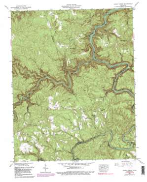
Honey Creek Topo Map Tennessee
To zoom in, hover over the map of Honey Creek
USGS Topo Quad 36084d6 - 1:24,000 scale
| Topo Map Name: | Honey Creek |
| USGS Topo Quad ID: | 36084d6 |
| Print Size: | ca. 21 1/4" wide x 27" high |
| Southeast Coordinates: | 36.375° N latitude / 84.625° W longitude |
| Map Center Coordinates: | 36.4375° N latitude / 84.6875° W longitude |
| U.S. State: | TN |
| Filename: | o36084d6.jpg |
| Download Map JPG Image: | Honey Creek topo map 1:24,000 scale |
| Map Type: | Topographic |
| Topo Series: | 7.5´ |
| Map Scale: | 1:24,000 |
| Source of Map Images: | United States Geological Survey (USGS) |
| Alternate Map Versions: |
Honey Creek TN 1952, updated 1953 Download PDF Buy paper map Honey Creek TN 1952, updated 1970 Download PDF Buy paper map Honey Creek TN 1952, updated 1975 Download PDF Buy paper map Honey Creek TN 1952, updated 1980 Download PDF Buy paper map Honey Creek TN 1952, updated 1989 Download PDF Buy paper map Honey Creek TN 1952, updated 1989 Download PDF Buy paper map Honey Creek TN 2000, updated 2001 Download PDF Buy paper map Honey Creek TN 2010 Download PDF Buy paper map Honey Creek TN 2013 Download PDF Buy paper map Honey Creek TN 2016 Download PDF Buy paper map |
1:24,000 Topo Quads surrounding Honey Creek
> Back to 36084a1 at 1:100,000 scale
> Back to 36084a1 at 1:250,000 scale
> Back to U.S. Topo Maps home
Honey Creek topo map: Gazetteer
Honey Creek: Bays
Jakes Hole elevation 278m 912′Honey Creek: Bends
The Narrows elevation 284m 931′Honey Creek: Bridges
Burnt Mill Bridge elevation 334m 1095′Honey Creek: Crossings
Leatherwood Ford elevation 268m 879′Honey Creek: Falls
Double Falls elevation 303m 994′The Falls elevation 259m 849′
Honey Creek: Forests
Scott State Forest elevation 432m 1417′Honey Creek: Populated Places
Gernt elevation 309m 1013′Goad elevation 472m 1548′
Mount Helen elevation 429m 1407′
Speck elevation 292m 958′
Zenith elevation 322m 1056′
Honey Creek: Rapids
First Drop Rapids elevation 310m 1017′O and W Rapids elevation 273m 895′
Rions Eddy elevation 288m 944′
The Ell elevation 298m 977′
Washing Machine Rapids elevation 302m 990′
Honey Creek: Ridges
Big Ridge elevation 465m 1525′Groom Ridge elevation 451m 1479′
Hurricane Ridge elevation 471m 1545′
Long Ridge elevation 462m 1515′
Honey Creek: Streams
Anderson Branch elevation 267m 875′Bandy Creek elevation 267m 875′
Bear Branch elevation 340m 1115′
Black Creek elevation 323m 1059′
Camp Branch elevation 323m 1059′
Caney Branch elevation 341m 1118′
Coyle Branch elevation 287m 941′
Deadening Branch elevation 304m 997′
East Fork Joe Branch elevation 395m 1295′
Fall Branch elevation 265m 869′
Groom Branch elevation 308m 1010′
Gum Branch elevation 364m 1194′
Honey Creek elevation 333m 1092′
Jacks Branch elevation 284m 931′
Joe Branch elevation 359m 1177′
Laurel Fork elevation 310m 1017′
North Fork Fall Branch elevation 378m 1240′
North Fork Honey Creek elevation 333m 1092′
North Fork Rock Branch elevation 369m 1210′
North White Oak Creek elevation 267m 875′
Panther Branch elevation 348m 1141′
Panther Creek elevation 287m 941′
Pine Creek elevation 292m 958′
Potter Branch elevation 292m 958′
Reed Branch elevation 290m 951′
Rock Branch elevation 364m 1194′
Sebands Branch elevation 346m 1135′
Skull Creek elevation 333m 1092′
South Fork Camp Branch elevation 352m 1154′
Still Camp Branch elevation 349m 1145′
Sun Branch elevation 339m 1112′
Wagon Ford Branch elevation 351m 1151′
West Fork Coyle Branch elevation 287m 941′
West Fork Joe Branch elevation 395m 1295′
White Oak Creek elevation 355m 1164′
Wolf Branch elevation 345m 1131′
Honey Creek: Valleys
Logging Hollow elevation 284m 931′Honey Creek digital topo map on disk
Buy this Honey Creek topo map showing relief, roads, GPS coordinates and other geographical features, as a high-resolution digital map file on DVD:


