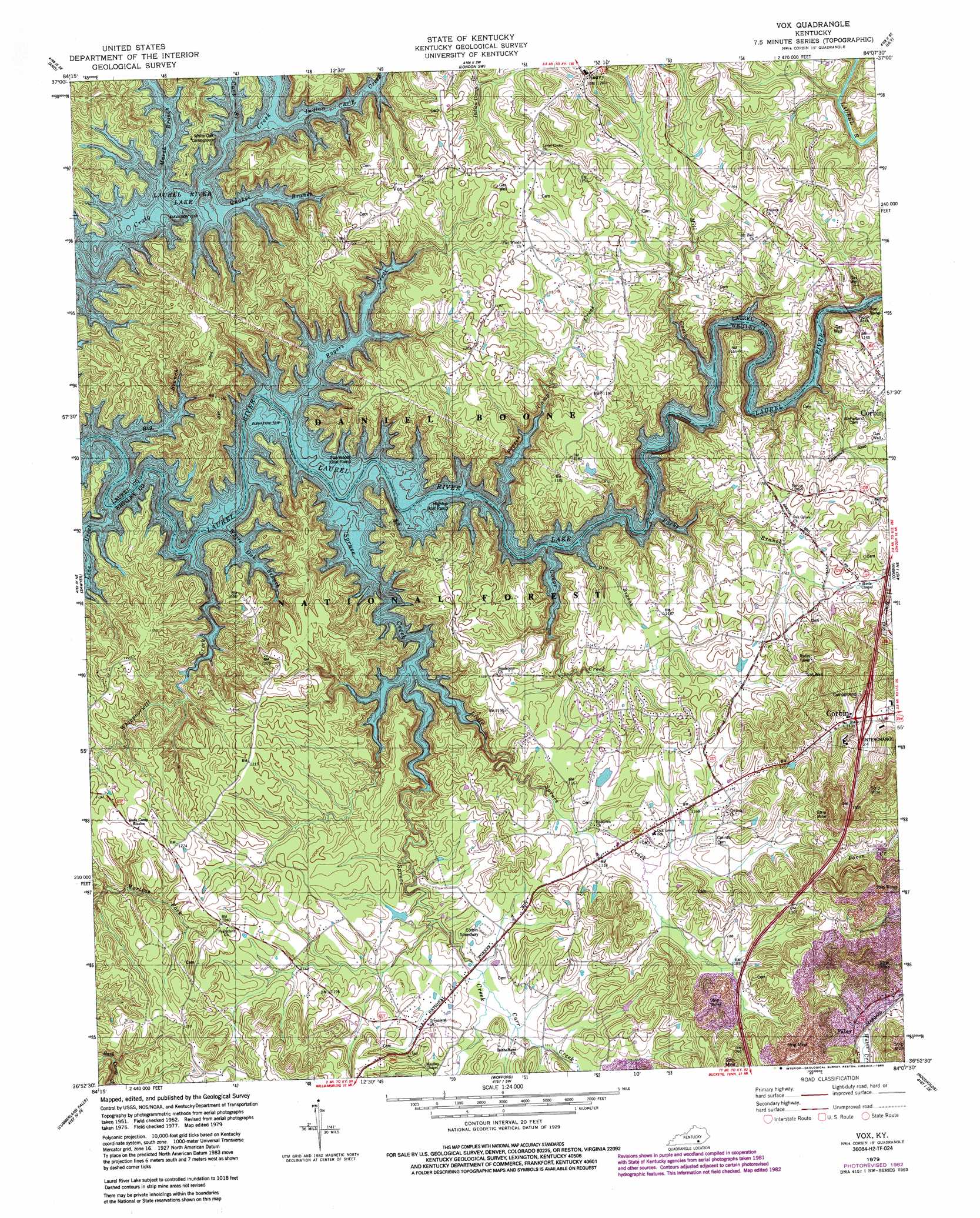
Vox Topo Map Kentucky
To zoom in, hover over the map of Vox
USGS Topo Quad 36084h2 - 1:24,000 scale
| Topo Map Name: | Vox |
| USGS Topo Quad ID: | 36084h2 |
| Print Size: | ca. 21 1/4" wide x 27" high |
| Southeast Coordinates: | 36.875° N latitude / 84.125° W longitude |
| Map Center Coordinates: | 36.9375° N latitude / 84.1875° W longitude |
| U.S. State: | KY |
| Filename: | o36084h2.jpg |
| Download Map JPG Image: | Vox topo map 1:24,000 scale |
| Map Type: | Topographic |
| Topo Series: | 7.5´ |
| Map Scale: | 1:24,000 |
| Source of Map Images: | United States Geological Survey (USGS) |
| Alternate Map Versions: |
Vox KY 1952, updated 1953 Download PDF Buy paper map Vox KY 1952, updated 1965 Download PDF Buy paper map Vox KY 1979, updated 1979 Download PDF Buy paper map Vox KY 1979, updated 1983 Download PDF Buy paper map Vox KY 2011 Download PDF Buy paper map Vox KY 2013 Download PDF Buy paper map Vox KY 2016 Download PDF Buy paper map |
| FStopo: | US Forest Service topo Vox is available: Download FStopo PDF Download FStopo TIF |
1:24,000 Topo Quads surrounding Vox
Shopville |
Billows |
Bernstadt |
London |
Portersburg |
Dykes |
Ano |
London Sw |
Lily |
Blackwater |
Hail |
Sawyer |
Vox |
Corbin |
Heidrick |
Wiborg |
Cumberland Falls |
Wofford |
Rockholds |
Barbourville |
Whitley City |
Hollyhill |
Williamsburg |
Saxton |
Frakes |
> Back to 36084e1 at 1:100,000 scale
> Back to 36084a1 at 1:250,000 scale
> Back to U.S. Topo Maps home
Vox topo map: Gazetteer
Vox: Populated Places
Grove elevation 349m 1145′Vox elevation 361m 1184′
Vox: Post Offices
Legal Post Office (historical) elevation 305m 1000′Vox: Streams
Big Branch elevation 305m 1000′Cane Branch elevation 305m 1000′
Carr Creek elevation 337m 1105′
Conoe Creek elevation 305m 1000′
Dix Branch elevation 305m 1000′
Frozen Camp Creek elevation 305m 1000′
Indian Camp Creek elevation 305m 1000′
Line Creek elevation 305m 1000′
Little Spruce Creek elevation 305m 1000′
Marsh Branch elevation 305m 1000′
Mill Creek elevation 305m 1000′
Parks Branch elevation 305m 1000′
Quaker Branch elevation 305m 1000′
Rogers Creek elevation 305m 1000′
Spruce Creek elevation 305m 1000′
Whippoorwill Creek elevation 305m 1000′
White Oak Branch elevation 305m 1000′
Vox digital topo map on disk
Buy this Vox topo map showing relief, roads, GPS coordinates and other geographical features, as a high-resolution digital map file on DVD: