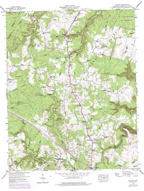
Isoline Topo Map Tennessee
To zoom in, hover over the map of Isoline
USGS Topo Quad 36085a1 - 1:24,000 scale
| Topo Map Name: | Isoline |
| USGS Topo Quad ID: | 36085a1 |
| Print Size: | ca. 21 1/4" wide x 27" high |
| Southeast Coordinates: | 36° N latitude / 85° W longitude |
| Map Center Coordinates: | 36.0625° N latitude / 85.0625° W longitude |
| U.S. State: | TN |
| Filename: | o36085a1.jpg |
| Download Map JPG Image: | Isoline topo map 1:24,000 scale |
| Map Type: | Topographic |
| Topo Series: | 7.5´ |
| Map Scale: | 1:24,000 |
| Source of Map Images: | United States Geological Survey (USGS) |
| Alternate Map Versions: |
Isoline TN 1935 Download PDF Buy paper map Isoline TN 1946, updated 1976 Download PDF Buy paper map Isoline TN 1949 Download PDF Buy paper map Isoline TN 2010 Download PDF Buy paper map Isoline TN 2013 Download PDF Buy paper map Isoline TN 2016 Download PDF Buy paper map |
1:24,000 Topo Quads surrounding Isoline
> Back to 36085a1 at 1:100,000 scale
> Back to 36084a1 at 1:250,000 scale
> Back to U.S. Topo Maps home
Isoline topo map: Gazetteer
Isoline: Airports
Carey Airport elevation 581m 1906′Isoline: Bends
Gould Bend elevation 524m 1719′Isoline: Crossings
Interchange 317 elevation 540m 1771′White Pine Ford elevation 524m 1719′
Isoline: Dams
Adams Creek Dam elevation 541m 1774′Downing Creek Dam elevation 540m 1771′
Frank Dam elevation 561m 1840′
Hill Lake Number One Dam elevation 528m 1732′
Tankersley Lake Dam elevation 549m 1801′
Isoline: Flats
Hunter Meadow elevation 572m 1876′Isoline: Populated Places
Bowman elevation 552m 1811′Creston elevation 518m 1699′
Elmore elevation 574m 1883′
North Crossville Addition elevation 546m 1791′
Parker Ford elevation 494m 1620′
Plateau elevation 592m 1942′
Tabor elevation 561m 1840′
Woody elevation 588m 1929′
Isoline: Reservoirs
Adams Creek Lake elevation 541m 1774′Downing Creek Reservoir elevation 540m 1771′
Frank Lake elevation 561m 1840′
Hill Lake Number One elevation 528m 1732′
Tankersley Lake elevation 549m 1801′
Isoline: Streams
Baker Branch elevation 513m 1683′Caney Fork Creek elevation 522m 1712′
Coley Creek elevation 528m 1732′
Copeland Creek elevation 515m 1689′
Drowning Creek elevation 515m 1689′
Gould Creek elevation 459m 1505′
Lee Branch elevation 508m 1666′
Lickfork Creek elevation 490m 1607′
Mine Branch elevation 480m 1574′
Owens Branch elevation 518m 1699′
Patton Creek elevation 480m 1574′
Piney Creek elevation 546m 1791′
Procter Creek elevation 508m 1666′
Rocky Branch elevation 509m 1669′
Scale Creek elevation 513m 1683′
Slatestone Branch elevation 542m 1778′
Stephens Branch elevation 521m 1709′
Terrell Branch elevation 542m 1778′
Wallace Branch elevation 528m 1732′
Isoline: Summits
Big Hill elevation 617m 2024′Isoline digital topo map on disk
Buy this Isoline topo map showing relief, roads, GPS coordinates and other geographical features, as a high-resolution digital map file on DVD:


