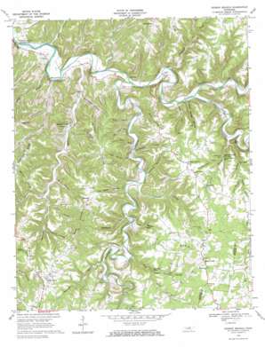
Dodson Branch Topo Map Tennessee
To zoom in, hover over the map of Dodson Branch
USGS Topo Quad 36085c5 - 1:24,000 scale
| Topo Map Name: | Dodson Branch |
| USGS Topo Quad ID: | 36085c5 |
| Print Size: | ca. 21 1/4" wide x 27" high |
| Southeast Coordinates: | 36.25° N latitude / 85.5° W longitude |
| Map Center Coordinates: | 36.3125° N latitude / 85.5625° W longitude |
| U.S. State: | TN |
| Filename: | o36085c5.jpg |
| Download Map JPG Image: | Dodson Branch topo map 1:24,000 scale |
| Map Type: | Topographic |
| Topo Series: | 7.5´ |
| Map Scale: | 1:24,000 |
| Source of Map Images: | United States Geological Survey (USGS) |
| Alternate Map Versions: |
Dodson Branch TN 1968, updated 1970 Download PDF Buy paper map Dodson Branch TN 2010 Download PDF Buy paper map Dodson Branch TN 2013 Download PDF Buy paper map Dodson Branch TN 2016 Download PDF Buy paper map |
1:24,000 Topo Quads surrounding Dodson Branch
> Back to 36085a1 at 1:100,000 scale
> Back to 36084a1 at 1:250,000 scale
> Back to U.S. Topo Maps home
Dodson Branch topo map: Gazetteer
Dodson Branch: Cliffs
Dave Bluff elevation 227m 744′Hardscrabble Bluff elevation 240m 787′
Pendleton Bluff elevation 220m 721′
Dodson Branch: Falls
Dry Creek Falls elevation 262m 859′Dodson Branch: Parks
Blackburn Fork State Scenic River elevation 188m 616′Roaring River State Scenic River elevation 158m 518′
Dodson Branch: Pillars
Hardscrabble Pinnacle elevation 240m 787′Dodson Branch: Populated Places
Center Grove elevation 304m 997′Dodson Branch elevation 299m 980′
Freewill elevation 304m 997′
Mayfield (historical) elevation 301m 987′
Morrison Creek elevation 179m 587′
Mount Union elevation 327m 1072′
Pacific (historical) elevation 165m 541′
Dodson Branch: Ridges
Backbone Ridge elevation 301m 987′Freewill Ridge elevation 301m 987′
Martin Ridge elevation 296m 971′
Sugartown Ridge elevation 311m 1020′
Dodson Branch: Springs
The Boils elevation 181m 593′Dodson Branch: Streams
Aaron Branch elevation 155m 508′Blackburn Fork elevation 158m 518′
Bowman Branch elevation 199m 652′
Dodson Branch elevation 175m 574′
Dry Creek elevation 192m 629′
Gaw Branch elevation 158m 518′
Hopper Creek elevation 162m 531′
Long Branch elevation 156m 511′
Morrison Creek elevation 158m 518′
Pole Bridge Branch elevation 176m 577′
Spring Creek elevation 167m 547′
Talley Creek elevation 154m 505′
Dodson Branch: Summits
Booger Hill elevation 299m 980′Seven Knobs elevation 284m 931′
Steprock Hill elevation 282m 925′
Tater Knob elevation 273m 895′
Dodson Branch: Valleys
Big Jessie Hollow elevation 169m 554′Burroughs Hollow elevation 170m 557′
Cubelow Hollow elevation 228m 748′
Engia Hollow elevation 167m 547′
Hammock Hollow elevation 181m 593′
Hardscrabble Hollow elevation 251m 823′
Hardy Hollow elevation 259m 849′
Hurricane Hollow elevation 164m 538′
Judd Hollow elevation 181m 593′
Lankford Hollow elevation 177m 580′
Nancy Miles Hollow elevation 168m 551′
Petty Hollow elevation 192m 629′
Poke Mansell Hollow elevation 174m 570′
Roberts Hollow elevation 176m 577′
Ruff Hollow elevation 186m 610′
Sara Lee Hollow elevation 165m 541′
Scott Hollow elevation 165m 541′
Seth Hollow elevation 176m 577′
Talley Hollow elevation 155m 508′
Tom Allen Hollow elevation 175m 574′
Tom Hollow elevation 204m 669′
Twelve Corners Hollow elevation 212m 695′
Wash Morgan Hollow elevation 168m 551′
Dodson Branch digital topo map on disk
Buy this Dodson Branch topo map showing relief, roads, GPS coordinates and other geographical features, as a high-resolution digital map file on DVD:


