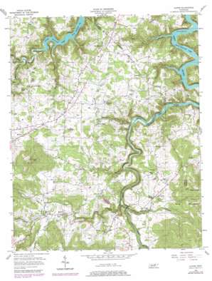
Alpine Topo Map Tennessee
To zoom in, hover over the map of Alpine
USGS Topo Quad 36085d2 - 1:24,000 scale
| Topo Map Name: | Alpine |
| USGS Topo Quad ID: | 36085d2 |
| Print Size: | ca. 21 1/4" wide x 27" high |
| Southeast Coordinates: | 36.375° N latitude / 85.125° W longitude |
| Map Center Coordinates: | 36.4375° N latitude / 85.1875° W longitude |
| U.S. State: | TN |
| Filename: | o36085d2.jpg |
| Download Map JPG Image: | Alpine topo map 1:24,000 scale |
| Map Type: | Topographic |
| Topo Series: | 7.5´ |
| Map Scale: | 1:24,000 |
| Source of Map Images: | United States Geological Survey (USGS) |
| Alternate Map Versions: |
Alpine TN 1956, updated 1957 Download PDF Buy paper map Alpine TN 2010 Download PDF Buy paper map Alpine TN 2013 Download PDF Buy paper map Alpine TN 2016 Download PDF Buy paper map |
1:24,000 Topo Quads surrounding Alpine
> Back to 36085a1 at 1:100,000 scale
> Back to 36084a1 at 1:250,000 scale
> Back to U.S. Topo Maps home
Alpine topo map: Gazetteer
Alpine: Dams
Jolly Lake Dam elevation 267m 875′Alpine: Populated Places
Alpine elevation 280m 918′Eagle Creek (historical) elevation 314m 1030′
Ivyton elevation 285m 935′
Monroe elevation 311m 1020′
Nettle Carrier (historical) elevation 290m 951′
Oak Dale elevation 289m 948′
Rhyan Springs elevation 300m 984′
Rocky Ridge elevation 280m 918′
Westfork (historical) elevation 284m 931′
Wirmingham elevation 307m 1007′
Alpine: Post Offices
Alpine Post Office elevation 279m 915′Monroe Post Office elevation 318m 1043′
Alpine: Reservoirs
Jolly Lake elevation 267m 875′Alpine: Ridges
Rocky Ridge elevation 317m 1040′Alpine: Streams
Big Branch elevation 207m 679′Big Hollow Branch elevation 198m 649′
Black Hollow Branch elevation 218m 715′
Cowan Branch elevation 212m 695′
Crawford Branch elevation 268m 879′
Marr Branch elevation 198m 649′
Nettlecarrier Creek elevation 213m 698′
Poor Branch elevation 206m 675′
Sells Mill Creek elevation 198m 649′
Whorley Branch elevation 199m 652′
Alpine: Summits
Pilot Knob elevation 534m 1751′Alpine: Valleys
Big Hollow elevation 198m 649′Black Hollow elevation 221m 725′
Bugger Hole Hollow elevation 211m 692′
Cowan Hollow elevation 221m 725′
Crawford Hollow elevation 268m 879′
Means Hollow elevation 266m 872′
Alpine digital topo map on disk
Buy this Alpine topo map showing relief, roads, GPS coordinates and other geographical features, as a high-resolution digital map file on DVD:


