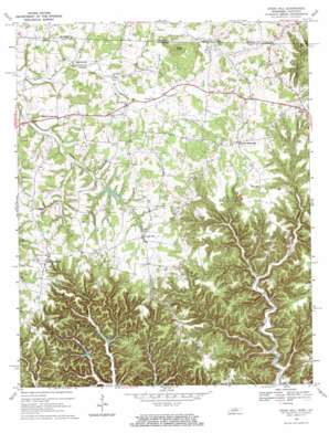
Union Hill Topo Map Tennessee
To zoom in, hover over the map of Union Hill
USGS Topo Quad 36085e6 - 1:24,000 scale
| Topo Map Name: | Union Hill |
| USGS Topo Quad ID: | 36085e6 |
| Print Size: | ca. 21 1/4" wide x 27" high |
| Southeast Coordinates: | 36.5° N latitude / 85.625° W longitude |
| Map Center Coordinates: | 36.5625° N latitude / 85.6875° W longitude |
| U.S. States: | TN, KY |
| Filename: | o36085e6.jpg |
| Download Map JPG Image: | Union Hill topo map 1:24,000 scale |
| Map Type: | Topographic |
| Topo Series: | 7.5´ |
| Map Scale: | 1:24,000 |
| Source of Map Images: | United States Geological Survey (USGS) |
| Alternate Map Versions: |
Union Hill TN 1968, updated 1971 Download PDF Buy paper map Union Hill TN 2010 Download PDF Buy paper map Union Hill TN 2013 Download PDF Buy paper map Union Hill TN 2016 Download PDF Buy paper map |
1:24,000 Topo Quads surrounding Union Hill
> Back to 36085e1 at 1:100,000 scale
> Back to 36084a1 at 1:250,000 scale
> Back to U.S. Topo Maps home
Union Hill topo map: Gazetteer
Union Hill: Dams
Jennings Creek Watershed Dam Number Five elevation 202m 662′Jennings Creek Watershed Dam Number Six elevation 237m 777′
Line Creek Watershed Dam Number Three B elevation 251m 823′
Union Hill: Populated Places
Boles elevation 271m 889′Boles elevation 260m 853′
Cherry Crossroads elevation 269m 882′
Clementsville elevation 240m 787′
Denton Crossroads elevation 304m 997′
Miles Crossroads elevation 305m 1000′
Oak Grove elevation 251m 823′
Pine Hill elevation 291m 954′
Union Hill elevation 276m 905′
Union Hill: Reservoirs
Lake Number Five elevation 202m 662′Lake Number Six elevation 237m 777′
Line Creek Lake Number Three B elevation 251m 823′
Union Hill: Ridges
McCormick Ridge elevation 304m 997′Union Hill: Streams
Brannon Creek elevation 184m 603′Cove Creek elevation 292m 958′
Hurricane Creek elevation 237m 777′
Left Fork Brimstone Creek elevation 180m 590′
Little Brimstone Creek elevation 167m 547′
Pide Branch elevation 160m 524′
Right Fork Brannon Creek elevation 195m 639′
Right Fork Brimstone Creek elevation 181m 593′
Sweetwater Creek elevation 252m 826′
Union Hill: Summits
Brays Knob elevation 343m 1125′Union Hill: Valleys
Bird Hollow elevation 195m 639′Union Hill digital topo map on disk
Buy this Union Hill topo map showing relief, roads, GPS coordinates and other geographical features, as a high-resolution digital map file on DVD:


