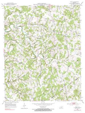
Tracy Topo Map Kentucky
To zoom in, hover over the map of Tracy
USGS Topo Quad 36085g8 - 1:24,000 scale
| Topo Map Name: | Tracy |
| USGS Topo Quad ID: | 36085g8 |
| Print Size: | ca. 21 1/4" wide x 27" high |
| Southeast Coordinates: | 36.75° N latitude / 85.875° W longitude |
| Map Center Coordinates: | 36.8125° N latitude / 85.9375° W longitude |
| U.S. State: | KY |
| Filename: | o36085g8.jpg |
| Download Map JPG Image: | Tracy topo map 1:24,000 scale |
| Map Type: | Topographic |
| Topo Series: | 7.5´ |
| Map Scale: | 1:24,000 |
| Source of Map Images: | United States Geological Survey (USGS) |
| Alternate Map Versions: |
Tracy KY 1953, updated 1954 Download PDF Buy paper map Tracy KY 1953, updated 1966 Download PDF Buy paper map Tracy KY 1979, updated 1984 Download PDF Buy paper map Tracy KY 2010 Download PDF Buy paper map Tracy KY 2013 Download PDF Buy paper map Tracy KY 2016 Download PDF Buy paper map |
1:24,000 Topo Quads surrounding Tracy
> Back to 36085e1 at 1:100,000 scale
> Back to 36084a1 at 1:250,000 scale
> Back to U.S. Topo Maps home
Tracy topo map: Gazetteer
Tracy: Populated Places
Cooktown elevation 240m 787′Dry Fork elevation 250m 820′
Etoile elevation 222m 728′
Lamb elevation 280m 918′
Peter Creek elevation 197m 646′
Tracy elevation 259m 849′
Tracy: Springs
Blue Spring elevation 207m 679′Tracy: Streams
Burges Branch elevation 218m 715′Caney Fork elevation 185m 606′
Dry Branch elevation 176m 577′
Dry Fork elevation 201m 659′
Hunt Branch elevation 194m 636′
Indian Camp Branch elevation 196m 643′
Payne Branch elevation 194m 636′
Tracy digital topo map on disk
Buy this Tracy topo map showing relief, roads, GPS coordinates and other geographical features, as a high-resolution digital map file on DVD:


