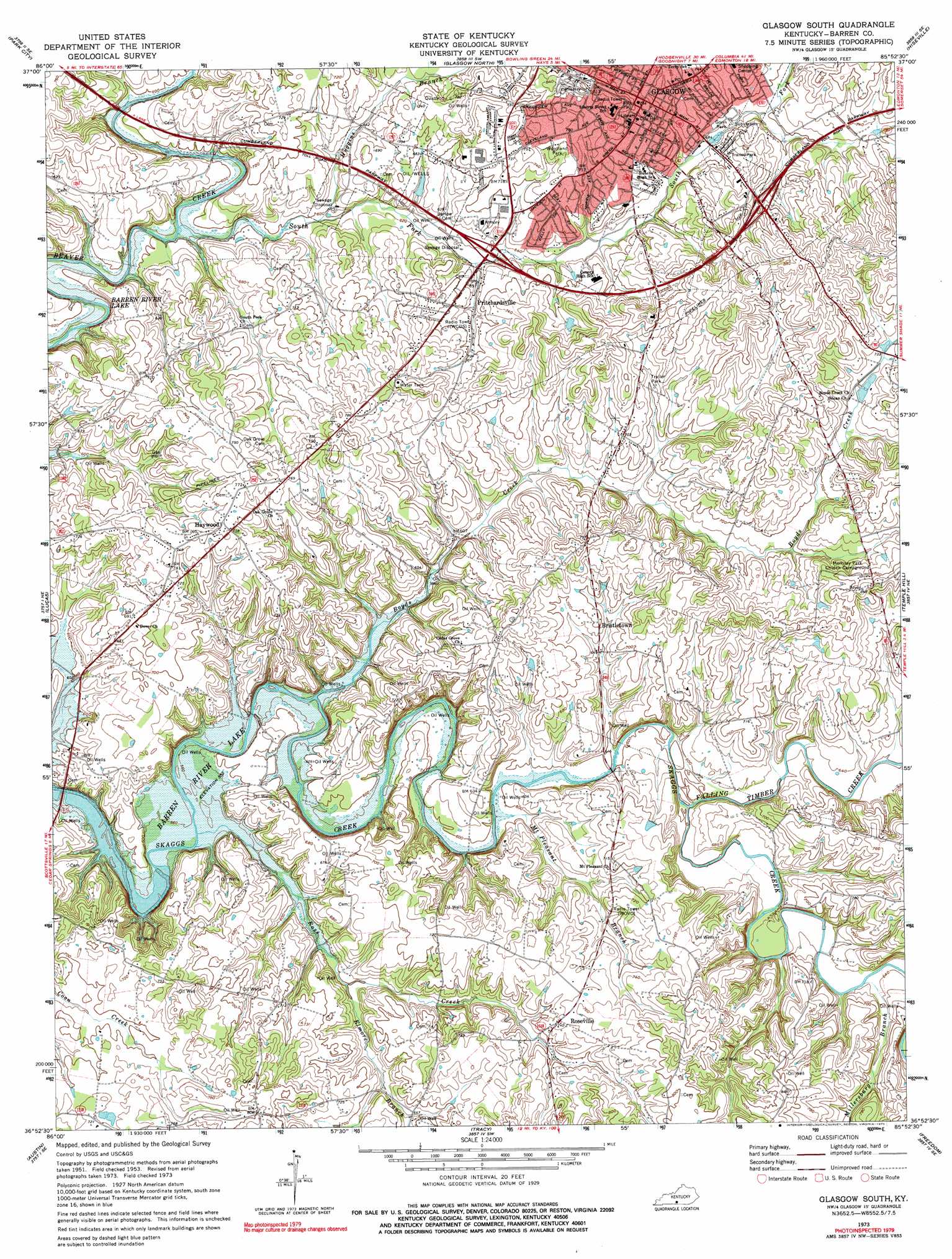
Glasgow South Topo Map Kentucky
To zoom in, hover over the map of Glasgow South
USGS Topo Quad 36085h8 - 1:24,000 scale
| Topo Map Name: | Glasgow South |
| USGS Topo Quad ID: | 36085h8 |
| Print Size: | ca. 21 1/4" wide x 27" high |
| Southeast Coordinates: | 36.875° N latitude / 85.875° W longitude |
| Map Center Coordinates: | 36.9375° N latitude / 85.9375° W longitude |
| U.S. State: | KY |
| Filename: | o36085h8.jpg |
| Download Map JPG Image: | Glasgow South topo map 1:24,000 scale |
| Map Type: | Topographic |
| Topo Series: | 7.5´ |
| Map Scale: | 1:24,000 |
| Source of Map Images: | United States Geological Survey (USGS) |
| Alternate Map Versions: |
Glasgow South KY 1953, updated 1954 Download PDF Buy paper map Glasgow South KY 1965, updated 1967 Download PDF Buy paper map Glasgow South KY 1973, updated 1975 Download PDF Buy paper map Glasgow South KY 1973, updated 1979 Download PDF Buy paper map Glasgow South KY 2010 Download PDF Buy paper map Glasgow South KY 2013 Download PDF Buy paper map Glasgow South KY 2016 Download PDF Buy paper map |
1:24,000 Topo Quads surrounding Glasgow South
Rhoda |
Mammoth Cave |
Horse Cave |
Park |
Center |
Smiths Grove |
Park City |
Glasgow North |
Hiseville |
Sulphur Well |
Meador |
Lucas |
Glasgow South |
Temple Hill |
Summer Shade |
Scottsville |
Austin |
Tracy |
Freedom |
Sulphur Lick |
Petroleum |
Holland |
Fountain Run |
Gamaliel |
Tompkinsville |
> Back to 36085e1 at 1:100,000 scale
> Back to 36084a1 at 1:250,000 scale
> Back to U.S. Topo Maps home
Glasgow South topo map: Gazetteer
Glasgow South: Parks
Gorin Park elevation 207m 679′Woodland Park elevation 231m 757′
Glasgow South: Populated Places
Bristletown elevation 214m 702′Glasgow elevation 230m 754′
Haywood elevation 232m 761′
Pritchardsville elevation 198m 649′
Roseville elevation 226m 741′
Glasgow South: Streams
Boyds Creek elevation 170m 557′Elmore Branch elevation 183m 600′
Falling Timber Creek elevation 183m 600′
Huggins Branch elevation 181m 593′
Millersburg Branch elevation 195m 639′
Mount Pleasant Branch elevation 177m 580′
Rose Creek elevation 170m 557′
South Fork Beaver Creek elevation 173m 567′
Glasgow South digital topo map on disk
Buy this Glasgow South topo map showing relief, roads, GPS coordinates and other geographical features, as a high-resolution digital map file on DVD: